
This page introduces the Via Claudia Augusta hiking route with a profile and a selection of pictures. Experience the route once used by the Etruscans, Rhaetians, Celts and Romans during your trip. Alternatively, go on a long-distance hike along the Via Claudia Augusta. It takes several days, but most people can manage. Hikers from all continents and of all ages between 5 and 93 have jumped at the opportunity to embark on this unique adventure.

Are you already familiar with the new Whatsapp function, channels, through which subscribers can follow information? For reasons that we have not yet been able to find out, our “Travel Channel Via Claudia Augusta” cannot yet be found via the search function in Whatsapp, which you can access via “News” and then with the “Plus”. However, if you open this page on your smartphone, you can click on this link and follow the channel. In this way, we can inform you in the preparation phase of your discovery of the Via Claudia Augusta, during the discovery and also afterwards about news and interesting facts, e.g. if a route of the Via Claudia Augusta is interrupted in an area and a detour is necessary or if the bike shuttle is delayed ...
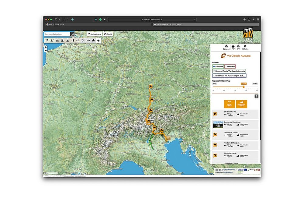
With the interactive map you can plan your trip. You can transfer this planning by QR code or conventional code to the apps for iPhone and Android. On the internet portal www.vicalaudia.org and in the interactive map you can also have a good smolder and get in the mood for the trip. > to the interacitve map


On this map, the historical route, the hiking route and all other content have been pre-selected. You can see all pre-selected content by zooming in on the map. To select content individually or plan a long-distance hike, click the orange bar underneath this text.