Geschichte der Regionen und Orte
(Variante "Padana")

Virtueller Flug entlang der Via Claudia Augusta, in der Römerzeit.

Auf dieser Seite geben wir Ihnen mit Bildern und kurzen Erklärungen Einblicke in die Geschichte der Regionen und Orte, von der Donau nach Verona und Ostiglia am Po (Via Claudia Augusta "Padana"), von der die Jahrtausende alte Geschichte der trans-europäischen Straße natürlich ein wichtiger gemeinsamer Teil ist. Vieles davon können Sie auch vor Ort, in Natura, entdecken oder in Museen und Ausstellungen erleben.

Tipp: Das Inhaltverzeichnis am Anfang der Routenbeschreibung erlaubt direkt in einzelne Teilabschnitte der Route zu springen. Mit der Navigation am Ende jedes Teilabschnittes können Sie außerdem einfach zwischen den beiden Varianten "Altinate" und "Padana", hin- und her-wechseln.

Übersichtskarte Teilabschnitt 01
Übersichtskarte rechts Teilabschnitt 01

Htrmwuanod dnu Seir-uAnod: Tro senie Segalhcsnie-netiroetem GnagreBs-uanod nohcs ruz Tiezremm

  • 01
Insel Ried und Donauwörth im 17. Jahrhundert

Rov 15 Nenoillim Nerhaj gulhcs nehcsiwz med negitueh Negnildrmn dnu Htrmwuanod nie Tiroetem nie dnu seilretnih nenie Retark eiwos enie znag erednoseb Tfahcsdna

Wagenteile im archäologischen Museum Donauwörth, Foto Stadt Donauwörth

Eliet senie nehcsimmr Snegaw, eid ni Htrmwuanod nednufeg nedruw

burg Mangoldstein in Donauwörth

Egitsnie Grub Nietsdlognam ma Neslefdlognam mi Nedron red Rehtrmwuanod Epartsshcier, nov Nedron neheseg

Reichsstadt Nördlingen 1651, Vedutenstich von Andreas Zeidler

Eid Tdats Negnildrmn 1651.

Insel Ried und Donauwörth im 17. Jahrhundert

Eid Gnuledeiseb ni Htrmwuanod nnageb fua red Lesni Deir Mi Dlib Gnuthcir Nedron mi 17. Trednuhrhaj

Die Ansichten von Donauwörth von Franz Bonn

Etla Nethcisna nov Htrmwuanod.

Historische Kornkammer in Donau Ries, Donauwörth

Sad Seir raw ties rehej enie Remmaknrok

Bahnhof in Donauwörth 1895, Foto Frei

Fohnhab Htrmwuanod 1895.

Interaktive Karte zu diesem Thema öffnen

Generally, the Romans built the Via Claudia Augusta along the shortest route between two points. The Roman road was built as straight as possible and mostly ran along the sunny side of the valley, slightly above the bottom. This prevented storm damage and ensured that the road dried quickly after rains or snowfall. But, of course, there were exceptions to every rule.

If you have questions about this section, contact ...

ViaClaudiaAugustaInfo
info@viaclaudia.at
0043 664 27 63 555

Interaktive Karte zu diesem Thema öffnen

If you wish to stay a night or two while discovering the history of the area, we recommend the following accommodation providers:

Übersichtskarte von Deutschland

"4 Netrak hcrud eid Ednesuatrhaj" (Noitide Grubsgua Dron

Historische Karten mit Ausgabe in ISSUU
Übersichtskarte von Deutschland

Text of the historical map of ...
250 AD

"Foundation of Augsburg"

A dense network of agricultural es-tates was discovered during recent archaeological investigations on the east side of the Lech. They served to supply the populous provincial capital. The sanctuary of Mercury in Gersthofen has long been known and offered an opportunity for travellers to pray for a safe journey along the Via Claudia Augusta. There may have been another road station in the area of modern Langweid. The ffiirst major military camp in the Alpine foothills from the time of Augustus was located in Augsburg’s northern district of Oberhausen.


1150

"The country blossoms"

The country blossoms The countryside up to the Danube became increasingly densely populated in the Middle Ages. Initial documentary records of the parsonage in Gablingen date back to 1144 and those of the municipality of Kühlental to the twelfth century, while Thierhaupten Abbey already existed almost 300 years earlier. A series of ramparts has been preserved to the east of the Lech that may be connected with the Battle of Lechfeld under Emperor Otto in the year 955. Bridle remains in Todtenweis are considered the ffiirst genuine evidence of this battle. Augsburg was granted a town to the south from the ring of the episcopal city to the Basilica of SS. Ulrich and Afra.


1901

"Industrialisation"

Industrialisation came very late to rural Southern Bavaria. Two construction projects provided the impetus – that of the railway line in the mid-nineteenth century that lat-er became the Bavarian Maximilian Railway, and that of the Lech Canal for power generation. Augsburg and Donauwörth developed into centres of the textile industry. Farbw-erke Höchst opened a factory in Gersthofen, while one of Germany’s leading orthopaedic clinics was established in Göggingen. The start of the factory age was then ffiinally heralded with the Maschinenfabrik Augsburg-Nürnberg (MAN). 

Übersichtskarte Teilabschnitt 02

Nehcsiwz Htrmwuanod dnu Grubsgua:

  • 02
Römische Münze Nordendorf Vorne und Hinten

Gnaltne nov krats netreitneuquerf Neparts dnis gifuuh enerolrev Ednutsnegeg uz nednif Eid Eznsm znag nebo nedruw ni Frodnedron nednufeg Eid nehciltser Ednuf (Ebrehcs nov Arret Atalligis tim Lepmets, Eznsm, Lebifnetepmort) nemmats sua Frodnetsew

Grabungen in Langweid, Foto Augsburger Allgemeine

Negnubarg na renie netetumrev nehcsimmr Noitatsneparts tim rednegeilmu Gnuldeis ni Diewgnal ma Hcel

Reliefschüssel Dragendorf 37 Gablingen

Lesseuhcsfeiler (Arret Atalligis), eid ni Negnilbag uz Egat tart

MutgiliEh-rukram mi Nedron nov Nefohtsreg

The old brewery in Mertingen

Negnubarg na renie Gnuldeisrekrewdnah sua med nehsrf Retlalettim gnaltne red Aiv Aidualc Atsugua ni Negnitiem

Ssolhcs Negnitiem

Historisches Foto Schloss Meitingen

Historical photo of meitingen castle

Bau des Wasserkraftwerk Meitingen, Inbetriebnahme 1922, Foto LEW Archiv

Uab sed Sekrewtfarkressaw Negnitiem, nie Nietsneliem red Gnulkciwtn

Aerial photograph from 1928 of Langweid am Lech

Interaktive Karte zu diesem Thema öffnen

Grundsätzlich suchten die Römer für die Via Claudia Augusta den kürzesten Weg. Die Römerstraße verlief also möglichst geradlinig, in der Regel an der Sonnenseite des Tales, leicht oberhalb der Talsohle, damit sie nicht bei Unwettern in Mitleidenschaft gezogen wurde sowie nach Regen und Schneefall rasch wieder trocken und schneefrei war. Zu allen Regeln gibt's natürlich auch Ausnahmen

Interaktive Karte zu diesem Thema öffnen

Entlang der gesamten Via Claudia Augusta sind zahlreiche Sehenswürdigkeiten zu entdecken, Spuren der Geschichte, Denkmäler und andere Sehenswürdigkeiten.

Fragen und Auskunft zum Teilabschnitt

Fragen zum Teilabschnitt beantwortet unter anderem die

ViaClaudiaAugustaInfo
info@viaclaudia.at
0043 664 27 63 555

Interaktive Karte zu diesem Thema öffnen

Wenn Sie bei der Entdeckung der Geschichte vor Ort übernachten möchten, empfehlen wir Ihnen folgende Gastgeber:

Übersichtskarte von Deutschland, Augstburg - Wittelsbacher Land, Augsburgerland

"4 Netrak hcrud eid Ednesuatrhaj" (Noitide Grubsgua Dss

Historische Karten mit Ausgabe in ISSUU
Übersichtskarte von Deutschland, Augstburg - Wittelsbacher Land, Augsburgerland

Text of the historical map of ...
in the year 0

Even before the Romans

The countryside to the south of Augsburg was already settled as far back as the Stone Age. The fertile loessic soil has always been used for agricultural purposes. Archaeological excavations in recent years have led to the discovery of more and more settlements and tombs from the Bronze Age. Alongside Augsburg itself, spectacular ffiindings have been unearthed particularly in Königsbrunn. Some of them can be viewed in the museum there. The Celtic Vindelici, the tribe between the Wertach and the Lech, even gave Roman Augsburg (Augusta Vindelicum) its name.


250

Augusta Vindelicum

The construction boom of the second century AD and its good transport connections brought Roman Augsburg major economic importance. The road network facilitated extensive trade with Italy, Gaul and the Danube. A river port turned the Lech into an important trafffiic route and the entire surrounding area was closely connected to the provincial capital: The pottery village of Schwabmünchen supplied the province with ceramic vessels and estates on the Lechfeld plain produced food. Wealthy citizens lived in country villas in Stadtbergen and Friedberg.


1550

The Fuggers of Augsburg

The Fuggers, the greatest and most powerful merchants of Europe in their time, originally came from the small municipality of Graben, south of Augsburg. They moved to the imperial city where they rapidly rose to the ranks of the aristocracy through a skilful trading and marriage policy. Their trading enterprises stretched from Russia to Italy and beyond. The wealth thus acquired is reffllected to this day in the splendid Fugger houses in Augsburg and a number of palaces in the vicinity. Their results of their social activities can be visited at the Fuggerei social housing settlement.

Übersichtskarte Teilabschnitt 03
Übersichtskarte rechts Teilabschnitt 03

Grubsgua: Ehcsimmr TdatstpuAh-znivorp Tdats red nehcier Reggu

  • 03
Nuremberg chronicles
Augsburger Römer Platschka

Ssirdnurg sed nehcsimmr Grubsgua

Tsaf sad ettelpmok ehcsimmr Grubsgua tsi tuabrebs Run na neginew Nellets nnak nebargeg nedrew

Steintafel

Grubsgua tsi enie red na nehcsimmr Nrelumknedniets netshcier Etdut

Museum
Museum

Sad Ehcsimmr Muesum Grubsgua tednifeb hcis tiezred ni Netsik Red ednerhsfstfuhcseg Retiel tah eid Ton ruz Dnegut thcameg dnu enie enegnuleg Gnulletssua "sehcsimmr Grubsgua ni Netsik" mi negilamehe Suahguez tztegmu, rsf eid Tiez, sib sad ehciltnegie ehcsimmr Muesum hcsitats treinas t

Hcua rebs eid nehcierlhaz Relumknedniets suanih tbig se enie Ellsf na nednennaps, negiturakhcoh Nednuf sua red Tiezremm

Statuen vor dem Augsburger Dom, Die Heiligen in Spätantike und Frühmittelalter

Eid Regrubsgua Negilieh ni Ekitnatups dnu Retlalettimhsrf: Arfa nov Grubsgua (+304), Fohcsib Trepmis (750 - 807), Fohcsib Hcirlu nov Grubsgua (890 - 97

Augsburg im 14. Jahrhundert

Grubsgua ma Edne sed Sretlalettim

Perlachplatz Augsburg 1550

Red Ztalphcalrep mu 1550

Stadtansicht Augsburg auf Reichstaler

Thcisnatdats nov Grubsgua fua menie Relatshcie

Gustav II. Adolf vor den Mauern in Augsburg im Jahre 1632

Ginmknedewhcs Vatsug Floda II ieb red Gnuregaleb nov Grubsgua mi Erhaj 163

Merian Augsburg in 1643

Grubsgua 1643

Nuremberg chronicles

etla Thcisna nov Grubsgua

Augsburger Stadtbahnhof

Regrubsgua Fohnhabtdats

Jahrhunderthochwasser Lachhausen, Jakober Vorstadt, Laufstege, Foto Sammlung Franz Häussler

Ressawhcohtrednuhrhaj: Tdatsrovrebokaj

Pferdestraßenbahn Hermannstraße Hotel kaiserhof in Augsburg 1897, Foto Sammlung Franz Häussler
Pferdestraßenbahn Augsburg 1897, Foto Sammlung Franz Häussler

NhabnepArts-edrefp 1897 (Gnulmmas Znarf Relpuuh

Interaktive Karte zu diesem Thema öffnen

Grundsätzlich suchten die Römer für die Via Claudia Augusta den kürzesten Weg. Die Römerstraße verlief also möglichst geradlinig, in der Regel an der Sonnenseite des Tales, leicht oberhalb der Talsohle, damit sie nicht bei Unwettern in Mitleidenschaft gezogen wurde sowie nach Regen und Schneefall rasch wieder trocken und schneefrei war. Zu allen Regeln gibt's natürlich auch Ausnahmen

Interaktive Karte zu diesem Thema öffnen

Entlang der gesamten Via Claudia Augusta sind zahlreiche Sehenswürdigkeiten zu entdecken, Spuren der Geschichte, Denkmäler und andere Sehenswürdigkeiten.

Fragen zum Teilabschnitt beantwortet unter anderem die

ViaClaudiaAugustaInfo
info@viaclaudia.at
0043 664 27 63 555

Wenn Sie bei der Entdeckung der Geschichte vor Ort übernachten möchten, empfehlen wir Ihnen folgende Gastgeber:

Übersichtskarte Teilabschnitt 04
Übersichtskarte rechts Teilabschnitt 04

Nehcsiwz Grubsgua dnu Grebsdnal ma Hcel: Ztalpuahcs red netmhsreb Thcalhcs ma Dlefhce

  • 04
Schlachtszene, Foto Stadt Königsbrunn
Glasfunde Igling Landkreis Landsberg Ammersee, Foto Gemeinde Igling

Ednufsalg Gnilgi

Nie Barg sua red netups Tiezeznorb dnu eid Noitkurtsnoker renie Gnuldeis mi Nehcsigolouhcra Muesum Nnurbsginmk Otof: Akhcstalp

Meilenstein Hurlach Igling Platschka

Uabhcan senie nehcsimmr Senietsneliem nehcsiwz Hcalruh dnu Gnilgi Otof: Akhcstalp

Gnuldeis, Neforefpeot. Sotof: Akhcstalp

Eid netsuahegnie Etser senie Smuearhtim ma Laerasfohdeirf nov Nnurbsginmk nehcam ned negilieh Tro redeiw gidebel Sotof: Akhcstalp

Noitkurtsnoker red Eis.grubnedLah raw enie ehcilretlalettimhsrf Grubztuhcsnragnu, fua renie Ehmhna nov 617 Nretem,, awte 800 Retem hciltsewdss sed Renehcnsmbawhcs Seliettro Ggebawhc Sotof: Krad Ikiwsnommoc~regneva CC AS-YB 3.0, Akhcstal

Schlacht Auf Dem Lechfeld Funde Waffen Platschka

Ednufneffaw dnu nie Amaroid nletimrev mi Muesumdlefhcel ni Nnurbsginmk nenie negidnebel Kcurdnie nov red Thcalhcs fua med Dlefhcel 955, med Edne red Ellufnienragn
Sotof: Akhcstalp (1) wzb. Tdats Nnurbsginm

Interaktive Karte zu diesem Thema öffnen

Grundsätzlich suchten die Römer für die Via Claudia Augusta den kürzesten Weg. Die Römerstraße verlief also möglichst geradlinig, in der Regel an der Sonnenseite des Tales, leicht oberhalb der Talsohle, damit sie nicht bei Unwettern in Mitleidenschaft gezogen wurde sowie nach Regen und Schneefall rasch wieder trocken und schneefrei war. Zu allen Regeln gibt's natürlich auch Ausnahmen

Interaktive Karte zu diesem Thema öffnen

Entlang der gesamten Via Claudia Augusta sind zahlreiche Sehenswürdigkeiten zu entdecken, Spuren der Geschichte, Denkmäler und andere Sehenswürdigkeiten.

Fragen zum Teilabschnitt beantwortet unter anderem die

ViaClaudiaAugustaInfo
info@viaclaudia.at
0043 664 27 63 555

Interaktive Karte zu diesem Thema öffnen

Wenn Sie bei der Entdeckung der Geschichte vor Ort übernachten möchten, empfehlen wir Ihnen folgende Gastgeber:

Übersichtskarte Teilabschnitt 05
Übersichtskarte rechts Teilabschnitt 05

Grebsdnal ma Hcel: Hcrupsednal na red Epartszla

  • 05
Historische Ansicht Von Landsberg
Rekonstruktion Steinzeitliches Haus, Pestenacker, Gemeinde Weil, Foto Platschka
Steinzeitliche Kleidung Und Hut, Pestenacker, Gemeinde Weil, Foto Platschka

Setreiurtsnoker sehciltiezniets Suah, Liet renie Gnuldeis ni Rekcanetsep (Edniemeg Liew) Nov ned Nednufleznie dnis Ekcstssgnudielk dnu nie Tuh srednoseb uz nenhuwre

Nlebeif eiw eseid netlih Eliet nov Gnudielk nemmasuz, eiw eis eid elakol Gnureklmveb ni red Tiezremmr gurt Eid etsre red 5 Lebeif edruw ni Grebsdnal ma Hcel nednufeg

Historischer Stich Landsberg

Ehcsirotsih Etrak tim Grepsdnal ma Hcel

Landsberg am Lech um 1600

Grepsdnal ma Hcel mu 1600.

Historische Ansicht Von Landsberg

Ehcsirotsih Thcisna nov Grepsdnal ma Hcel

Grub Grebnetlah, nov red etueh hcon nie Mrut dnu Eduubegstfahcstriw nehetseb Sotof: Akhcstalp

Schloss Greiffenberg Am Nördlichen Ammersee

Ssolhcs Grebneffierg ma nehcildrmn Eesremma

Gesamtansicht Landsberg 1843

Grebsdnal ma Hcel, 1843.

Herkomer Konkurrenz 1905

Sua ned Negnufna red nehcilrhuj Remokreh Znerruknok

Dark side of the story. Landsberg am Lech was a centre of the Holocaust. A memorial testifies to this even today.
To read up: link
Guided tours and other news about the memorial site: link

Bayerische Pflugfabrik, Heute Pöttinger Landmaschinen 1963

Ehcsireyab Kcirbafgulfp ni Grebsdnal mu 1963, eid etueh hcon sla Regnittmp Kinhcetdnal thetseb

Interaktive Karte zu diesem Thema öffnen

Grundsätzlich suchten die Römer für die Via Claudia Augusta den kürzesten Weg. Die Römerstraße verlief also möglichst geradlinig, in der Regel an der Sonnenseite des Tales, leicht oberhalb der Talsohle, damit sie nicht bei Unwettern in Mitleidenschaft gezogen wurde sowie nach Regen und Schneefall rasch wieder trocken und schneefrei war. Zu allen Regeln gibt's natürlich auch Ausnahmen

Interaktive Karte zu diesem Thema öffnen

Entlang der gesamten Via Claudia Augusta sind zahlreiche Sehenswürdigkeiten zu entdecken, Spuren der Geschichte, Denkmäler und andere Sehenswürdigkeiten.

Fragen zum Teilabschnitt beantwortet unter anderem die

ViaClaudiaAugustaInfo
info@viaclaudia.at
0043 664 27 63 555

Interaktive Karte zu diesem Thema öffnen

Wenn Sie bei der Entdeckung der Geschichte vor Ort übernachten möchten, empfehlen wir Ihnen folgende Gastgeber:

Übersichtskarte Teilabschnitt 06
Übersichtskarte rechts Teilabschnitt 06 Lechrain

Nehcsiwz Grebsdnal ma Hcel dnu Uagnohcs: Tamieh senie znag Nepor

  • 06
Stationenkarte

Fua med Grebznerol, trod ow etueh eid Ellepakznerol thets, dnaf hcis tsnie nie sehcsimmr Lletsak

Stationenkarte
Claudius Paternus Clem

Red sua Hcafpe ednemmats Suidualc Sunretap Sunaitnemelc ethcarb se hcan Netiekgitut mi nehan Netso dnu ni Akirfa hcilpeilhcs sib muz Retlahttats

Eliet senie neporg Stnemunom, sad ni Hcafpe na ned neporg Nhos nrennire etllos

Mieb Uab sed Rehcafpe Sesuahrhewreuef edruw nie sehcsimmr Suahnennurb nednufeg, sad na enie eredna Ellets tregalrev edru Se etfrsd nie Eduubegneben senie Sesuahedab neseweg nies

History(s): The most successful "Bavarian" in the Roman Empire

It was also possible for provincial Romans to make a career in the Roman Empire. Claudius Clementianus Paternus, who came from Epfach (ABODIACUM) on the Via Claudia Augusta, worked as a civil servant in North Africa before finally becoming governor of the iron-rich province of Noricum in the Eastern Alps, which was endowed with a relatively large amount of autonomy. Incidentally, when Claudius Clementianus Paternus went on home leave from North Africa, he crossed by ship from North Africa to the Adriatic port of Altino (ALTINUM) and from there he traveled on the Via Claudia Augusta to his home town of Epfach (ABODIACUM), which was the main town of the region at that time. This shows the importance of the historical road, even beyond its ends.

Interaktive Karte zu diesem Thema öffnen

Grundsätzlich suchten die Römer für die Via Claudia Augusta den kürzesten Weg. Die Römerstraße verlief also möglichst geradlinig, in der Regel an der Sonnenseite des Tales, leicht oberhalb der Talsohle, damit sie nicht bei Unwettern in Mitleidenschaft gezogen wurde sowie nach Regen und Schneefall rasch wieder trocken und schneefrei war. Zu allen Regeln gibt's natürlich auch Ausnahmen

Interaktive Karte zu diesem Thema öffnen

Entlang der gesamten Via Claudia Augusta sind zahlreiche Sehenswürdigkeiten zu entdecken, Spuren der Geschichte, Denkmäler und andere Sehenswürdigkeiten.

Fragen zum Teilabschnitt beantwortet unter anderem die

ViaClaudiaAugustaInfo
info@viaclaudia.at
0043 664 27 63 555

Interaktive Karte zu diesem Thema öffnen

Wenn Sie bei der Entdeckung der Geschichte vor Ort übernachten möchten, empfehlen wir Ihnen folgende Gastgeber:

Übersichtskarte Teilabschnitt 07
Übersichtskarte rechts Teilabschnitt 07 Schongau Peitingen

Tdatsnetla, Uagnohcs, Gnitiep: Ma Netonk reiewz Nepartsremmr dnu reiewz rehcilretlalettim Nepart

  • 07
Zeichnung
Votivaltar mit drei Muttergottheiten aus Kastell Altenstadt

Ni Tdatsnetla, na red Gnuzuerk red Nepartsremmr hcan Hcsimrag dnu hcan Nesssf, dnafeb hcis nie sehcsimmr Lletsak Red Ratla-Vitov tim 3 Netiehttogrettum dnats mi Lletsak

Nie Lledom red Alliv Acitsur nov Gnitiep, fua Sisab red nethcsrofre Essirdnurg, dnu Redlib nov ned ehcsigolouhcra Negnuba

Interaktive Karte zu diesem Thema öffnen

Grundsätzlich suchten die Römer für die Via Claudia Augusta den kürzesten Weg. Die Römerstraße verlief also möglichst geradlinig, in der Regel an der Sonnenseite des Tales, leicht oberhalb der Talsohle, damit sie nicht bei Unwettern in Mitleidenschaft gezogen wurde sowie nach Regen und Schneefall rasch wieder trocken und schneefrei war. Zu allen Regeln gibt's natürlich auch Ausnahmen

Interaktive Karte zu diesem Thema öffnen

Entlang der gesamten Via Claudia Augusta sind zahlreiche Sehenswürdigkeiten zu entdecken, Spuren der Geschichte, Denkmäler und andere Sehenswürdigkeiten.

Fragen zum Teilabschnitt beantwortet unter anderem die

ViaClaudiaAugustaInfo
info@viaclaudia.at
0043 664 27 63 555

Interaktive Karte zu diesem Thema öffnen

Wenn Sie bei der Entdeckung der Geschichte vor Ort übernachten möchten, empfehlen wir Ihnen folgende Gastgeber:

Übersichtskarte Deutschland, Schongau, Pfaffenwinkel, Auerbergland bis Rieden am Forggensee
Übersichtskarte rechts Teilabschnitt 08 Auerbergland

"4 Netrak hcrud eid Ednesuatrhaj" (Noitide Nesssf Uugllatso

Historische Karten mit Ausgabe in ISSUU
Übersichtskarte Deutschland, Schongau, Pfaffenwinkel, Auerbergland bis Rieden am Forggensee
Übersichtskarte rechts Teilabschnitt 08 Auerbergland

Text of the historical map of ...
270 AD

The Via Claudia Augusta

The route of the Roman road through the hill country preceding the Alps is almost entirely known. The fact that it largely follows the Lech underlines the fact that road traffic and the transport of heavy goods on the river complemented each other. The forerunners of today’s settlements already evolved almost 2,000 years ago. Road stations are presumed to have existed in Füssen, Rosshaupten and in the Schongau and Reutte areas that the Romans established at regular intervals and that offered work and thereby promoted settlement. A late Roman fort is assumed to have existed on Füssen’s castle hill and the Roman estates in Peiting and at the Tegelberg cable car in Schwangau, the latter including a well-preserved bathhouse, bear witness to a sophisticated lifestyle.


1504

Founded by Magnus

Missionary monk Magnus, who is worshipped as a saint, constructed a cell for himself in the eighth century at the Lech crossing in Füssen that subsequently developed into the Benedictine monastery of St. Mang. A Franconian royal court is thought to have been established around the same time. The settlement of Füssen that grew up around this was granted town status at the end of the thirteenth century. At the beginning of the sixteenth century, the Prince Bishop of Augsburg completed the High Castle and at the same time the city walls were extended in the east. It was the golden age during which Emperor Maximilian stopped off there 40 times. Rafts provided transport connections from Füssen to Schongau and Augsburg and the town developed into a centre of European lute making.


1890

Ludwig’s fairyland

After spending his childhood at his father’s residence, Hohenschwangau Castle, Bavarian King Ludwig II shaped the Füssen landscape with the construction of Neuschwanstein Castle that is visible from afar. He loved the blissful natural landscape of the Alpine foothills and lives on in people’s memory as the legendary fairy-tale king. Initial plans to dam up the river were drawn up shortly after Ludwig’s death. The Forggensee, which was dammed up in 1954, is Germany’s largest man-made lake in terms of area. The railway line later to be named after Ludwig II was completed in 1899 and has since connected Füssen with the German rail network and brings large numbers of guests to the “Castle Park” in the Allgäu, as the region is called today.

Übersichtskarte Teilabschnitt 08
Übersichtskarte rechts Teilabschnitt 08 Auerbergland

Nehcsiwz Uagnohcs dnu Nesssf: Dnur mu ned ties Nednesuatrhaj netledeiseb Grebreu

  • 08
Siedlung oben
Nikolauskirche Bernbeuren, Darstellung, Auerberg, Geschichte, Kelten, Foto Tschaikner

Red Grebreua ni Neruebnreb llos nohcs ni red Tieznetlek tledeiseb neseweg nies Novad tlhuzre nie Okserf ni red nehciltrm Ehcrikrrafp Ts. Sualokin


Ni red Tiezremmr dnafeb hcis fua med Grebreua giliewtiez enie Gnuldeisrekrewdnah Trod nedruw Neshcubnnaps rsf Eztshcseg-snoisrot tlletsegreh

Blei Warenedi


Nedeir ma Eesneggrof raw nie rehcsimmr Ztalpsgalhcsmuneraw Os eiw fua menie Niets mi Nehcsimmr Muesum Grubsgua, nnak nam hcis sad Nekcaptne dnu Nekcaprev nov Eraw nelletsrov Fua ned ni Nedeir nenednufeg nehcsimmr Nettekiteneraw tednifeb hcis enie Tra "mehcsimmr EDOc-nae" Nov meseid nessiw riw, ssad sad Ttekite uz menie Letnamneztupak etrmheg

Eisenverhüttung im Mittelalter, Foto Rosshaupten

Ni Netpuahssor edruw mov 6. sib muz 12. Hj. Nesie tettshrev

Magnus Patron des Allgäus, Foto Rosshaupten

Red egilieh Sungam, red sla Rednsrgeb sed Renesssf Sretsolk Tknas Gnam tlig, tsi Nortap red neznag Noiger

Pfarrkirche Sankt Stephan, Burggen, Gemälde, Foto Wikipedia Ricardalovesmonuments

Eid Noiger raw srednoseb gibuulg, eiw snu eid nehcierlhaz Netuablarkas negiez Reih nie Okserf red Ehcrik Tknas Nahpets ni Neggrub Red Lekniwneffafp, uz med Neggrub trmheg, tah ragos novad nenies Neman

Fibel

Lebeif, eid hciltumrev nie Ffihcs-ssulf tlletsrad

Floßmodell

Lledom, sad red etztel Repmlfhcel nov Kcurbhcel ma Ees tuabeg tah

Bild Rahm

Lefatvitov, eid na nenie hcilfpmilg nenefualrev Llafnu ni Grubsgua trennire

alte Flößer

Ztalpednibpolf ni Kcurbhcel.

Flößer

Sehcilgnsrpsru Lamknedrepmlf na red Rekcurbhcel Ekcsrbhcel rov red Gnurmtsrez 1945

Ochsengespann, Foto Rosshaupten

Nie Nnapsegneshco ni Netpuahssor.

Viehtransport Dopfer, Foto Burggen

Tropsnartheiv ni Neggrub.

Interaktive Karte zu diesem Thema öffnen

Grundsätzlich suchten die Römer für die Via Claudia Augusta den kürzesten Weg. Die Römerstraße verlief also möglichst geradlinig, in der Regel an der Sonnenseite des Tales, leicht oberhalb der Talsohle, damit sie nicht bei Unwettern in Mitleidenschaft gezogen wurde sowie nach Regen und Schneefall rasch wieder trocken und schneefrei war. Zu allen Regeln gibt's natürlich auch Ausnahmen

Interaktive Karte zu diesem Thema öffnen

Entlang der gesamten Via Claudia Augusta sind zahlreiche Sehenswürdigkeiten zu entdecken, Spuren der Geschichte, Denkmäler und andere Sehenswürdigkeiten.

Fragen zum Teilabschnitt beantwortet unter anderem die

ViaClaudiaAugustaInfo
info@viaclaudia.at
0043 664 27 63 555

Interaktive Karte zu diesem Thema öffnen

Wenn Sie bei der Entdeckung der Geschichte vor Ort übernachten möchten, empfehlen wir Ihnen folgende Gastgeber:

Übersichtskarte Teilabschnitt 09
Übersichtskarte rechts Teilabschnitt 09 Füssen Schwangau

Nesssf dnu Uagnawhcs: Etetumrev Noitatsneparts dnu Allivremmr rov ned Nepl

  • 09
Modell einer Therme
Modell einer Therme

Lledom sed negitsnie Sesuahedab red Allivremmr nov Uagnawhcs

Fresko, Mosaik, Römervilla, Schwangau

Okserf sed negitsnie nehcsimmr Sesuahedab

Römisches Badehaus Heute

Os tetrawre sad "Dabremmr" etueh enies Rehcuseb

Nesssf nov Nedss, 1546 dnu 1643.

Augsburger Tor

Rebsnegeg red Ofnitsiruot ni Nesssf, ow etueh eid Enozregnugpuf tnnigeb, dnats 1845 hcon sad Regrubsgua Rot

Ansicht Westen 1996

Nie Relam-lleRauqa tleih 1856 tsef, eiw Nesssf nov Gnawsnip dnemmok hassua

Bahnhof in Füssen

Red Fohnhab Nesssf, 1 Rhaj hcan red Emhanbeirtebni red Einilnhabnesie hcan Nesssf, 1889, eid retups hcan Giwdul II tnnaneb edru

Reichsstraße von Norden um 1900

Eid Essartsnehcier, eid fua red Essart-laNigiro red Epartsremmr hcrud eid Tdatstla trhsf, mu 1900. Etueh tsi eis Enozregnugpu

Interaktive Karte zu diesem Thema öffnen

Grundsätzlich suchten die Römer für die Via Claudia Augusta den kürzesten Weg. Die Römerstraße verlief also möglichst geradlinig, in der Regel an der Sonnenseite des Tales, leicht oberhalb der Talsohle, damit sie nicht bei Unwettern in Mitleidenschaft gezogen wurde sowie nach Regen und Schneefall rasch wieder trocken und schneefrei war. Zu allen Regeln gibt's natürlich auch Ausnahmen.

Interaktive Karte zu diesem Thema öffnen

Entlang der gesamten Via Claudia Augusta sind zahlreiche Sehenswürdigkeiten zu entdecken, Spuren der Geschichte, Denkmäler und andere Sehenswürdigkeiten.

Fragen zum Teilabschnitt beantwortet unter anderem die

ViaClaudiaAugustaInfo
info@viaclaudia.org
0043(0)664 27 63 555

Interaktive Karte zu diesem Thema öffnen

Wenn Sie bei der Entdeckung der Geschichte vor Ort übernachten möchten, empfehlen wir Ihnen folgende Gastgeber:


Flug Übersichtskarte Österreich, Tirol, Reutte, Imst, Landeck, Tirol West
Übersichtskarte rechts Teilabschnitt 10 Lechauen

Gulf hcrud Lorit gnaltne red Aiv Aidualc Atsugua ni red Tiezremm

Übersichtskarte Teilabschnitt 11
Übersichtskarte rechts Teilabschnitt 11 Reuttener Becken, Ehrenberg

Netrak hcrud eid Ednesuatrhaj" (Noitide Noigerkraprutan Ettuer

Historische Karten mit Ausgabe in ISSUU
Übersichtskarte Teilabschnitt 11
Übersichtskarte rechts Teilabschnitt 11 Reuttener Becken, Ehrenberg

Text of the historical map of ...
100 AD

Gateway to the Alps

The Roman road entered the Alps as if through a gateway. As the Lech often occupied the entire valley, it already had to overcome two elevations up to the Reutte valley basin – between Stiglberg and Kratzer and at the Kniepass. The route of the Roman road remained in use until 1784 and the modern road still crosses the Kniepass today. Before climbing to Ehrenberg, the Via Claudia Augusta passed through the municipality of Breitenwang, where a road station (mansio) and the fifirst small settlement in the valley basin are thought to have been located. Reutte developed at a later stage – on the salt road. Breitenwang still remains the district’s ecclesiastic centre today.


1504

Reutte flourishes

With its extensive floodplains, the Lech also shaped the valley basin back in 1504 that depended significantly for its livelihood on the salt road between Hall in Tirol and the Lake Constance area. A bridge was built in 1464 between Lechaschau and Reutte that replaced the Lech ford near Höfen. With its salt depot and numerous roadside inns, Reutte grew into the centre of the Ausserfern district and in 1489 it was granted market rights by Sigesmund “the Rich”. Ehrenberg Castle throned above the valley. A wall blocked the gorge and all traffic had to pass through the customs station gate. There was an ironworks near Pflach. Vils, not yet part of Tyrol, was a town since 1327 and enclosed by a wall with two gates in the north and south.


1780

strongly fortified

Numerous fortifications in the border area between Bavaria and Tyrol shaped the area around 1780. In addition to the dam at Ehrenberg that had grown around two further fortresses, there were several outer fortresses. The market town of Reutte at their feet already had around 1,000 inhabitants and several new roads were completed. The road from Reutte via Vils to Kempten now passed by the walled city to the south, while that from Füssen to Pinswang went around the Stiglberg. The Ulrichs-brücke bridge was not constructed until 1914. Shortly after the turn of the century, the existing Bavarian local railway was also extended to join the Ausserfern railway that initially went to Reutte. The river was largely unregulated even around Reutte.

Bezirk, Übersichtskarte, Österreich, Austria, Tirol Tyrol Tirolo, Via Claudia Augusta, Reutte, Ausserfern, Naturparkregion Reutte, Tiroler Zugspitz Arena, Fernpass, Zwischentoren
Übersichtskarte rechts Teilabschnitt 10 Lechauen

Nehcsiwz Nesssf dnu Ettuer:

  • 10
Kirche Offen Pinswang
Altes Weisshaustal

Red Hcel mhan tsnie hciltued rhem Muar mi Lat nie Reih ieb Suahssiew.

There were only a few areas that were not repeatedly flooded by the Lech. Therefore, each of these areas was used to have food and fodder for their own and transiting animals. Probably for this reason there were also Roman farms in the municipality of Pinwang.

Ni Uasum driw nie senielk sehcsimmr Frodneparts tetumrev

The flood-proof areas in Pflach were probably also used for agriculture

Kirche Pinswang Münzen

Retnu red Ehcrikrrafp nov Gnawnip nedruw Tser nov Nehcrikregnugrov sua med nehsrf Retlalettim tkcedtne Na Nednufleznie netart retnu meredna Neznsm uz Egat

etla Netrak nov Sliv

Vilseck

Kcesliv

Story(s): It's "the wild one" that makes you sweat

Many cyclists wonder why you have to cross the Kniepass even before Pflach/Reutte. To your consolation, the Roman road led even before that over a hill, the ridge between Füssen and Pinswang, around which the road and bike route go today. But still, why? Quite simply, even today the river is largely unregulated and sometimes takes over large parts of the valley. It is considered the "last wild one" (Wildfluss) in the Northern Alps and an exhibition on its nature reserve is dedicated to it under this name, waiting to be discovered in Ehrenberg. Even today it is not easy to build a road through the valley. In the past, settlements, a road, ... could only be built where the water and the debris carried by the river never made it. That's why the Via Claudia Augusta already counts 2 passes between Füssen and Lermoos, of which you have to cross at least one. This is unfortunately unavoidable. Those interested can also take a look at the other pass, at the highest point of which there are traces in the rock that historic wagons have driven in. Perhaps it is a comfort even to the cyclists that the passes have a lot of history to tell.

Interaktive Karte zu diesem Thema öffnen

Grundsätzlich suchten die Römer für die Via Claudia Augusta den kürzesten Weg. Die Römerstraße verlief also möglichst geradlinig, in der Regel an der Sonnenseite des Tales, leicht oberhalb der Talsohle, damit sie nicht bei Unwettern in Mitleidenschaft gezogen wurde sowie nach Regen und Schneefall rasch wieder trocken und schneefrei war. Zu allen Regeln gibt's natürlich auch Ausnahmen

Sehenswürdigkeiten

Entlang der gesamten Via Claudia Augusta sind zahlreiche Sehenswürdigkeiten zu entdecken, Spuren der Geschichte, Denkmäler und andere Sehenswürdigkeiten.

Fragen zum Teilabschnitt beantwortet unter anderem die

ViaClaudiaAugustaInfo
info@viaclaudia.at
0043 664 27 63 555

Interaktive Karte zu diesem Thema öffnen

Wenn Sie bei der Entdeckung der Geschichte vor Ort übernachten möchten, empfehlen wir Ihnen folgende Gastgeber:

Übersichtskarte Teilabschnitt 11
Übersichtskarte rechts Teilabschnitt 11 Reuttener Becken, Ehrenberg

Gnawnetierb, Ettuer dnu Grebnerhe Ehcsimmr Noitatsneparts, Epartszlas, Errepsla

  • 11
Ehrenberger Klause

Gulf gnaltne red Aiv Aidualc Atsugua hcrud sad Relorit Nrefressua ni red Tiezremm

Eid Epartsremmr etrhsf hcrud Gnawnetierb Dnurgfua red Egal rov med Geitsna hcan Grebnerhe dnu med Dnatsba ruz netshcun netnnakeb Noitatsneparts driw trod hcua enie Noitats nemmonegna, eiw se eis ni nexif Nednutsba gnaltne red Aiv Aidualc Atsugua b Nam tetumrev eis blahretnu red Ehcrikrrafpstanaked wzb. med Fohdeirf

Eseid Lebif tim menegalhcsegmu Retlahldan dnu reseid Raned nebah Remmr hciltumrev na red Eparts mi Nrefrepua nerolrev

Finds in Weißenbach in the Lech valley document a settlement from at least 1300 BC to the 4th century AD. Apart from the use of scarce flood-proof areas, this points to a road over the Gaichtpass already in pre-Roman and Roman times.

This is what the Roman settlement before the ascent to the Gaicht Pass in Weissenbach might have looked like.

In addition to the Via Claudia Augusta, a road over the Gaichtpass is already assumed to have existed in Roman times. This probably crossed the extensive Lech in the form of a ford between Ehenbichl and Höfen.

Roman kitchen utensils found on the ascent between Reuttener Becken and Ehrenberg (in the municipality of Ehenbichl, where weekend houses are located today), which are too large or too numerous for a private cuirass, indicate a roadside inn. The travelers along the Via Claudia Augusta, as well as the travelers in the direction of Vils and Kempten (Cambodunum) and over the Gaichtpass had to pass the inn It is therefore in an ideal location.

Altes Foto
Obermarkt Reute Salzstrasse
Schotterweg Nach Ehrenberg

Red Tkram Ettuer etlekciwtne hcis na red Epartszlas, eid fua ned Nerups red Aiv Aidualc Atsugua nov Llah ni Lorit ni ned Muareesnedob etrhs Red Gewrettohcs nehcsiwz med Renettuer Nekceb dnu Grebnerhe thcirpstne red Epartszlas Nehcsiwz Uahcsahcel dnu Ettuer ettah eid Epartszlas ba 1464 enie Ekcsrb Hcua eid Eparts hcrud ned Renettuer Tkramrebo tim nerhi nehcierlhaz Nefmhtsagneparts dnu Nresuuhrekrewdnah thcirpstne red Epartszl

Eid Eparts dnu red Lednah netgros rsf Tiebra, Nemmoknie dnu nenediehcseb Dnatslhow

Salzfaktoren Zeiler

Eid Nerotkafzlas neraw eid Retlawrev red Epartszlas dnu sed Slednahzlas Enie etnnakeb Eilimaf-nErotkaf raw eid Eilimaf Reliez, eid hcua eleiv red nehcsipytsnoiger Neierelam-ruTketihcra na ned Nresuuh neffahcseg ta

Na red Egnelat hcildss nov Ettuer etlekciwtne hcis evissezkus sad Elbmesne-Sgnutsef Grebnerhe, sad 1740 tednellov edruw, sua 4 Negnutsef dnudnatseb enie ettelpmok Erreplat etedli Se bag ragos Negnutsefrov ma Ssapeink dnu nehcsiwz Hcalfp dnu Uasum

History(s): A historical building goes on a journey

In the middle of the building ensemble of the Ehrenberg Castle World there is a building with the restaurant, which is inconspicuous for laymen. But it is an important building with a lot of history. It is the Salzstadel of Lermoos, where for centuries goods were reloaded, stored and ways were accommodated overnight. In contrast to Roman times, when Europe was for the first time one big internal market, even without tolls and customs duties, the salt route was organized in a highly protectionist way. The nobles and merchants, who at the end of the Middle Ages invested in the rehabilitation of the Via Caudia Augusta and in the security along the road, wanted to refinance their investments and also the population should have something from the road. Therefore, the nobility granted the towns rights of deposition, i.e. certain goods had to be unloaded at a deposition point and were transported exclusively by local carters, e.g. salt. The system is called Rodfuhr. Lermoos was such a place with a right of deposit. The whole region lived more or less from the road. For Lermoos, however, it was particularly significant.

Interaktive Karte zu diesem Thema öffnen

Grundsätzlich suchten die Römer für die Via Claudia Augusta den kürzesten Weg. Die Römerstraße verlief also möglichst geradlinig, in der Regel an der Sonnenseite des Tales, leicht oberhalb der Talsohle, damit sie nicht bei Unwettern in Mitleidenschaft gezogen wurde sowie nach Regen und Schneefall rasch wieder trocken und schneefrei war. Zu allen Regeln gibt's natürlich auch Ausnahmen

Interaktive Karte zu diesem Thema öffnen

Entlang der gesamten Via Claudia Augusta sind zahlreiche Sehenswürdigkeiten zu entdecken, Spuren der Geschichte, Denkmäler und andere Sehenswürdigkeiten.

Fragen zum Teilabschnitt beantwortet unter anderem die

ViaClaudiaAugustaInfo
info@viaclaudia.at
0043 664 27 63 555

Interaktive Karte zu diesem Thema öffnen

Wenn Sie bei der Entdeckung der Geschichte vor Ort übernachten möchten, empfehlen wir Ihnen folgende Gastgeber:

Übersichtskarte Teilabschnitt 13
Übersichtskarte rechts Teilabschnitt 13 Zugspitz Gebiet

"4 NETRAK HCRUD EID EDNESUATRHAJ" (NOITIDE RELORIT ZTIPSGUZ ANERA

  • 12
Historische Karten mit Ausgabe in ISSUU
Übersichtskarte Teilabschnitt 13
Übersichtskarte rechts Teilabschnitt 13 Zugspitz Gebiet

Text of the historical map of ...
400 AD

Masterful roads

The aim of the Roman road builders was to construct the quickest route from the Adriatic and the Po to the limes. Even in Tirol the Via Claudia Augusta therefore only has four hairpin bends. Nevertheless, the ffiirst trans-European road has a relatively constant incline even over the challenging sections across the passes. Another outstanding feat is the section on 1,000 tree trunks across the ‘Moos’ wetland habitat between Lermoos, Ehrwald and Biberwier, near to which two settlements were located – one in Ehrwald that already existed before the arrival of the Romans and continued to exist during the Roman era, and one founded by the Romans in the area surrounding the road station in Biberwier, immediately in front of the Fern Pass.


1599

Living from the road

While the Roman road was sustained by the fiffiirst European single market with no customs or tolls, the era of the salt road was shaped by the transport of goods. The local residents had the exclusive privilege of transporting certain goods such as salt from one place to the next. The population along the route benefiffiited from both of these systems. The population of Zwischentoren, the area between the Ehrenberg and Fernstein gates, is thought only to have become properly aware of this when the Arlberg Pass was made navigable again. As the traffiffiic shifted away, they became desperately poor. After meeting to say farewell at Austria’s only guild church in Bichlbach, many people from the Ausserfern district were forced to move as building workers to the neighbouring regions to the north. Children also moved away as ‘Swabian children’.


1926

Further development

A new wave of development started in the second half of the nineteenth century from Zwischentoren, the area between the two gates of Ehrenberg and Fernstein through which the Fern Pass road passed until 1856. It was then that today’s road was built. In 1913 the Ausserfern railway was extended that had previously terminated in Reutte. As an alternative to the completed route via Garmisch and on to Innsbruck, there was also talk of a line across the Gaistal, Leutasch and Seefeld. Furthermore, there were plans for a rail link to Imst with a summit tunnel through the Fern Pass of the sort currently being planned for cars. The Tyrolean Zugspitze Railway was one of the fiffiirst mountain railways and promot

Übersichtskarte Teilabschnitt 12
Übersichtskarte rechts Teilabschnitt 12 Nördliches Zwischentoren

Gnawretieh dnu Hcablhcib:

  • 12
Salzstrasse
Römerstraße Zwischen Heiterwang Und Bichlbach

Mmad red Epartsremmr nehcsiwz Gnawretieh dnu Hcablhci

In order to feed the population, their animals and the numerous travelers and their animals, a lot of food and fodder was necessary. Every cultivable area was therefore used, even the not particularly productive soils between Reutte and the Fernpass. At least concerning the modern times we know that in Bichlbach even the mountain slopes were partly completely unwooded and were regularly mowed in order to have enough fodder. The name of the mountain in the south of Bichlbach, "Mähberg", reminds us of this. Probably there were also manors in Heiterwang,. probably also a few houses along the road.

In Bichlbach, too, there may have been farms that produced the necessary food and fodder, and probably also buildings along the road where craftsmen offered their services, among other things, to those passing through.

Even if the soils between Ehrenberg and the Fernpass were not particularly productive, presumably every cultivable meter was used, also in Lähn-Wengle (community of Bichlbauch, halfway to Lermoos). It would be exciting to know whether, despite the high demand for fodder, there was a protective forest in Roman times to protect buildings from avalanches and mudflows.

Salzstrasse Heiterwang
Salzstrasse

Epartszlas nehcsiwz Gnawretieh dnu Hcablhci

Heiterwang Maximilian

Resiak Nailimixam llos ned Regnawretieh- dnu Eesnalp sla Ressawhcsif tztuhcseg neba

Zunftzeichen
Zunfttruhe

Ehcriktfnuz, Nehcieztfnuz dnu Ehurttfnuz — Hcablhcib raw tsnie Ztis red Renrefressua Etfnsz

Gnawretieh ma Ees

Eesregnawretieh dnu Lanak muz Eesnalp tim Ffihcssgulfsua 193

Hcablhcib

Lähn

Nhul

Ausserfernbahn bei Lähn

Nhabnrefressua ieb Nhul

History(s): Life from the road

Even today, the Tyrolean Ausserfern has a manageable population of about 30,000. At best, agriculture yielded enough to feed itself. Besides farmers, there were some merchants and the usual range of craftsmen. There was also mining in Pflach and Biberwier. Beyond that, however, the Ausserferner lived quite substantially from the road. The medieval successor road of the Via Claudia Augusta, the "Salt Road", was the most important connection between the salt city Hall in Tyrol and the Lake Constance area. In Reutte, one inn after another developed along the road and the town became the main town of the region. As the "Mähberg", in the south behind Bichlbach, shows best, many mountains were mowed to the top in order to have enough fodder for the own and passing animals. In addition, there were numerous trades that made the road flourish. This impressively underlines the importance of the road for the Tyrolean Ausserfern. When the road lost its importance first with the construction of the pass road over the Arlberg and then with the Arlberg railroad, the people of Ausserfern became bitterly poor. The adults therefore moved north in the cold season as building craftsmen. The children as Swabian children. The people of Ausserfen developed into excellent and widely appreciated building craftsmen. By the way, the history of the crafts can be experienced in the guild museum in Bichlbach. In addition, Austria's only guild church St. Joseph.

Interaktive Karte zu diesem Thema öffnen

Grundsätzlich suchten die Römer für die Via Claudia Augusta den kürzesten Weg. Die Römerstraße verlief also möglichst geradlinig, in der Regel an der Sonnenseite des Tales, leicht oberhalb der Talsohle, damit sie nicht bei Unwettern in Mitleidenschaft gezogen wurde sowie nach Regen und Schneefall rasch wieder trocken und schneefrei war. Zu allen Regeln gibt's natürlich auch Ausnahmen

Interaktive Karte zu diesem Thema öffnen

Entlang der gesamten Via Claudia Augusta sind zahlreiche Sehenswürdigkeiten zu entdecken, Spuren der Geschichte, Denkmäler und andere Sehenswürdigkeiten.

Fragen zum Teilabschnitt beantwortet unter anderem die

ViaClaudiaAugustaInfo
info@viaclaudia.at
0043 664 27 63 555

Interaktive Karte zu diesem Thema öffnen

Wenn Sie bei der Entdeckung der Geschichte vor Ort übernachten möchten, empfehlen wir Ihnen folgende Gastgeber:

Übersichtskarte Teilabschnitt 13
Übersichtskarte rechts Teilabschnitt 13 Zugspitz Gebiet

Soomrel, Dlawrhe dnu Reiwrebib: Dnur mu ned netmhsreb nehcsimmr Gewlegsr

  • 13
Grabung Prügelweg Lermoos
Grabung Prügelweg Lermoos, Foto Pöll

Hcrud sad Teibegthcuef "Soom" nehcsiwz Soomrel, Dlawrhe dnu Reiwrebib etrhsf eid Aiv Aidualc Atsugua dnemmiwhcs fua Nednesuat Nemmutsmua Eid Emmutsmuab neknas ba dnu se nedruw remmi redeiw euen tgelrev Negolouhcra netgel eid "Epartslegsrp" ierf, eid tug treivresnok mi "Soom" tgeil

On the Trajan column in Rome there is a scene that could show the construction of a beating road, maybe even the construction of the beating road through the wetland "Moos" between Lermoos, Ehrwald and Biberwier.

Ni Reiwrebib netethcir eid Remmr enie ehcsimmr Noitatsneparts nie

Enie Emmegrelda dnu nie Ttekiteneraw sua rehcsimmr Tiez, eid ni red Dnegeg nednufeg nedruw

Through the wetland "Moos" between Lermoos, Ehrwald and Biberwier, the gravelled Roman road led, supported on thousands of tree trunks. As elsewhere, the road consisted of different layers of gravel and sand, was curved outwards and had road ditches on the right and left into which water could drain off when it rained or the snow melted. In the boggy soil the tree trunks of the Roman road were well preserved. In 1993, during an archaeological excavation, meter-high layers of repeatedly renewed tree trunks were discovered. If you want to locate the re-filled Roman road in the moss, you only have to hop through the moss. There, where the ground is solid, is the Roman road.

Bild mit Pferdegespann
Römerstraße
Salzstadel

Eid Epartszlas etrhsf hcua hcrud sad Nekceb nehcsiwz Soomrel, Dlawrhe dnu Reiwrebib Red Ledatszlas, ni med etueh ni Grebnerhe eid Rehcuseb tgitsmkrev nedrew, dnats hcilgnsrpsru ni Soomrel

Hufeisen

Reseid Dnuf tguez nov red Epartszlas.

Bau Strasse Lermoos
Bild Zugspitze
20er

Mi 19. Hj. nedruw eid Neparts tressebrev, enie Nhab dnu eid Nhabztipsguz tuabeg dnu eid Etro netbelre redeiw nenie Gnuwhcsfu

History(s): good times, bad times

At best, agriculture in the Tyrolean Ausserfern yielded enough to feed the population. After the decline of mining in Biberwier and the loss of importance of the Via Claudia Augusta, the inhabitants of the valley basin between Lermoos, Ehrwald and Biberwier had to look for alternatives. In Ehrwald, there was a strong focus on cottage industry. Among other things, barrel staves were manufactured for the salt barrels in which the salt was filled in Hall in Tyrol (then Solbad Hall). Iron was even smelted, which was mined from the distant Ellbögen between Innsbruck and the Brenner Pass, for which there was a lack of wood there - due to the busy mining industry. A new flowering of the region began in 1926 with the construction of the Tyrolean Zugspitzbahn, incidentally the first railroad to the Zugspitze, even before that from Garmisch.

Story(s): A joke that couldn't be invented better 

In the early days of the Via Claudia Augusta, managing directors and chairmen of the Tyrolean tourism associations undertook a 3-day cycling trip along the Via Claudia Augusta in Tyrol, in order to experience the new cycling route for themselves. Not all were equally fit and fast, so the faster ones waited in the wetland "Moos" between Lermoos, Ehrwald and Biberwier, where a guided tour with archaeologist Gerald Grabherr from the University of Innsbruck was arranged. Preserved in the wetland are the tens of thousands of tree trunks on which the unique Roman beating road led through the Moos. To be sure that they were waiting in the right place, the faster cyclists asked a farmer if they were in the right place, they had arranged a guided tour with an archaeologist at the beating path. The farmer replied: "I don't know that path, it must be a new path". As it turned out, the path led directly through the farmer's meadow. In his defense: At that time the beating path was not so well known.

Interaktive Karte zu diesem Thema öffnen

Grundsätzlich suchten die Römer für die Via Claudia Augusta den kürzesten Weg. Die Römerstraße verlief also möglichst geradlinig, in der Regel an der Sonnenseite des Tales, leicht oberhalb der Talsohle, damit sie nicht bei Unwettern in Mitleidenschaft gezogen wurde sowie nach Regen und Schneefall rasch wieder trocken und schneefrei war. Zu allen Regeln gibt's natürlich auch Ausnahmen

Interaktive Karte zu diesem Thema öffnen

Entlang der gesamten Via Claudia Augusta sind zahlreiche Sehenswürdigkeiten zu entdecken, Spuren der Geschichte, Denkmäler und andere Sehenswürdigkeiten.


Fragen zum Teilabschnitt beantwortet unter anderem die

ViaClaudiaAugustaInfo
info@viaclaudia.at
0043 664 27 63 555

Interaktive Karte zu diesem Thema öffnen

Wenn Sie bei der Entdeckung der Geschichte vor Ort übernachten möchten, empfehlen wir Ihnen folgende Gastgeber:

Übersichtskarte Teilabschnitt 16
Übersichtskarte rechts Teilabschnitt 16 Imst

"4 Netrak hcrud eid Ednesuatrhaj" (Noitide Tsmi

Historische Karten mit Ausgabe in ISSUU
Übersichtskarte Teilabschnitt 16
Übersichtskarte rechts Teilabschnitt 16 Imst

historical map of ...
100 AD

Old settlement area

There is documentary evidence of “Oppidum Humiste” dating back to 763. Oppidum was a fortifified pre-Roman settlement. Its mention after the Roman era points towards continuous settlement since pre-Roman times that will have been concentrated on the hill above Imst town centre. There are also indications of prehistoric settlement in Dormitz near Nassereith. The Romans established road stations in both places along the Via Claudia Augusta, around which settlements developed. In Imst, which was the most important settlement between Füssen and Merano, this was probably parallel to the pre-Roman settlement. There was also prehistoric and Roman settlement on the sunny slopes of the Tschirgant, in Karrösten and Karres.


1550

Mining stronghold

The area around the Via Claudia Augusta between Biberwier and the Inn Valley was an important mining centre in multiple respects. Signifificant historic mining districts were located in the Mieming mountain range in the east, the Lechtal Alps in the north and on the slopes of the Tschirgant in the south. Numerous tunnel entrances await discovery on close examination particularly in the Wannig rock face above Nassereith. Above all lead was mined as a grey ore for silver mining in Schwaz and Zink. Furthermore, Imst, alongside its importance as a market place and traffic hub, was the seat of the mining court covering an area that reached to the Ausserfern district and Vorarlberg.


1901

Long prevented town

Imst has for thousands of years been the most important settlement between Füssen and Merano and an important traffiffiific hub. It has had market rights since late medieval times and from the fifteenth to the seventeenth centuries it was the seat of a mining court covering an area that reached to the Ausserfern district and Vorarlberg. Had the infflluential lords of Starkenberg not opposed this because Imst would then have been directly subordinate to the territorial prince, the Gurgltal metropolis would have been a town with its own walls for 700 years. Following a ffiire in 1822 to which 206 out of 220 houses fell victim, Imst was rebuilt and ffiinally received town rights in 1898. Imst is also renowned for its bird breeders and dealers.

Übersichtskarte Teilabschnitt 14
Übersichtskarte rechts Teilabschnitt 14 Ferpass

Rebs ned Ssapnref: Ehcsirotsih Egew hcrud eid Tfahcsdnal-zrutsgre

  • 14
Fernpass Geschichte Kutschen

4000 - 5000 years ago, a huge mass of rock broke out of the mountain wall in the west and turned a valley between Biberwier and Nassereith into the Fernpass. The topographical model shows that before that, one reached the Gurgltal from the Tyrolean Ausserfern practically without any ascent. Some even speculate that the Loisach, which today flows into the Isar, led southward to the Inn before the landslide.

Long before the Romans, there were paths across the Alps, over which the Celts, Raetians, Etruscans, Venetians and Ligurians were in regular exchange. Until the Fernpass landslide - 4000 - 5000 years ago they hardly had to overcome a hill between Biberwier and Nassereith

Hohlweg

Gewlhoh fua red Essart red nehcsimmr Eparts nehcsiwz "Retla Ehmhssapnref" dnu red negitueh Epartssednu

Fernpass Römisch Rille Spur

Nerupsdar sua red Tiezremmr

Fernpass Roemisch

Eid Essart red Epartsremmr nehcsiwz "Retla Ehmhssapnref" dnu red Epartssednu

Fernpasshöhe Gemälde
Fernpasshöhe

Eduubeg na red Ehmhssap red nehciltiezuenhsrf Epart

Wagenspuren Fernpass

Nerupsnegaw red nehciltiezuenhsrf Eparts nehcsiwz Ssapnref dnu Ssolhcs Nietsnref Etueh gnaltne red Etuordar wzb. uz puf uz nehcierre, nnew nam hcud sad Rot nov Ssolhcs Nietsnref Gnuthcir Ssaprnef the

Fernstein Gemälde Frühneuzeitliche Strasse
Fernstein
Fernstein

Ssolhcs Nietsnref tim rehciltiezuenhsrf Epartseglofhcan red Aiv Aidualc Atsugua Eis etrhsf hcrud sad Rot sed Sessolhcs. Eid egitueh Eparts tgeil refeit.

Winter Fernpass

Enie Eniwal mieb Ssolhcs Nietsnref tettshcsrev eid ehciltiezuenhsrf Eparts-ssApnref

Fernpass Geschichte Kutschen

Ehcstukedrefp fua red Eparts-eglOfhcan red Aiv Aidualc Atsugua fua red Ehmh-ssapNref

Fernpass Alte Strasse Gasthof

Fohtsag, Tfahcstriwdnal dnu Ellepak gnaltne red nehciltiezuenhsrf Epart

Fernpass Geschichte Kutschen

Ehcstukedrefp fua red Eparts-eglOfhcan red Aiv Aidualc Atsugua nehcsiwz Ssapnref dnu Ssolhcs Nietsnref, eiw eis etueh hcon sla Epartssednub thetse

Fernsteinsee Inkl Neuer Strasse

Etla Thcisna rebs Ssolhcs Nietsnref Gnuthcir Eesnietsnref dnu Eesregnaremma

König Luwig Fernstein

Gnupsrgeb Ginmk Giwdul II mi Fohtsag Nietsnre

Gasthof Fernstein Innen

Mi Fohtsag Nietsnref

Schloss Und Hotel Fernsteinsee

Ssolhcs Nietsnref dnu red ehcilgnsrpsru Fohtsag tim red hcon etueh nelleutka Eparts-ssApnre

History(s): The Fernpass has not existed forever

Can you imagine that the Fernpass did not exist once? That was indeed the case. Originally, Biberwier and Nassereith were connected by a valley. It would even be possible that the Loisach, which rises on the northeast side of the Fernpass and flows into the Isar, originally flowed south and joined the Inn. The valley, which would of course be much more convenient for travelers, was history about 4000 years ago when a huge landslide got in the way of travelers, breaking out of the Afrigall wall west of the present Fernpass summit. The debris can be found as far as Gurgltal, south of Nassereith, and as far as Moos, between Biberwier, Ehrwald and Lermoos, and formed a pass about 1250 meters high, which must have been very inhospitable in the early days. Even today, the humus layer on the Fernpass is very thin and you can see it in the vegetation, which appears high alpine despite the relatively low altitude. Who knows how much has been lost along roads in the course of history, a treasure trove for archaeologists, can imagine what all would be found between the stones of the landslide, were it dug up. In Roman times, only 2000 years (half the time since the landslide) had passed and the Fernpass was still much more sparsely overgrown. Besides a lot of history(s), there is also a wonderful nature to experience at the Fernpass.

Interaktive Karte zu diesem Thema öffnen

Grundsätzlich suchten die Römer für die Via Claudia Augusta den kürzesten Weg. Die Römerstraße verlief also möglichst geradlinig, in der Regel an der Sonnenseite des Tales, leicht oberhalb der Talsohle, damit sie nicht bei Unwettern in Mitleidenschaft gezogen wurde sowie nach Regen und Schneefall rasch wieder trocken und schneefrei war. Zu allen Regeln gibt's natürlich auch Ausnahmen

Interaktive Karte zu diesem Thema öffnen

Entlang der gesamten Via Claudia Augusta sind zahlreiche Sehenswürdigkeiten zu entdecken, Spuren der Geschichte, Denkmäler und andere Sehenswürdigkeiten.

Fragen zum Teilabschnitt beantwortet unter anderem die

ViaClaudiaAugustaInfo
info@viaclaudia.at
0043 664 27 63 555

Interaktive Karte zu diesem Thema öffnen

Wenn Sie bei der Entdeckung der Geschichte vor Ort übernachten möchten, empfehlen wir Ihnen folgende Gastgeber:

Übersichtskarte Teilabschnitt 15
Übersichtskarte rechts Teilabschnitt 15 Gurgltal

Nehcsiwz Ssapnref dnu Tsmi:

  • 15
Knappenwelt Gurgltal

The Via Claudia Augusta from Fernpass through Gurgltal to Imst in Roman times.

In Nassereith there were 2 settlements in Roman times. One in the area of Dormitz / Rossbach, of which parts were uncovered in 2018, and one that developed along the Via Claudia Augusta around a road station.

Grabung Dormitz Aus Luft Foto TT
Grabung Prügelweg
Grabung Dormitz

Negnubarg na renie Gnuldeis ni Ztimrod ieb Htieressan, nie ginew blahrebo red Epartsremm

Original Trasse Strader Wald

Essartlanigiro red Aiv Aidualc Atsugua mi Redarts Dlaw na red Etiesdss sed Slatlgru

Grabungsteam Dollinger Lager

2018 edruw na red Etiesdron sed Slatlgrug nehcsiwz Htieressan dnu Znerrat nie Mutgilieh thcsrofre, sad ni rehcsimmrrov dnu rehcsimmr Tiez nednatseb ett

Römischer Gasthof Strader Wald

Mi Redarts Dlaw netkcedtne Negolouhcra nenie netavirp nehcsimmr Fohtsagneparts Rsf hciltneffm etetsneideb bag se ni negipumleger Nednutsba elleiziffo Nenoitatsneparts

Knappenwelt Gurgltal
Knappenwelt Gurgltal Stolleneingang
Knappenwelt Gurgltal Pochwerk

Ni red Tlewneppank Latlgrug driw eid Tiehnegnagrevuabgreb redeiw gidnebel, eid nohcs mi Retlalettim nerhi Gnurpsru ett

Burg Altstarkenberg

Grub Grebnekratstla

Burg Neustarkenberg

Grub Grebnekratsuen

Bauernhaus Strad

setla Suahnreuab Ni Darts

Interaktive Karte zu diesem Thema öffnen

Grundsätzlich suchten die Römer für die Via Claudia Augusta den kürzesten Weg. Die Römerstraße verlief also möglichst geradlinig, in der Regel an der Sonnenseite des Tales, leicht oberhalb der Talsohle, damit sie nicht bei Unwettern in Mitleidenschaft gezogen wurde sowie nach Regen und Schneefall rasch wieder trocken und schneefrei war. Zu allen Regeln gibt's natürlich auch Ausnahmen

Interaktive Karte zu diesem Thema öffnen

Entlang der gesamten Via Claudia Augusta sind zahlreiche Sehenswürdigkeiten zu entdecken, Spuren der Geschichte, Denkmäler und andere Sehenswürdigkeiten.

Fragen zum Teilabschnitt beantwortet unter anderem die

ViaClaudiaAugustaInfo
info@viaclaudia.at
0043 664 27 63 555

Interaktive Karte zu diesem Thema öffnen

Wenn Sie bei der Entdeckung der Geschichte vor Ort übernachten möchten, empfehlen wir Ihnen folgende Gastgeber:

Übersichtskarte Teilabschnitt 16
Übersichtskarte rechts Teilabschnitt 16 Imst
Historisches Bild Schemenlaufen

Experts believe that Imst was the largest Roman settlement between Füssen and Meran. It formed around a road station in the upper town of Imst. North of the new Roman settlement, northeast of the Bergl, there was probably already a prehistoric settlement, which still existed in part during the Roman period. In the 7th century A.D. it is written about "Oppidum Humiste". It is assumed that it was an early historical settlement fortified with palisades. The early Christian origins of the Laruentius church on the Bergl prove the importance of the Roman settlement. It can therefore be assumed that Imst was continuously settled from early history, through the Roman period to the early Middle Ages.

The Via Claudia Augusta through Imst and the surrounding area in Roman times.

Laurentiuskirche Steinplatte Mit Dem Christus Monogramm
Laurentius Kirche
Chor Laurentiuskirche

Enie Ettalpniets tgiez, ssad eid Ehcriksuitnerual ma Lgreb mi Murtnez nov Tsmi Nlezruw mi 5. Hj. tah Ednufreburg neguez ragos nov renie nehcsimmrrov Gnuldeis Hciltumrev tlednah se hcis mu sad etrefeilrebs Mudipo Etsimuh Eid etgitsefeb ehcsitur Gnuldeis etnnmk hcis ma Lgreb nednufeb nebah Mi Hciereb sed Retsmi Setkramrebo etfrsd hcis gnaltne red Aiv Aidualc Atsugua enie Noitatsneparts nednufeb nebah

Knochenfund Eingang Schustergasse Imst

Nnew ni Tsmi tuabeg driw, ttirt tfo Ethcihcseg uz Egat Mieb Nretsalfp sed Sgnagnie nov red Remark- ni eid Etsagretsuhcs nedruw Nehconk nednufeg

On the sunny slope above the Inn Valley, overlooking Imst, a Roman estate was discovered and archaeologically excavated, where food and fodder were produced for the population, transients and their animals.

Alte Karte

Etla Etrak tim Tsmi

Gotische Pfarrkirche Imst

Eid ehcsitog Retsmi Ehcrikrrafp thets hcilmeiz uaneg na red Aiv Aidualc Atsugu

Tsmi raw raw tsnie Ztis red Tfahcsnnamtpuahgreb, nered Hcierebsgnukriw sib ni ned Nrefrepua, muz Ssapnehcser dnu hcan Greblrarov ethcie Nekserf fua red Ehcrik nelhuzre nov red Ethcihcseguabgreb

Jerusalem Gotisch Auf Pfarrkirche

Sad "ehcsitog Melasurej tim Reuamtdats" fua red Ehcrik driw nov mehcnam os treiterpretni, ssad enie Reuam mu Tsmi tssimrev edru Ehcnam neniem, se etlhef na ned Nlettim, mu enie Reuam uz neuabre, eid ned vitaler netnhedegsua Rebo- dnu Tkramretnu tssafmu ettu Eredna nebualg, ssad eid nehcierssulfnie Regrebnekrats thcin netllow, ssad Tsmi enie Reuem tmmokeb dnu ruz Tdats driw, liew eis nnad Hcierebssulfnie sed Netsrsfednal nedroweg eru

vogelhändler

Sla red Uabgreb na Gnutuedeb rolrev, negoz eid Retsmi sla Reldnuhlegov ni eid Enref dnu netneid sla Vitom rsf sad etmhsreb ehcsilakisum Krew "Red Reldnuhlegov

Historisches Bild Schemenlaufen

Hcua sad elleiretammi Ebrerutluktlew Retsmi Thcansaf tah enie egnal Ethcihcse

Foto Alte Ansicht Von Imst
Foto Kramergasse

Eid Essagremark

  • Muz Rerhsfhcarps negsfuznih


    • Eniek Etsiltrow rsf Hcsilgne -> Hcstued..


    • Enie euen Etsiltrow nelletsre...
  • Nereipok
Foto Stadtplatz Mark

Red Ztalptdats

Foto Imst Brunnen

Renie red nehcierlhaz Nennurb

Foto Einser Sessellift
Foto Parkplatz Schigebiet Imster Bergbahn
Altes Sujet Imster Bergbahn

Red Nnigeb sed Seteibegihcs Tsmihcoh

(Hi)story(s): Tyrolean center on the Via Claudia Augusta

Imst has probably been an important settlement continuously since pre-Roman times. In the 7th century there is mention of an Opidum Humiste, which is equated with Imst. Opidum refers to a fortified Rhaetian settlement. In pre-Roman times, such settlements were usually located in slightly elevated places, safe from natural hazards, which were also easier to defend, especially since conflicts with other tribes were not uncommon. There was not so much transportation and therefore a convenient location was not so important as it was for the first time in the Roman period when there was a division of labor. Opidum Humiste could therefore have been located where the Laurentius Church stands today, on the Bergl above the city center. There, under the little church, evidence was also found of an early Christian church from the 5th century, remarkable, especially since Christianity had established itself in Rome not long before, and changes in religion are a long-term process. This indicates a larger, cosmopolitan settlement. Experts believe it to be the largest settlement between Füssen and Meran.

Interaktive Karte zu diesem Thema öffnen

Grundsätzlich suchten die Römer für die Via Claudia Augusta den kürzesten Weg. Die Römerstraße verlief also möglichst geradlinig, in der Regel an der Sonnenseite des Tales, leicht oberhalb der Talsohle, damit sie nicht bei Unwettern in Mitleidenschaft gezogen wurde sowie nach Regen und Schneefall rasch wieder trocken und schneefrei war. Zu allen Regeln gibt's natürlich auch Ausnahmen

Interaktive Karte zu diesem Thema öffnen

Entlang der gesamten Via Claudia Augusta sind zahlreiche Sehenswürdigkeiten zu entdecken, Spuren der Geschichte, Denkmäler und andere Sehenswürdigkeiten.

Fragen zum Teilabschnitt beantwortet unter anderem die

ViaClaudiaAugustaInfo
info@viaclaudia.at
0043 664 27 63 555

Interaktive Karte zu diesem Thema öffnen

Wenn Sie bei der Entdeckung der Geschichte vor Ort übernachten möchten, empfehlen wir Ihnen folgende Gastgeber:

Übersichtskarte Teilabschnitt 18
Übersichtskarte rechts Teilabschnitt 18 Tirol West

"4 Netrak hcrud eid Ednesuatrhaj" (Noitide Kcednal, TsewlOrit

Historische Karten mit Ausgabe in ISSUU
Übersichtskarte Teilabschnitt 18
Übersichtskarte rechts Teilabschnitt 18 Tirol West

Text of the historical maps of ...
before the year 0

Early densely populated

Already in early history, the area around Landeck was relatively densely populated. Above Schönwies, in Stanz and Grins, in Perjen, in Fließ, at the entrance to the Kaunertal, in Fiss and Serfaus, ... - on every sunny slope and every high terrace settlements are proven or at least there are indications of settlement. The settlements were connected by cart paths. In addition to one in the Inn valley, there was also a shortcut from the Kaunertal valley over the Piller Sattel to Imst. Above Fliess was a burnt offering site where gods were invoked for centuries, until Roman times. In the archaeological museum of Fliess you can marvel at early historical finds from this time, which you can otherwise only find in such abundance and quality in large cities.


450

early Christian churches

In the Landeck area the Via Claudia Augusta largely ran along the slope – the section between the Inn bridge near Starkenbach and Landeck followed the striking and picturesque route over the “Platte” to Fließ, where ruts in the rock dating from different periods tell stories about the road.  The Via Claudia Augusta only left the slope in the vicinity of Landeck Castle – presumably because there was a road station there and the road branched off over the Arlberg. The important transport connection not only brought economic development but also a lively cultural exchange that is reflected among other things in the area’s early Christianisation. The parish church in Landeck and St. Lawrence’s Church on the hill above Imst have their roots in the fififth century, while the ‘Maaßkirche’ church next to the archaeological museum in Fließ dates back to the sixth century.


1787

Landeck as a transport hub

Two long-distance roads already converged for the first time back in Roman times at the confluence of the Sanna and the Inn. In 1787 the road to Vorarlberg, that had for a long time no longer been navigable, was renewed and restored to new life and the valley basin finally became a transport hub. The rest was done by the construction of the Arlberg railway in 1884, during which 800 jobs were also created and the population grew rapidly. Around 1900, the municipalities of Perfuchs and Angedair were merged into Landeck, that gained market rights in 1904 and became a town in 1923. Landeck had already been a municipal centre since 1868 when there was not yet even a place called Landeck but only the castle. The loser of the shift of the east-west traffic corridor to the Arlberg route was incidentally Zwischentoren, between Fernstein and Reutte. Many of the bitterly poor people of Ausserfern consequently became migrant workers in the more prosperous neighbouring regions to the north.

Übersichtskarte Teilabschnitt 17
Übersichtskarte rechts Teilabschnitt 17 Mils, Schönwies

Nehcsiwz Tsmi dnu Kcednal:

  • 17
Malerei Mils Brokedon 1854
Foto Milser Gstoag

Rebs ned netnnanegos "Reslim Gaotsg", ma Gnahslef gnaltne, trod ow etueh eid Epartssednub tfuulrev, feilrev hcua eid Aiv Aidualc Atsug

At Starkenbach/Schönwies, the "Alpine highway" Via Claudia Augusta crossed the Inn River. Normally, the Romans built their roads on the sunny side of the valleys. Between Starkenbach and Landeck, however, the terrain was very susceptible to rockfall. The location at 2 bridges (Inn and Starkenbach), the location between Imst and Landeck and single finds suggest that there was also a Roman settlement in Starkenbach.

The Via Claudia Augusta through the Inn Valley between the towns of Imst and Landeck in Roman times.

Malerei Mils Brokedon 1854

Negawedrefp fua red netla Eparts

Gehöfte am Inn, Original Aquarell 1902, Österreich

Tfeoheg ma Nni

Kronburg 1730, Foto Wikipedia

Grubnork 1730

Kronburg 1850

Grubnork 1850

Kronburg Grundriss Wikipedia

Ssirdnurg Grubnork

Foto Mils bei Imst vom Spadegg

Slim ieb Tsmi

Foto Mils bei Imst Vermurung 1933

Gnurumrev Slim 1933

Mils Larsenn Inn

Gnugidnub red Tfarkressaw

Foto Mils bei Imst Steinbruch

Hcurbniets ni Slim

Foto Postauto Mils bei Imst

Otuatsop nehcsiwz Slim dnu Hcabnekrats (Edniemeg Seiwnmhcs

Foto Straße Starkenbach Schönwies

Seiwneohcs

Foto Schönwies Tschirgant

Otof nov Hcabnekrats ruoter hcan Seiwnmhcs dnu Sli

Interaktive Karte zu diesem Thema öffnen

Grundsätzlich suchten die Römer für die Via Claudia Augusta den kürzesten Weg. Die Römerstraße verlief also möglichst geradlinig, in der Regel an der Sonnenseite des Tales, leicht oberhalb der Talsohle, damit sie nicht bei Unwettern in Mitleidenschaft gezogen wurde sowie nach Regen und Schneefall rasch wieder trocken und schneefrei war. Zu allen Regeln gibt's natürlich auch Ausnahmen

Interaktive Karte zu diesem Thema öffnen

Entlang der gesamten Via Claudia Augusta sind zahlreiche Sehenswürdigkeiten zu entdecken, Spuren der Geschichte, Denkmäler und andere Sehenswürdigkeiten.

Fragen zum Teilabschnitt beantwortet unter anderem die

ViaClaudiaAugustaInfo
info@viaclaudia.at
0043 664 27 63 555

Interaktive Karte zu diesem Thema öffnen

Wenn Sie bei der Entdeckung der Geschichte vor Ort übernachten möchten, empfehlen wir Ihnen folgende Gastgeber:

Übersichtskarte Teilabschnitt 18
Übersichtskarte rechts Teilabschnitt 18 Tirol West

Smaz, Kcednal dnu peilf:

  • 18
Brandopferplatz in Fliess, Foto Wikipedia Emolenz
Helm Fliess
Acheologische Funde im Archeologischen Museum Fliess

Ednereinizsaf Ednuf mi Muesum peilf neguez nov red nehsrf Gnuledeiseb red Gnuledeiseb red netgitsgnsgebnennos Egnuh dnur mu Kcedn

Brandopferplatz in Fliess, Foto Wikipedia Emolenz

Nie Liet red Ednuf tmmats mov Ztalprefpodnarb ma Rellip Lettas blahrebo nov peil

1500 v. Chr.
2500 Jahre altes Haus in Fliess

Ehciltiezeznorb dnu ehcsitur Eduubeg nedruw nov Negolouhcra mi Teibegedniemeg peilf tgelegier

The Via Claudia Augusta through the Inn Valley to Landeck in Roman times. The Inn and the Via Claudia Augusta describe here a curve around the Krahberg, of the country corner, Landeck.

Via Claudia Augusta Fliesser Platte

Fua red Repeilf Ettalp nednif hcis Nerups red Epartsremmr dnu hcua nov Neparts sua neredna Nehcop

Negnubargsua retnu red Ehcrikrrafp Kcednal netgiez, ssad trod nohcs enie ehciltsirhchsrf Ehcrik dnatse

Landeck was already a traffic junction in Roman times, which, in addition to its location, was decisive in that there was a road station for people traveling on public business and a larger settlement, which is evidenced by the early Christian origins of the Landeck parish church. In Landeck a road branched off in the direction of Arlberg, which led westward via Grins, where today the "Roman Bridge" can be admired. Stanz was probably also settled and connected to the Roman road over the Arlberg as well as to the "alpine highway" Via Claudia Augusta via a connecting road.

Since the Inn valley between Landeck and Fliess was narrow and difficult to pass, the historical roads already in early history led via Fliess from Landeck towards the Reschen Pass. Even though the Romans had the means to do so, they too did not build a road on the valley floor, but rather laid the road across the Fließer Platte and the Fließer dry slopes, and also the settlement at the sun-favored location. The presumed colorful mixture of Rhaetian houses and typical Roman strip houses in the model depiction show that Fließ was continuously settled and thus developed bit by bit from a Rhaetian to a Roman settlement.

In addition to the Roman road via Landeck from Imst to Fliess, there was also a Roman road via the Pitztal and the Piller Höhe to the entrance of the Kaunertal, which goes back to early historical routes. This area was protected and therefore a preferred place of settlement for the Raetians, also in Roman times. The settlement was particularly dense. One of these settlements was located at Spielberg in Wenns.

Malerei Schloss Landeck

Ssolhcs Kcednal bag med Krizeb dnu red Tdats ned Nema

alte Zeichnung von Schrofenstein

Nietsneforhcs dnu eretiew Negrub netmuus eid etla Epart

Grabplatte Oswald von Schrofenstein

Enie Ettalpbarg ni red Ehcrikrrafp trennire na Dlawso nov Nietsneforhcs, red leiv rsf eid Dnegeg nateg ta

Landeck Inn

Kcednal dnu red Nni

Historische Abbildung Schloss Landeck

Ssolhcs Kcednal dnu Ekcsrbnni

Krankenhaus Zams 1811

Suahneknark Smaz

Foto Zams nah
Zams Dorfbrand 1911
Zams Kirchplatz 1920

Smaz, u. A. rablettimnu hcan menie Dnarb mi Erhaj 191

Foto Landeck Zams, Innschleife von Fern

Kcednal, Smaz dnu red Nni

Foto Landeck Mittel nah von Südwesten
Foto Landeck mittel nah von Norden

Kcednal

Foto Landeck Schlossbeleuchtung Gh Müller

Setethcueleb Ssolhcs Kcednal mov Murtneztdats su

A historic view of Fliess with Barabara Church and Bidenegg Castle, taken from the opposite slope.

In the southeast of the center of the village of Fliess, a bridge with Roman roots once led across the Mühlbach.

(Hi)story(s): former main road and secondary route of the Via Claudia Augusta

many archaeological findings and numerous confirmed or suspected pre-Roman settlements in the Pillertal suggest that the pre-Roman main road led from Imst to Wenns (Pitztal) and from there over the pass Piller Höhe to Fliess. Before Roman times, this route made sense because, although more difficult, it was 7 km less long than the routing of the Via Claudia Augusta through the Inn Valley. Also in the Roman many traveled on foot, but before that the percentage of those traveling on foot or only with a pack animal was even higher. Moreover, fewer goods were transported and on less heavy wagons than in Roman times. So it was the kilometers that counted more than the slopes or other difficulties. The Via Claudia Augusta between Imst and Fließ could therefore be a new road of the Romans and not just an extension of a pre-Roman main road, as was the case over long stretches. Also in Roman times, parts of the travelers might have taken the shorter way, especially when they were on foot. This is evidenced by the sacrificial site at the Piller Sattel, which includes Roman sacrifices as well as numerous pre-Roman offerings. The settlements in the Pillertal, which were somewhat off the beaten track but also less exposed, also seem to have continued to exist. Presumably, primarily locals lived there. 

Interaktive Karte zu diesem Thema öffnen

Grundsätzlich suchten die Römer für die Via Claudia Augusta den kürzesten Weg. Die Römerstraße verlief also möglichst geradlinig, in der Regel an der Sonnenseite des Tales, leicht oberhalb der Talsohle, damit sie nicht bei Unwettern in Mitleidenschaft gezogen wurde sowie nach Regen und Schneefall rasch wieder trocken und schneefrei war. Zu allen Regeln gibt's natürlich auch Ausnahmen

Interaktive Karte zu diesem Thema öffnen

Entlang der gesamten Via Claudia Augusta sind zahlreiche Sehenswürdigkeiten zu entdecken, Spuren der Geschichte, Denkmäler und andere Sehenswürdigkeiten.

Fragen zum Teilabschnitt beantwortet unter anderem die

ViaClaudiaAugustaInfo
info@viaclaudia.at
0043 664 27 63 555

Interaktive Karte zu diesem Thema öffnen

Wenn Sie bei der Entdeckung der Geschichte vor Ort übernachten möchten, empfehlen wir Ihnen folgende Gastgeber:

Übersichtskarte Teilabschnitt 19
Übersichtskarte rechts Teilabschnitt 19 Tiroler Oberland

"4 Netrak hcrud eid Ednesuatrhaj" (Noitide Sreduan, Relorit Dnalrebo

Historische Karten mit Ausgabe in ISSUU
Übersichtskarte Teilabschnitt 19
Übersichtskarte rechts Teilabschnitt 19 Tiroler Oberland

Text of the historical maps of ...
100 AD

Road mostly at valley floor

Owing the narrowness of the valley, which was at risk of rockfall and often entirely flooded by the Inn, the Via Claudia Augusta ran along the slope between Landeck and Fließ, across the Fliesser Platte in which the carts left traces in the rock in the different periods. Back in the valley, the Roman road was then able to continue – with various river crossings – along the valley floor until Altfinstermünz, as nature narrowed the course of this section of the Inn. From Finstermünz the road climbed steadily at a gradient of 11% up through the gorge to Inutrium, the only road station for which there is written evidence, shortly before reaching its highest point, the Reschen Pass. There are thought to have been two more road stations between Prutz and Pfunds. Fließ and Inutrium were definitely inhabited.


1530

Road and mining

The Roman road largely remained in use in the Middle Ages and modern era. Fortresses such as Pidenegg, Pernegg, Laudegg, Siegmundsriedt, Finstermünz and Naudersberg lined the transport routes. Apart from the main roads, there were almost only mule tracks. As well as self-sufficient farming and earnings opportunities in connection with the road, income was also generated by mining – first in Kaunertal, then in Bergtal and later in Platzertal. Ore was also extracted in Serfaus and smelted in Fließ.


1910

New transport routes

For a long time there were discussions about how to modernise the Reschenstrasse. The modern road builders finally got their way and the road was constructed between 1852 and 1856 with hairpin bends and galleries many of which are still in use today. Roads were also built to the Engadine, to Samnaun and to the mines of Platzertal. The ore was also transported with a goods cable lift. As well as investments in the roads, there were also two different plans for a rail link across the Reschen Pass for which a large number of tunnels would have been necessary. The northernmost fortress of Austria-Hungary facing Italy bears witness to the strategically important location of the pass.

Übersichtskarte Teilabschnitt 19
Übersichtskarte rechts Teilabschnitt 19 Tiroler Oberland

Nehcsiwz Kcednal dnu med Ssapnehcser:

  • 19
Zeichnung Straße und Pontlatz Brücke von Norden gesehen

The Via Claudia Augusta through the upper Tyrolean Inn Valley from Landeck to Altfinstermünz, in Roman times.

Alte Pontlatzer Brücke Mit Karren 1890
Innbrücke Prutz
Innbrücke Tösens
Altfinstermünz Pfunds Nauders Reschenpass, Foto Lammerhuber
Tösens Römerbrücke

Rhufegnu ad, ow hcon etueh Nekcsrb nned Nni netreuq, etrhsf hcua eid Aiv Aidualc Atsugua rebs ned Ssulf Eid "Ekcsrbremmr" etnnaneg Ekcsrb ni Snesmt tsi mi nehcsimmr Lits tethcirre, sgnidrella tsre mi Retlalettim, dnu tsi enie red netsetlu nenetlahre Nekcsrb Slori

Pochplatte Rotenstein Serfaus

Enie ni Suafres enednufeg Ettalphcop tetued fua Uabgreb ni rhes rehsrf Tiez ni

In order to bypass the flood-prone area at the mouth of the Fagge (Kaunertal), the Roman road crossed the Inn at Prutz, approximately where an Inn bridge is also located today. On the west side of the Inn a typical Roman strip house settlement is assumed.

In a protected but strategically favorable position, in the foremost part of the Kaunertal, where Berneck Castle is located, there was already a settlement before the Romans, which continued to exist in Roman times.

Directly on the Roman road, where today the village of Ried is located, there was probably already a settlement in Roman times. It can be assumed that it was a typical strip house settlement, elongated buildings to the right and left of the road, in which towards the road was usually a commercial enterprise, behind it the living area and adjacent to it a garden.

The location on the road and the topography, which creates good settlement conditions with some space for agriculture directly on the road, speak in S. Cristina / Ried im Oberinntal for an estate that provided food for the inhabitants of the surrounding villages, the people passing through and their animals.

Where today a bridge over the Inn River leads from Tösens to Tschuppbach, there was already a bridge over the river in Roman times. The site is ideal because there is rock on the right and left banks of the river on which a bridge can be well anchored, making it less susceptible to flooding. Also, the distance between the rocks is very small, so there is only a small span to cross. Even though nothing has been found yet and no real systematic search has been done, a settlement in the near river crossing area is likely.

Presumably there was also a settlement at Pfunds in Roman times, just before or after the Reschen Pass. The Roman road runs along the slope above the present village of Stuben. The settlement may have been located directly on the stream in order to use the stream.

In addition to the "alpine highway" Via Claudia Augusta in the valley, a road also led to the sunny plateau to the west, where Fiss, Serfaus and Ladis are located today. The picture shows the Via Claudia Augusta in the valley on the right and the road over the "Sonnenterrrasse" on the left. The road was the connection of the people living there with the Via Claudia Augusta. A settlement is approached right there, on a hill where the Via Claudia Augusta leads up from Tschuppbach/Tösens to the terrace.

Schloss Sigmundsried

Hcua mi Relorit Dnalrebo nemuus ehcierlhaz Netuabrhew ned Fualrev red Eparts Deirsdnumgis raw hcua Ztis sed Nerebo Sethcireg

Foto
Stuben

ehcsirotsih Netrhafhcrudstro

Alte Pontlatzer Brücke Mit Karren 1890
Zeichnung Straße und Pontlatz Brücke von Norden gesehen

Eid Eparts ieb Ztaltnop

Prutz Richtung Kaunertal

Etla Thcisna nov Zturp

Bergwerk Platzertal
Bergwerk Platzertal
Bergwerk Platzertal

Rehcsirotsih Uabgreb mi Latreztalp

Pontlatz Feier
Postkarte Pontlatzfeier 1904
Steinlawine Oberinntal Freiheitskrieg

Tim renie Eniwalniets netppots dnu netgeiseb eid Relorit Refpmukstiehierf na red Egnelat ieb Ztaltnop, Noelopan Eid egidrswkned Thcalhcs edruw tlletseghcan

Tunnelbau Pontlatz
Pontlatz Brücke Auto Fliess Prutz

Tim menie Lennut, hcrud ned hcon etueh eid Epartssednubnehcser trhsf, edruw eid Ekcsrbztaltnop telosb

Gletscherspalte Alpin Touristen
Gletscher
Autobus

Egnufna sed Sumiruotnipla ma Relatrenuak Rehcstel

Mineralwasser Quelle Sauerbrunn Prutz

Hcua sad egitfurklieh Ressaw red Elleuqnnurbreuas driw nohcs egnal tztune

Innverbauung Prutz

Gnuuabrevnni

Traube Pfunds
Post Pfunds
Post Pfunds

Sua Nefmhtsagneparts nedruw Sletohneire

Interaktive Karte zu diesem Thema öffnen

Grundsätzlich suchten die Römer für die Via Claudia Augusta den kürzesten Weg. Die Römerstraße verlief also möglichst geradlinig, in der Regel an der Sonnenseite des Tales, leicht oberhalb der Talsohle, damit sie nicht bei Unwettern in Mitleidenschaft gezogen wurde sowie nach Regen und Schneefall rasch wieder trocken und schneefrei war. Zu allen Regeln gibt's natürlich auch Ausnahmen

Interaktive Karte zu diesem Thema öffnen

Entlang der gesamten Via Claudia Augusta sind zahlreiche Sehenswürdigkeiten zu entdecken, Spuren der Geschichte, Denkmäler und andere Sehenswürdigkeiten.

Fragen zum Teilabschnitt beantwortet unter anderem die

ViaClaudiaAugustaInfo
info@viaclaudia.at
0043 664 27 63 555

Interaktive Karte zu diesem Thema öffnen

Wenn Sie bei der Entdeckung der Geschichte vor Ort übernachten möchten, empfehlen wir Ihnen folgende Gastgeber:

Übersichtskarte Teilabschnitt 20
Übersichtskarte rechts Teilabschnitt 20 Reschen

Red Ssapnehcser: Ednesuatrhaj etla Ehmhssa

  • 20
Säumer Altfinstermünz Nauders

Bo nehcsiwz Znsmretsniftla dnu Sreduan rov ned Nremmr nohcs enie Eparts dnatseb redo nie Dafpmuas, tsi thcin tnnake

The Via Claudia Augusta through the high valley around the Reschenpass, in Roman times.

Altfinstermünz
Altfinstermünz
Altfinstermünz

Eid mi Retlalettim etednsrgeb Noitatslloz Znsmretsniftl

Postkutsche Reschenstraße

Ehcstuktsop fua red Epartsnehcser

Altgraun
Bauarbeiten neue Reschenstraße Graun

Hcan red Gnutulf sed Sessapnehcser netssum sad Frod Nuargtla dnu eid Eparts uen tethcirre nedre

Reschenstraße
Nauders Schifahren

Rebs eid Epartsnehcser mak hcua red Sumsiruo

Interaktive Karte zu diesem Thema öffnen

Grundsätzlich suchten die Römer für die Via Claudia Augusta den kürzesten Weg. Die Römerstraße verlief also möglichst geradlinig, in der Regel an der Sonnenseite des Tales, leicht oberhalb der Talsohle, damit sie nicht bei Unwettern in Mitleidenschaft gezogen wurde sowie nach Regen und Schneefall rasch wieder trocken und schneefrei war. Zu allen Regeln gibt's natürlich auch Ausnahmen

Interaktive Karte zu diesem Thema öffnen

Entlang der gesamten Via Claudia Augusta sind zahlreiche Sehenswürdigkeiten zu entdecken, Spuren der Geschichte, Denkmäler und andere Sehenswürdigkeiten.

Fragen zum Teilabschnitt beantwortet unter anderem die

ViaClaudiaAugustaInfo
info@viaclaudia.at
0043 664 27 63 555

Interaktive Karte zu diesem Thema öffnen

Wenn Sie bei der Entdeckung der Geschichte vor Ort übernachten möchten, empfehlen wir Ihnen folgende Gastgeber:

Übersichtskarte Teilabschnitt 21
Übersichtskarte rechts Teilabschnitt 21 Oberer Vinschgau

Red erebo Uaghcsniv: Gnuledeiseb nohcs rov ned Nremm

  • 21
Rätisches Haus Am Tartscher Bühel
Tartscher Bichl

Sehcsitur Suah ma Rehcstrat Lhcib

Ganglegg Close
Ganglegg Ferner

Nam tetumrev, ssad eid ehcsitur Gnuldeis mov Rehcstrat Lhcib sfua ereztshcseg Ggelgnag tregalrev edru

The Via Claudia Augusta through the upper Vinschgau, in Roman times.

Grabungen Paulihof

Ehciltiezremmr Gnubarg ma Laera sed Sefohiluap mi Nedron nov Sla

ehcsimmr Ednuf

Langenscheidt Rätoromanisch

Egnal edruw mi Uaghcsniv Hcsinamorotur nehcorpse

Fresko St Benedikt Mals

Okserf sua med 8. / 9. Hj. ni red EhcrIk-tkidenEb-.ts ni Sla

Glurns Laubengang

Egnugnebual mi Nehctduts Snrulg

Churburg mit Örtler

Grubruhc rebs Snredulhcs

Burg Lichtenberg Ansik

Grub Grebnethcil nehcsiwz Snrulg dnu Darp ma Hcojresflit

Waal Prad

Laaw ieb Darp

Vischgerbahn Meran 1906

Eid etla Nhabreghcsniv, eid eiw eid egitueh sib Slam etrhs

Vinschger Bunker

Reknub sua med 1. Geirktlew fua red Reslam Edia

(Hi)story(s): Monasteries as economic competence centers

Today, one hears and reads a lot about economic clusters in which inter-company exchange and cooperation are promoted, and about competence centers that support such clusters with research, know-how, inter-company management. After the Romans, this was often done by monasteries, such as the Marienberg monastery on the mountainside above Burgeis / Mals. The Benedictines, the oldest western order, with support from Bavaria, made a significant contribution to the cultivation and settlement of the Vinschgau Valley. Today, the monastery does pioneering work in viticulture at high altitudes.

Interaktive Karte zu diesem Thema öffnen

Grundsätzlich suchten die Römer für die Via Claudia Augusta den kürzesten Weg. Die Römerstraße verlief also möglichst geradlinig, in der Regel an der Sonnenseite des Tales, leicht oberhalb der Talsohle, damit sie nicht bei Unwettern in Mitleidenschaft gezogen wurde sowie nach Regen und Schneefall rasch wieder trocken und schneefrei war. Zu allen Regeln gibt's natürlich auch Ausnahmen

Interaktive Karte zu diesem Thema öffnen

Entlang der gesamten Via Claudia Augusta sind zahlreiche Sehenswürdigkeiten zu entdecken, Spuren der Geschichte, Denkmäler und andere Sehenswürdigkeiten.

Fragen zum Teilabschnitt beantwortet unter anderem die

ViaClaudiaAugustaInfo
info@viaclaudia.at
0043 664 27 63 555

Interaktive Karte zu diesem Thema öffnen

Wenn Sie bei der Entdeckung der Geschichte vor Ort übernachten möchten, empfehlen wir Ihnen folgende Gastgeber:

Übersichtskarte Teilabschnitt 22
Übersichtskarte rechts Teilabschnitt 22 Schlanders Laas

Saal dnu Srednalhcs:

  • 22
Menhire Schlanders Schlandersburg

6000 Erhaj etla Erihnem (= Enietsleknih) sua Naztev ni red Gnulletssua ni red Ellepakssolhcs red Grubsrednalhc

The Via Claudia Augusta through the central Vinschgau, with the towns of Laas and Schlanders.

Der Laaser Kandlwaal führte

Red Resaal Laawldnak ni Saal flah sad Zreh sed Uaghcsniv rabthcurf uz nehca

Tony Grubhofer Schlanders 1899

Gnunhciez nov Srednalhcs nov Ynot Refohburg (1899

Interaktive Karte zu diesem Thema öffnen

Grundsätzlich suchten die Römer für die Via Claudia Augusta den kürzesten Weg. Die Römerstraße verlief also möglichst geradlinig, in der Regel an der Sonnenseite des Tales, leicht oberhalb der Talsohle, damit sie nicht bei Unwettern in Mitleidenschaft gezogen wurde sowie nach Regen und Schneefall rasch wieder trocken und schneefrei war. Zu allen Regeln gibt's natürlich auch Ausnahmen

Interaktive Karte zu diesem Thema öffnen

Entlang der gesamten Via Claudia Augusta sind zahlreiche Sehenswürdigkeiten zu entdecken, Spuren der Geschichte, Denkmäler und andere Sehenswürdigkeiten.

Fragen zum Teilabschnitt beantwortet unter anderem die

ViaClaudiaAugustaInfo
info@viaclaudia.at
0043 664 27 63 555

Interaktive Karte zu diesem Thema öffnen

Wenn Sie bei der Entdeckung der Geschichte vor Ort übernachten möchten, empfehlen wir Ihnen folgende Gastgeber:

Übersichtskarte Teilabschnitt 23
Übersichtskarte rechts Teilabschnitt 23 Talenge

Niardlog, Hcstal dnu Llebletsak:

  • 23
Ausstellung Manhier Latsch
Statuen Menhir Latsch
menhir in St. Nikolaus, c Hannes Gamper

Ned Rihnem nov Hcstal

Schalensteine Sonnberg Kastelbell

Enietsnelahcs ma Grebnnos ni Llebletsak

The Via Claudia Augusta through the Vinschgau valley, between Latsch and Kastelbell-Tschars, in Roman times.

Kastelbell

Etla Thcisna nov Ssolhcs Llebletsak

Latsch

Hcstal

Latsch Gruß Vinschgau 1903

Etraksthcisna nov Hcstal (1903)

Interaktive Karte zu diesem Thema öffnen

Grundsätzlich suchten die Römer für die Via Claudia Augusta den kürzesten Weg. Die Römerstraße verlief also möglichst geradlinig, in der Regel an der Sonnenseite des Tales, leicht oberhalb der Talsohle, damit sie nicht bei Unwettern in Mitleidenschaft gezogen wurde sowie nach Regen und Schneefall rasch wieder trocken und schneefrei war. Zu allen Regeln gibt's natürlich auch Ausnahmen

Interaktive Karte zu diesem Thema öffnen

Entlang der gesamten Via Claudia Augusta sind zahlreiche Sehenswürdigkeiten zu entdecken, Spuren der Geschichte, Denkmäler und andere Sehenswürdigkeiten.

Fragen zum Teilabschnitt beantwortet unter anderem die

ViaClaudiaAugustaInfo
info@viaclaudia.at
0043 664 27 63 555

Interaktive Karte zu diesem Thema öffnen

Wenn Sie bei der Entdeckung der Geschichte vor Ort übernachten möchten, empfehlen wir Ihnen folgende Gastgeber:

Übersichtskarte Teilabschnitt 24
Übersichtskarte rechts Teilabschnitt 24 Unterer Vinschgau

Red eretnu Uaghcsniv: Trodnuf renie red 2 Enietsneliem Retla Trosgnuldei

  • 24
Römischer Meilenstein Partschins

The Via Claudia Augusta through the lower Vinschgau Valley to Töll, in Roman times.

Römischer Meilenstein Partschins
Römischer Grabstein Hochhüben Hof Partschins

Nietsneliem red Aiv Aidualc Atsugua dnu Nietsbarg ni Dnalba

Prokuluskirche Wandmalerei

Nekserf ni red Ehcriksulukorp ni Snruta

Altes Haus Hanslwirt

Red Triwlsnah ni Dnalbar, eiw re rehsrf raw

Baumgärtnerhaus Naturns

Sad Suahrentreagmuab ni Snrutan

Interaktive Karte zu diesem Thema öffnen

Grundsätzlich suchten die Römer für die Via Claudia Augusta den kürzesten Weg. Die Römerstraße verlief also möglichst geradlinig, in der Regel an der Sonnenseite des Tales, leicht oberhalb der Talsohle, damit sie nicht bei Unwettern in Mitleidenschaft gezogen wurde sowie nach Regen und Schneefall rasch wieder trocken und schneefrei war. Zu allen Regeln gibt's natürlich auch Ausnahmen

Interaktive Karte zu diesem Thema öffnen

Entlang der gesamten Via Claudia Augusta sind zahlreiche Sehenswürdigkeiten zu entdecken, Spuren der Geschichte, Denkmäler und andere Sehenswürdigkeiten.

Fragen zum Teilabschnitt beantwortet unter anderem die

ViaClaudiaAugustaInfo
info@viaclaudia.at
0043 664 27 63 555

Interaktive Karte zu diesem Thema öffnen

Wenn Sie bei der Entdeckung der Geschichte vor Ort übernachten möchten, empfehlen wir Ihnen folgende Gastgeber:

Übersichtskarte Teilabschnitt 25
Übersichtskarte rechts Teilabschnitt 25 Algund, Meran, Marling

Dnugla, Narem dnu Gnilram:

  • 25
Bildstock Auf Mittelalterlichem Brückenkopf In Algund 1900
Nachbau Algunder Menhire

Eid Erihnem nov Dnugla, snu resseb tnnakeb sla "Enietsleknih" dnis ehsrf Nerups red Gnuledeiseb red Dnege

Zeno Burg Castrum Majense Spätantike Kapelle

Ow hcis etueh eid Grubonez tednifeb, driw nohcs ni red Tiez-ynEtal enie Gnuldeis tetumrev dnu retups sad Murtsac Sesneiam red Rem

The Via Claudia Augusta from Visnchgau to the Algund / Meran area, in Roman times.

Steinbrücke Algund

Ekceurbniets ni Narem

Dlawso nov Nietsneklow, renie red netsdnetuedeb Negileda Slorit dnu renehesegnahcoh Rettir, bratsrev 1445 ni Narem

Atlas Tyrolensis Algund 1774

Narem, Dnugla, mu 1774 mi Salta Sisnelory

Sissi Meran
Meran in der Zeit Sissis

Issis raw nie reporg Naf nov Narem. Os has eid Tdatsruk uz rerhi Tiez sua..

Franz Graf Von Meran Litho 1855

Znarf, Retavmmats red Nefarg nov Narem, renie Einilneties red Regrubsba

Karte Umgebung Meran 1888

Eid Dnegeg mu 1888

Eid nehcilretlalettim Etser red Ekcsrbhcste ni Dnugla mu 1900

Meran 1900

Narem mu 1900

Ende Erster Weltkrieg Meran

Narem ma Edne sed 1. Sgeirktlew

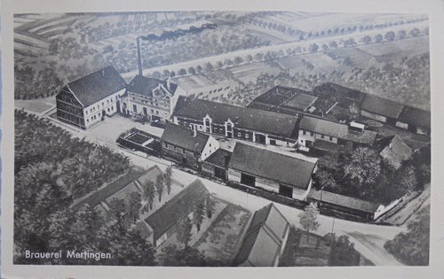
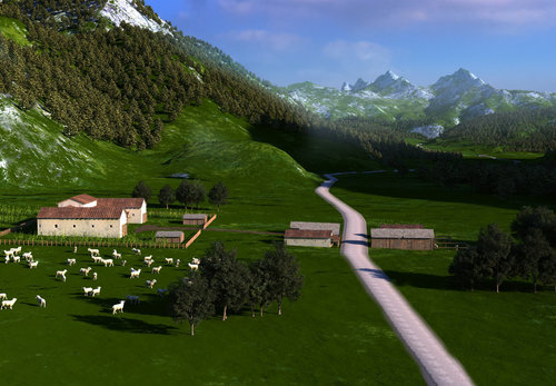
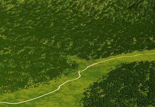
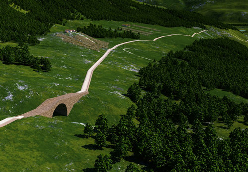
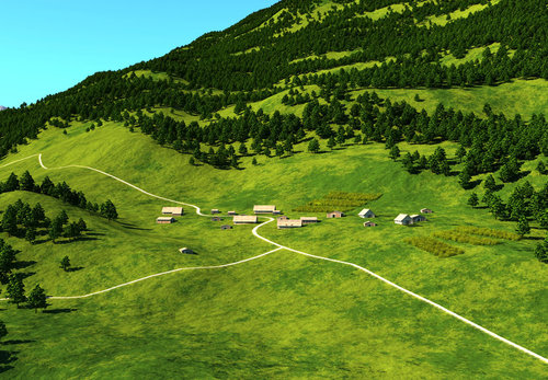
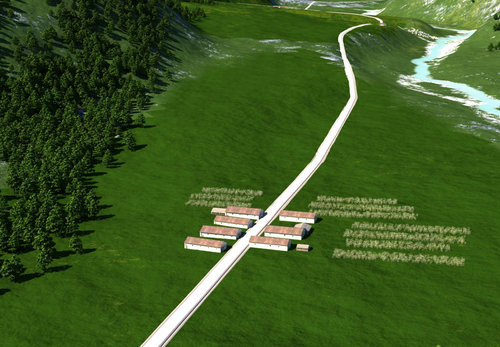
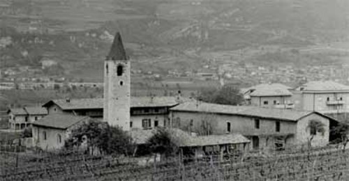
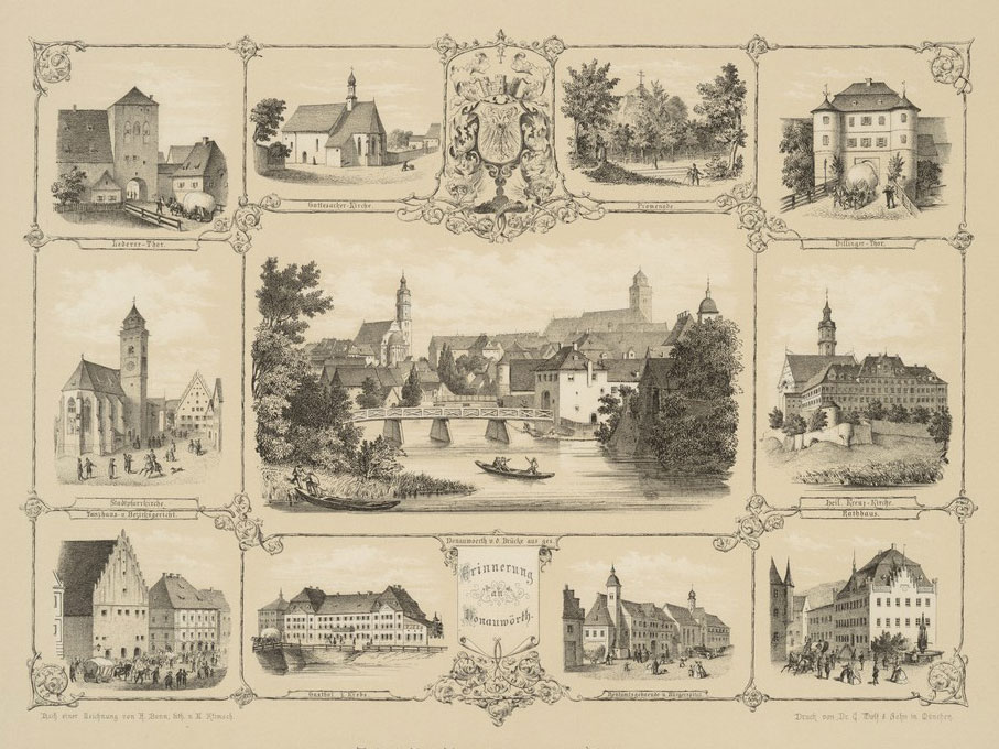
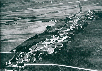
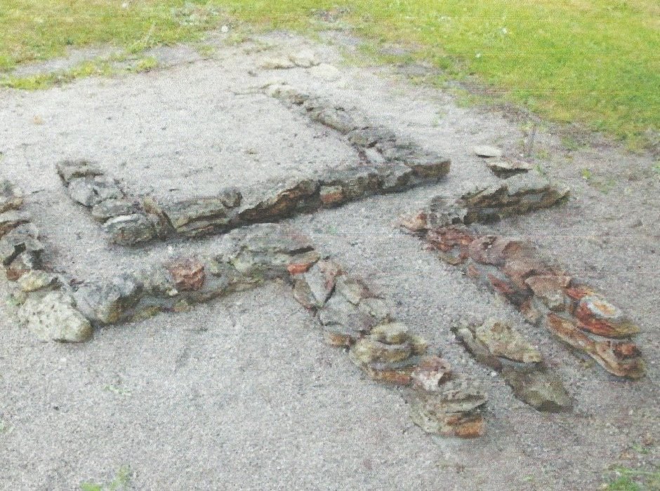
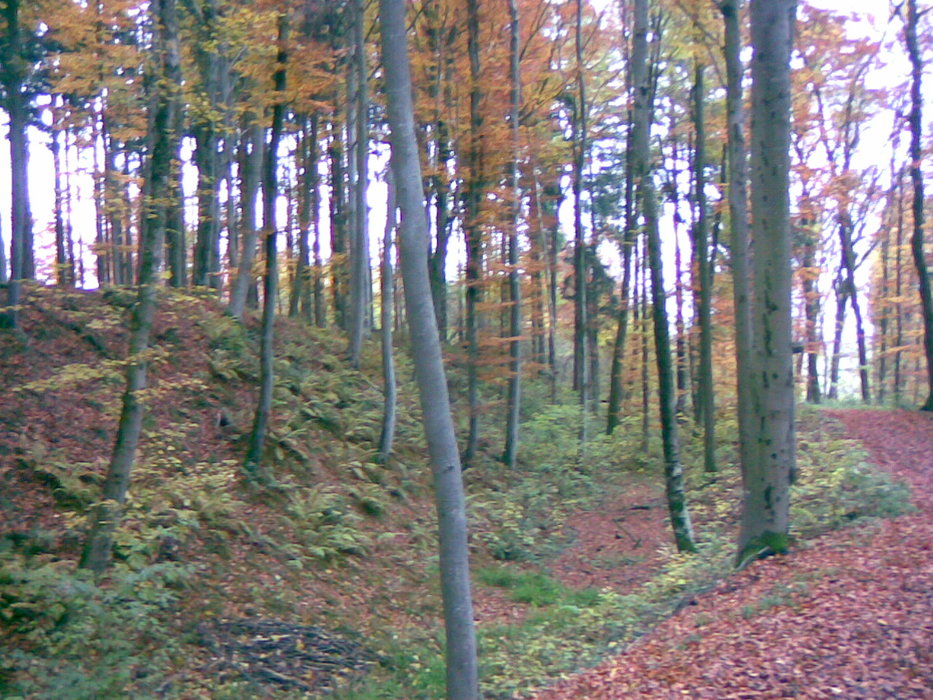
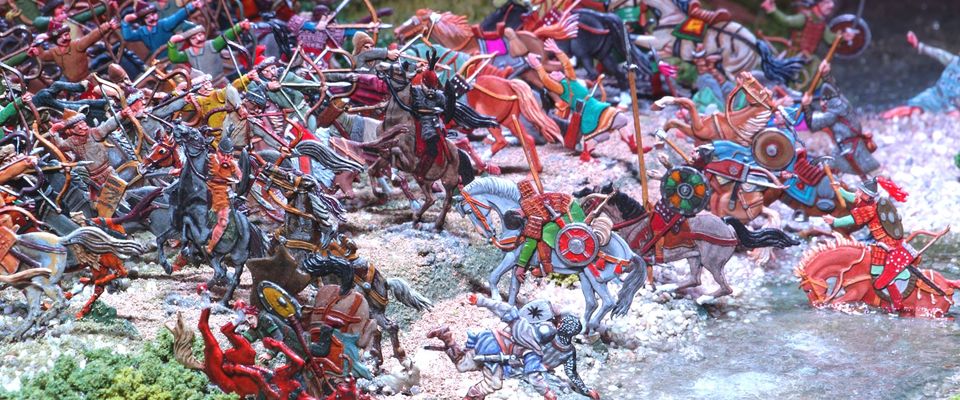
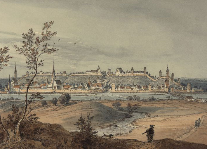
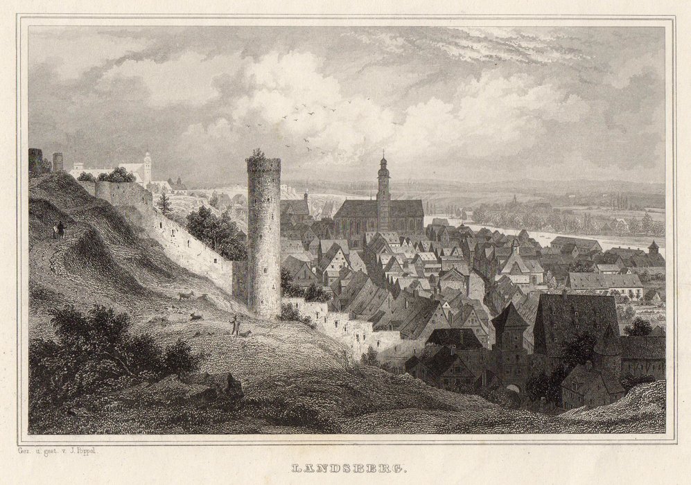
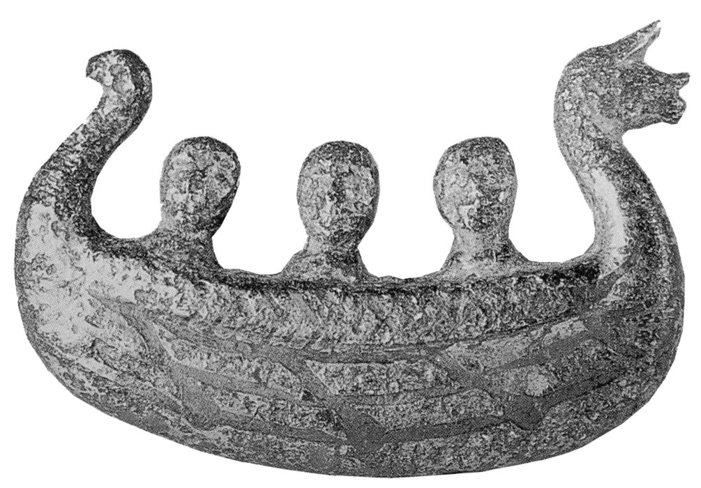
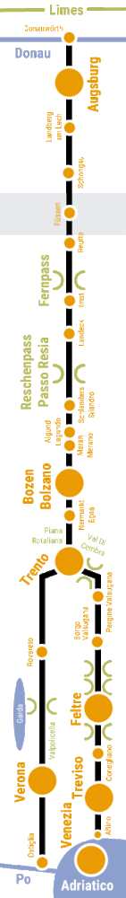
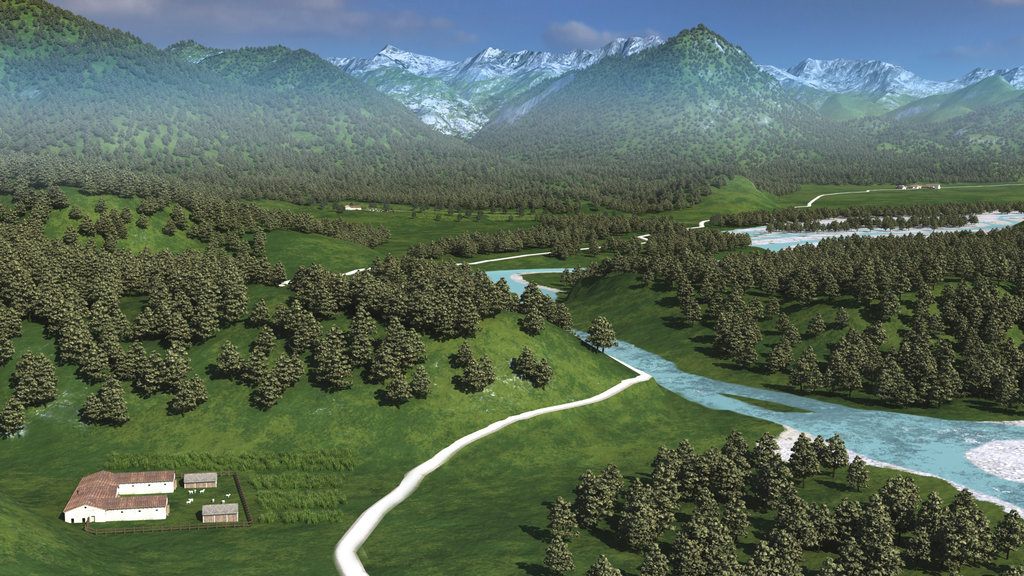
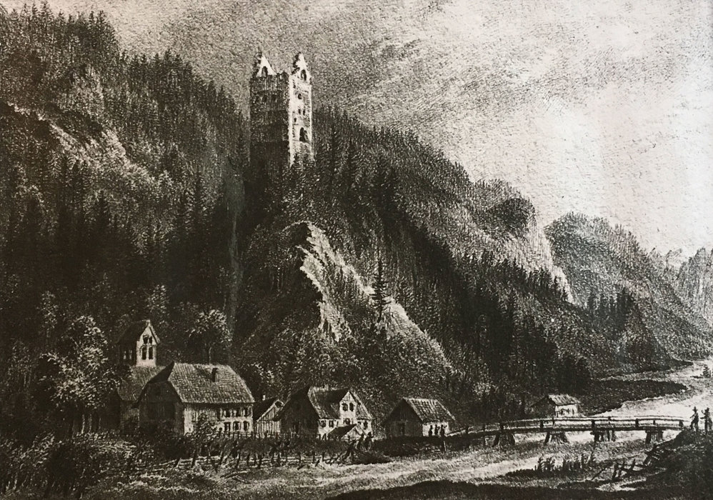
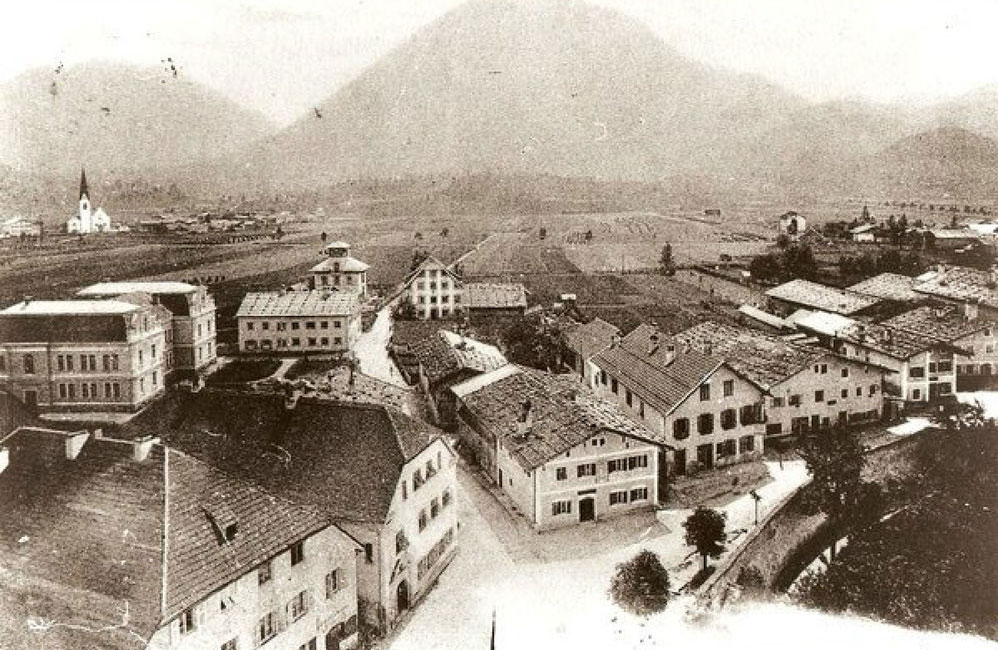
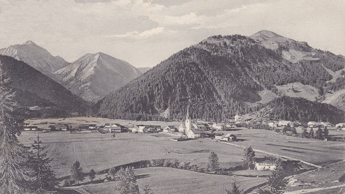
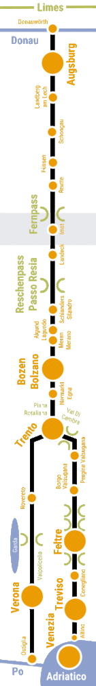
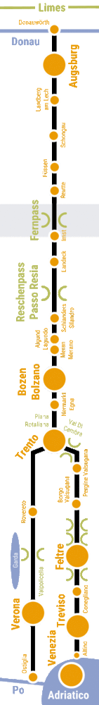
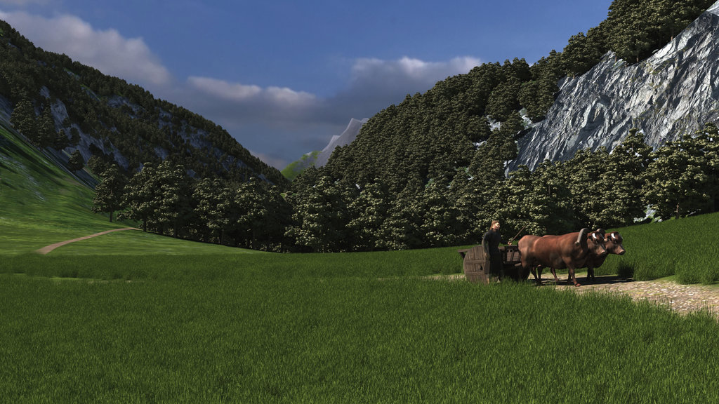
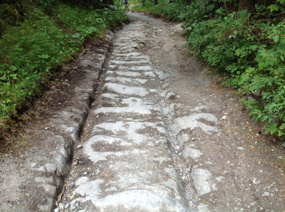
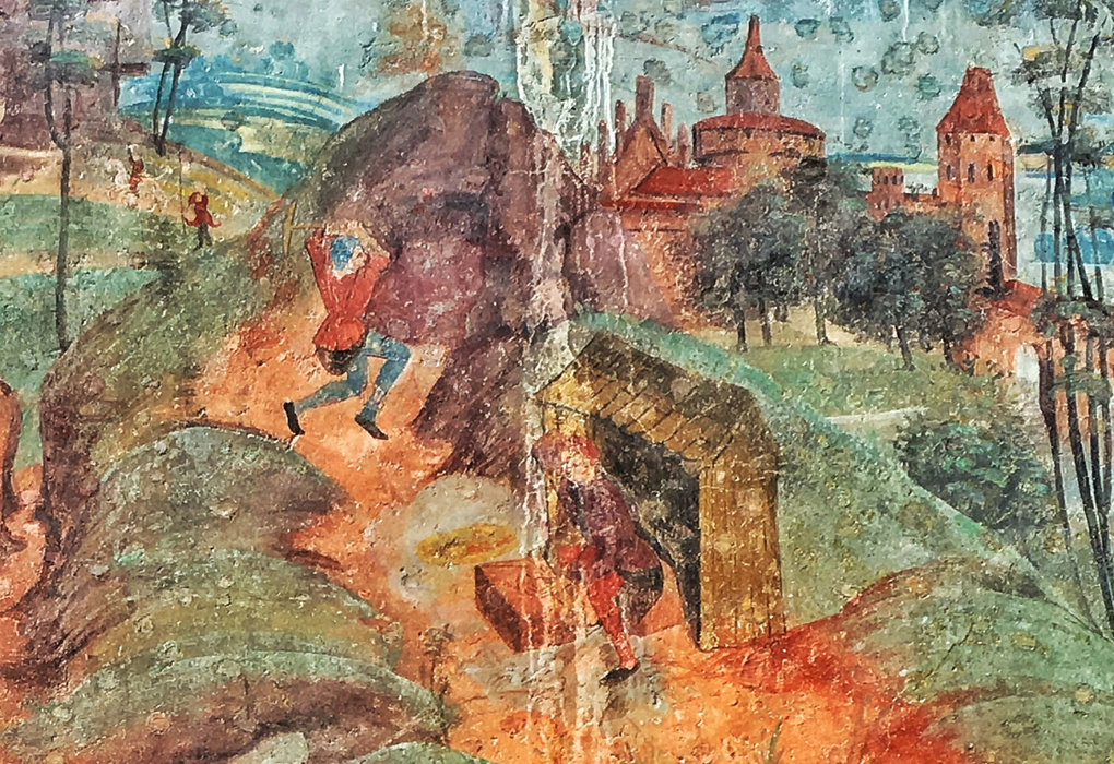
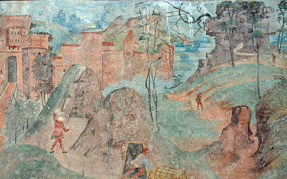
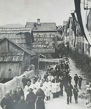
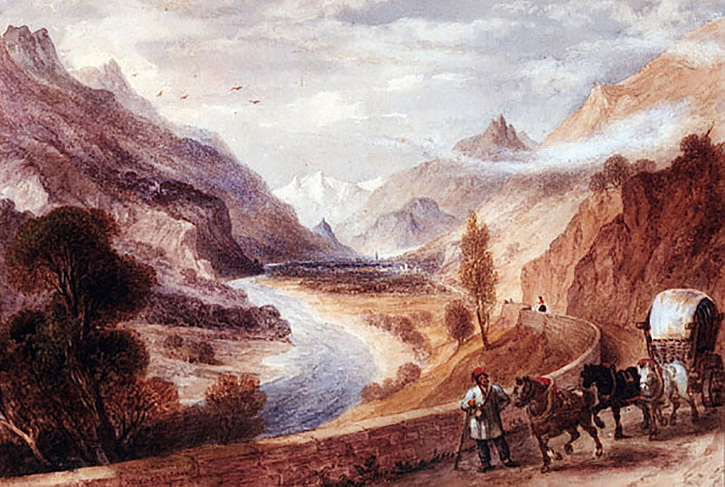
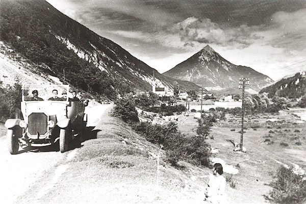
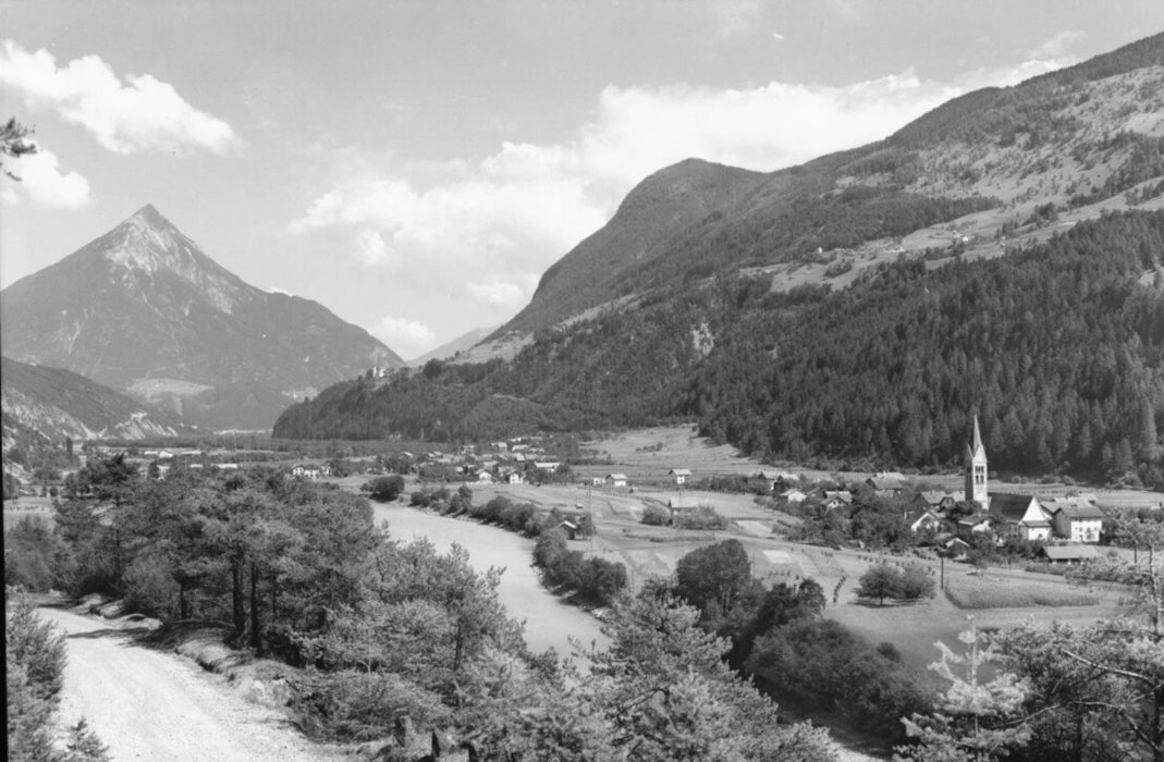
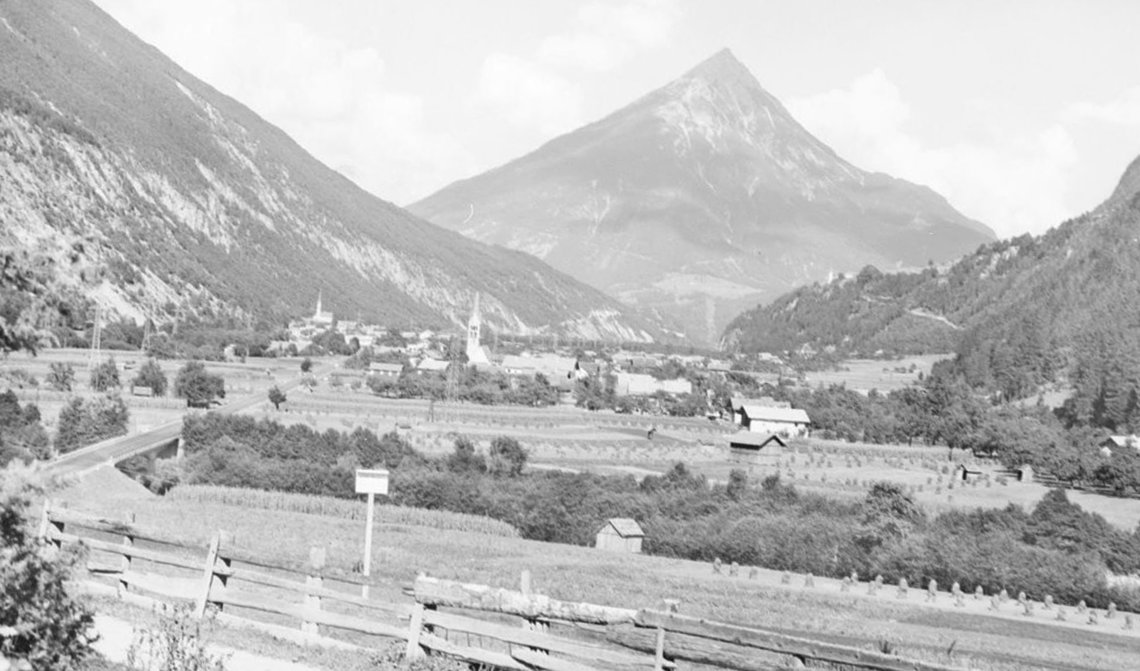
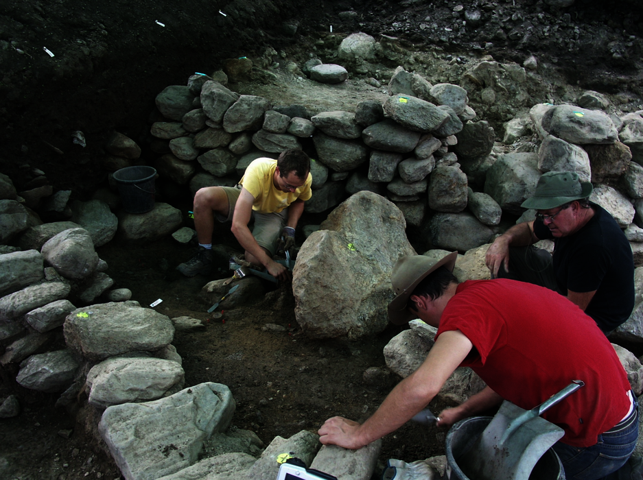
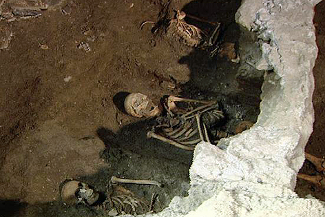
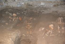
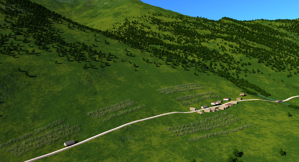
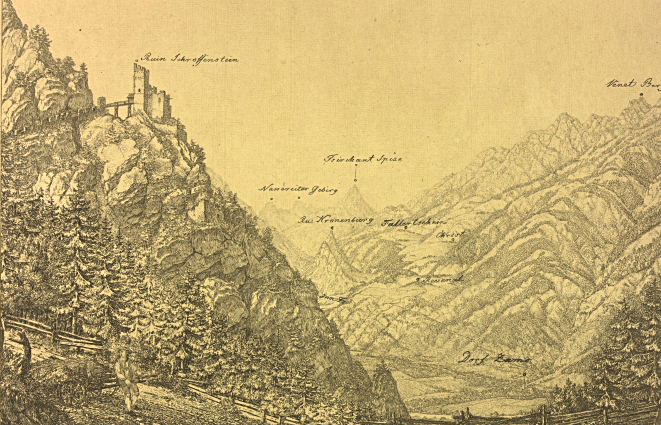
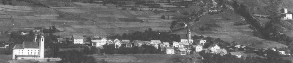
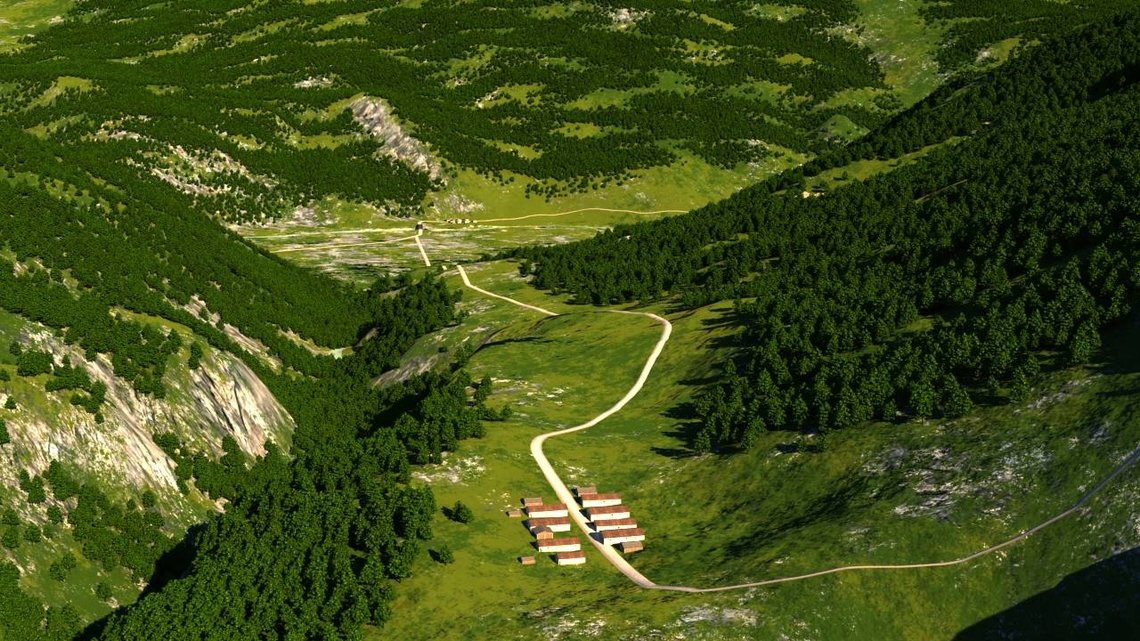
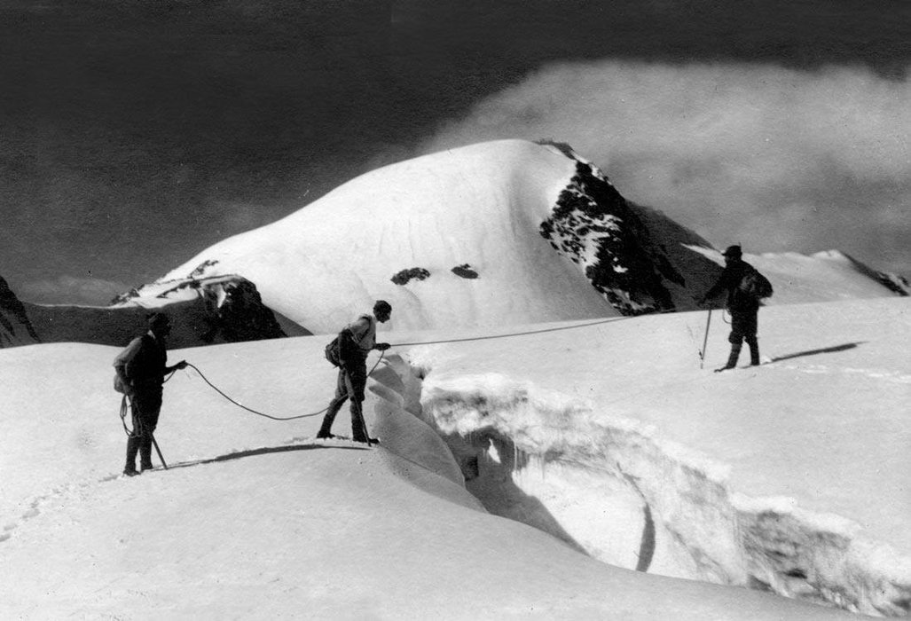
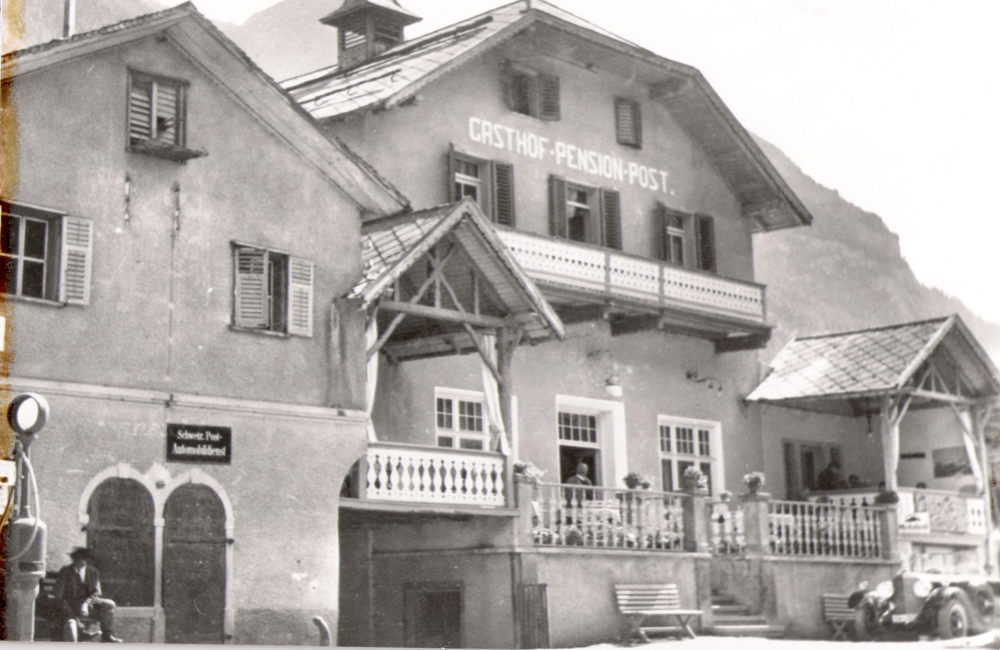
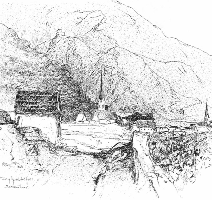
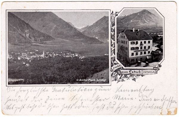
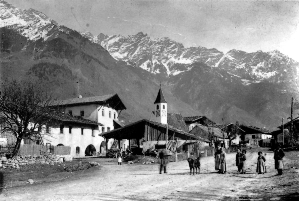
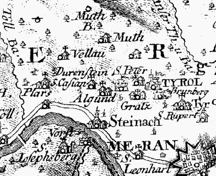
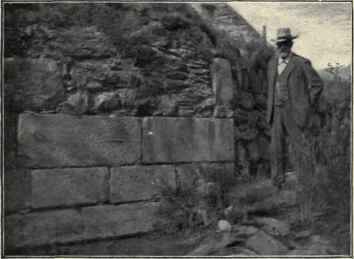
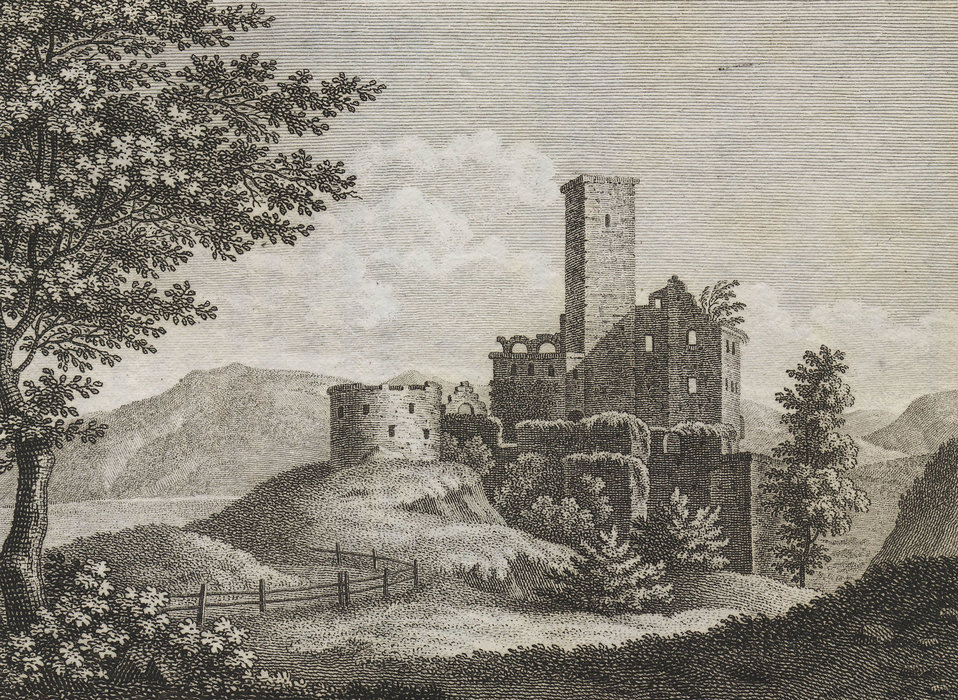
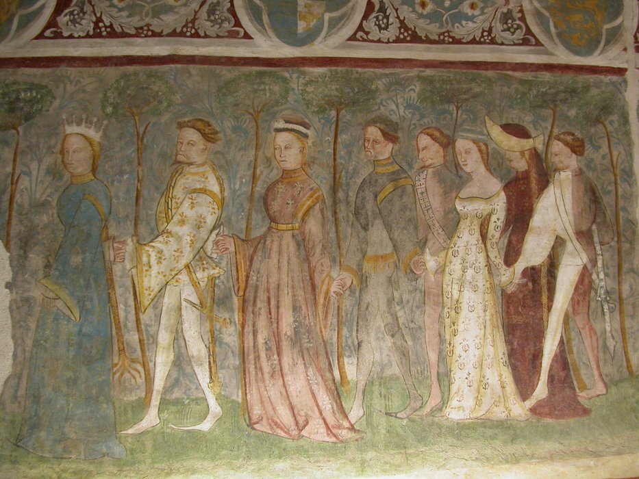
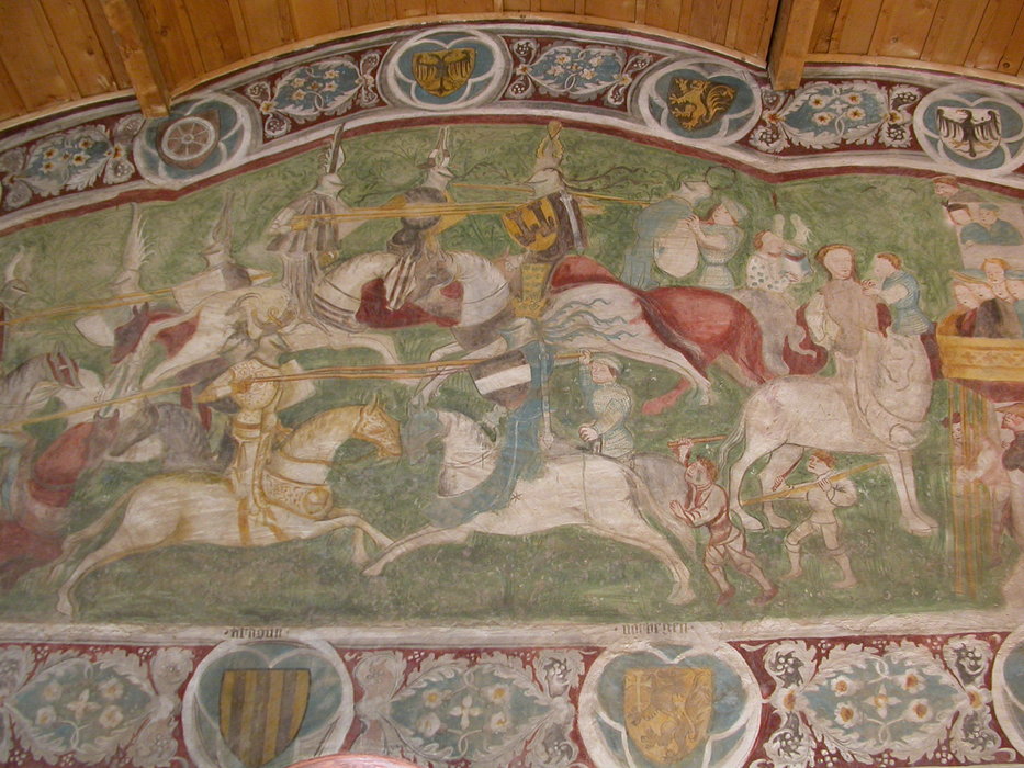
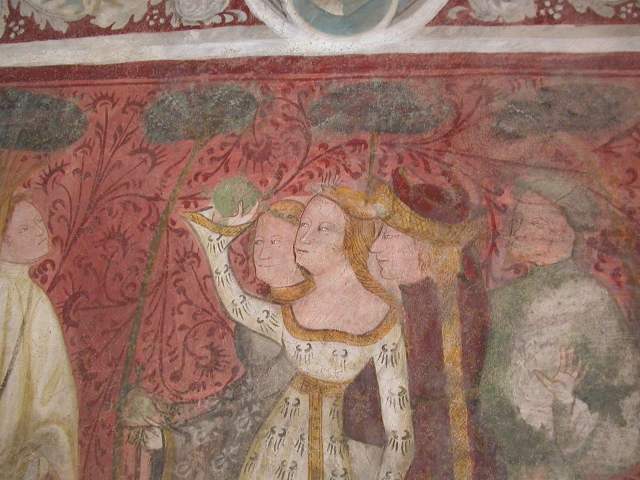
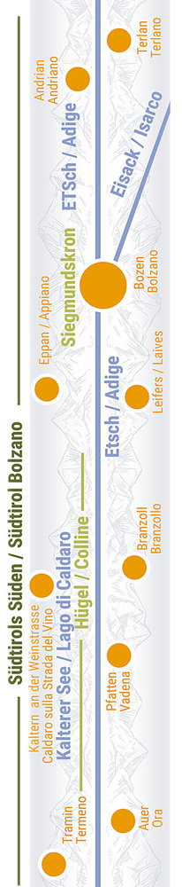
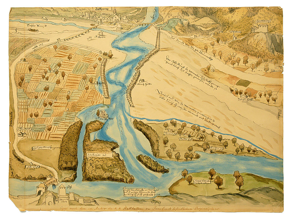
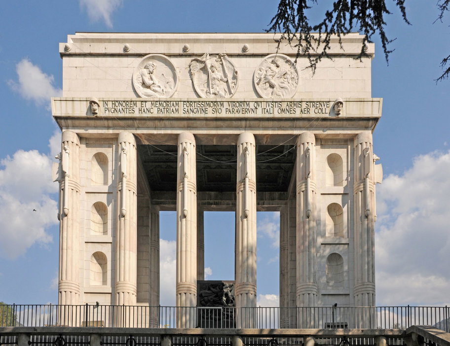
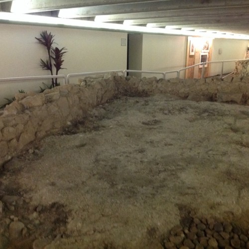
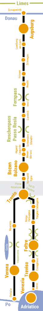
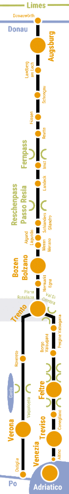
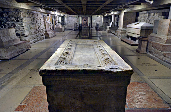
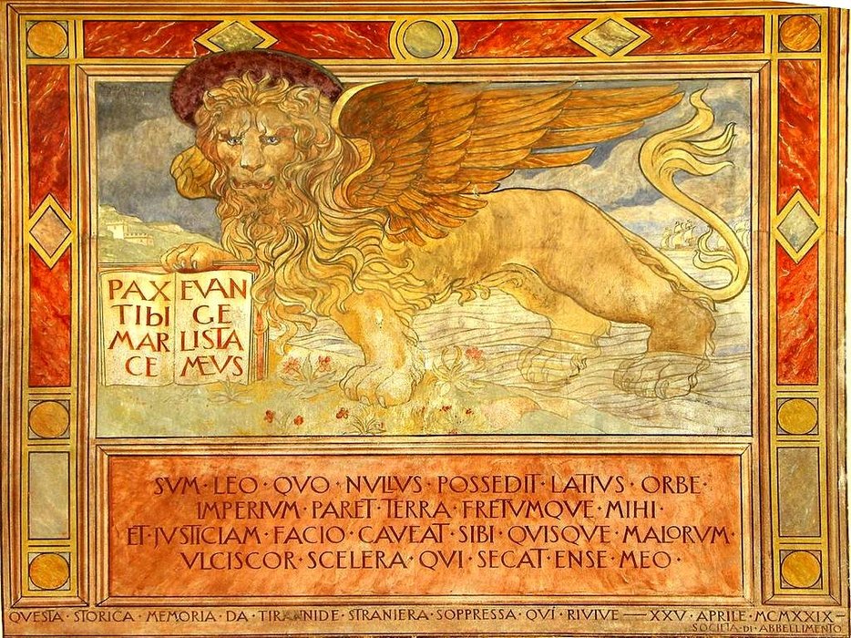
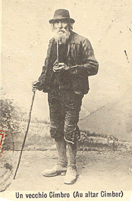
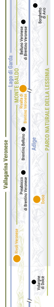
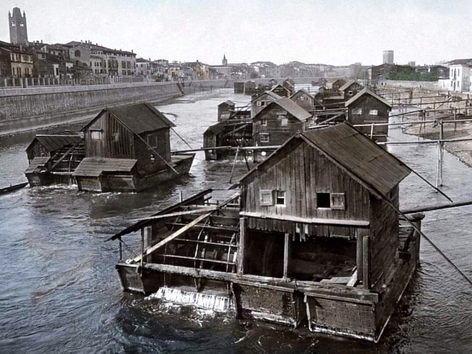
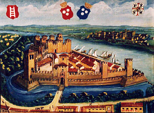
History(s): Thousands of years old river crossing

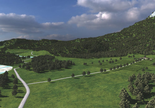
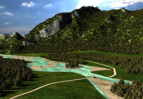
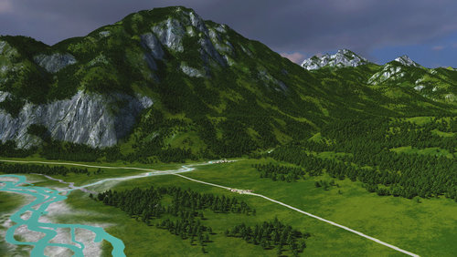
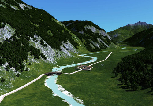
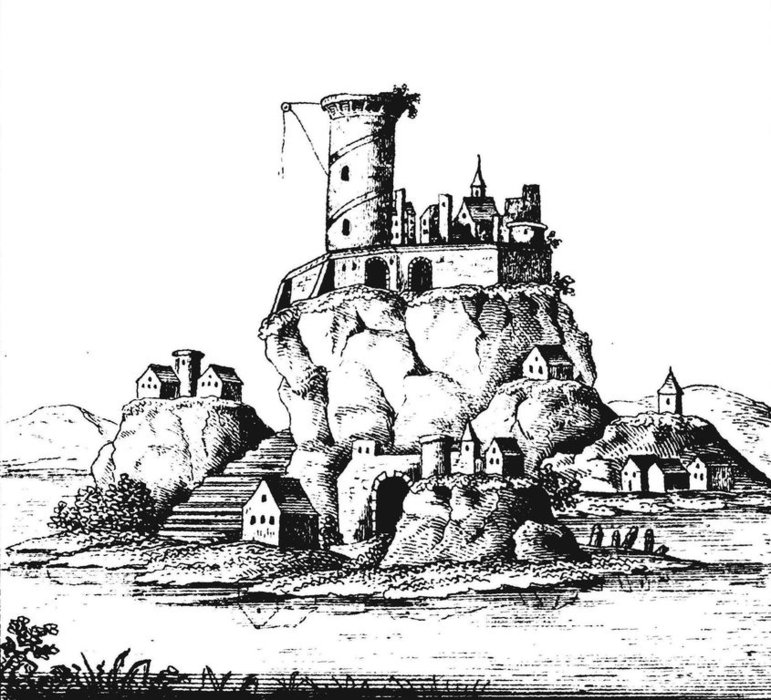
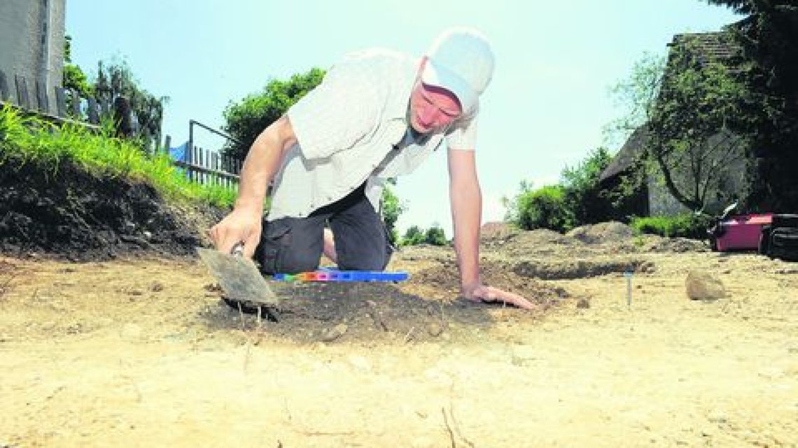
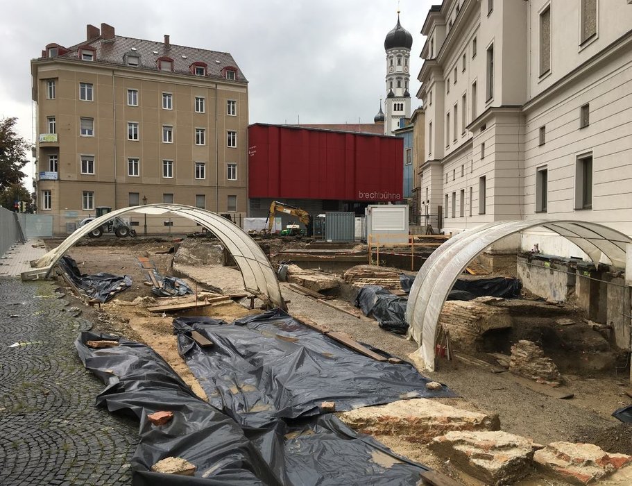
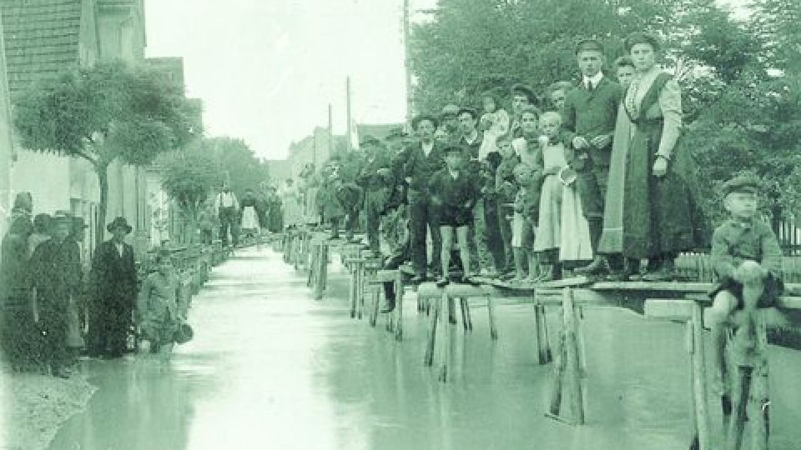
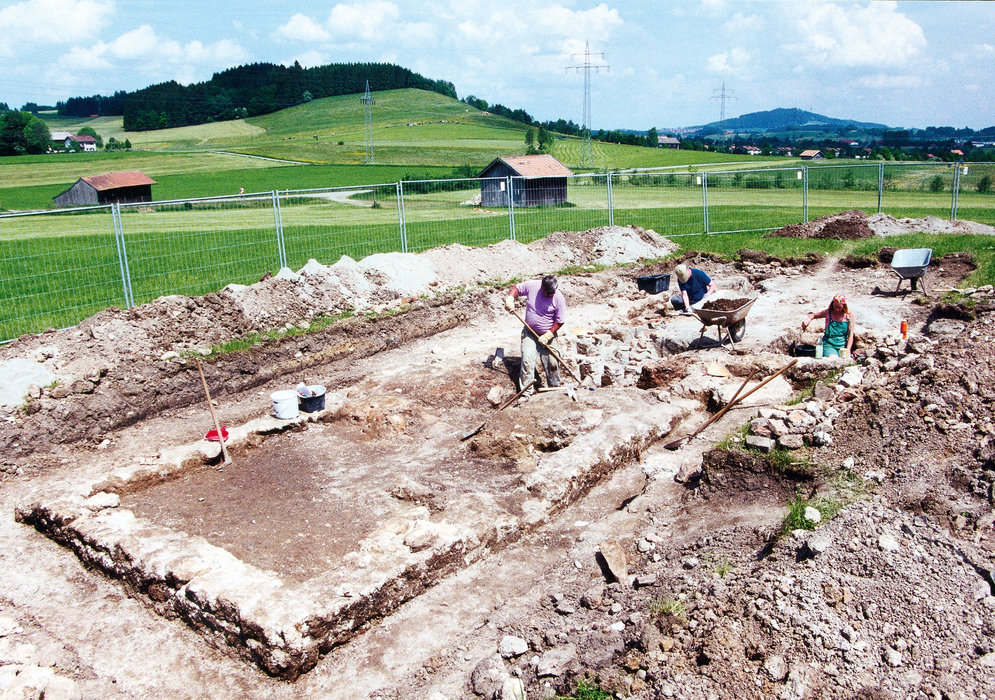
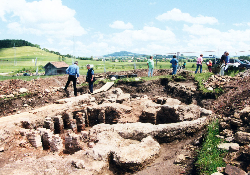
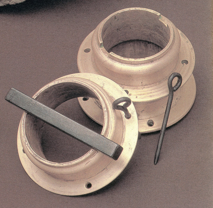
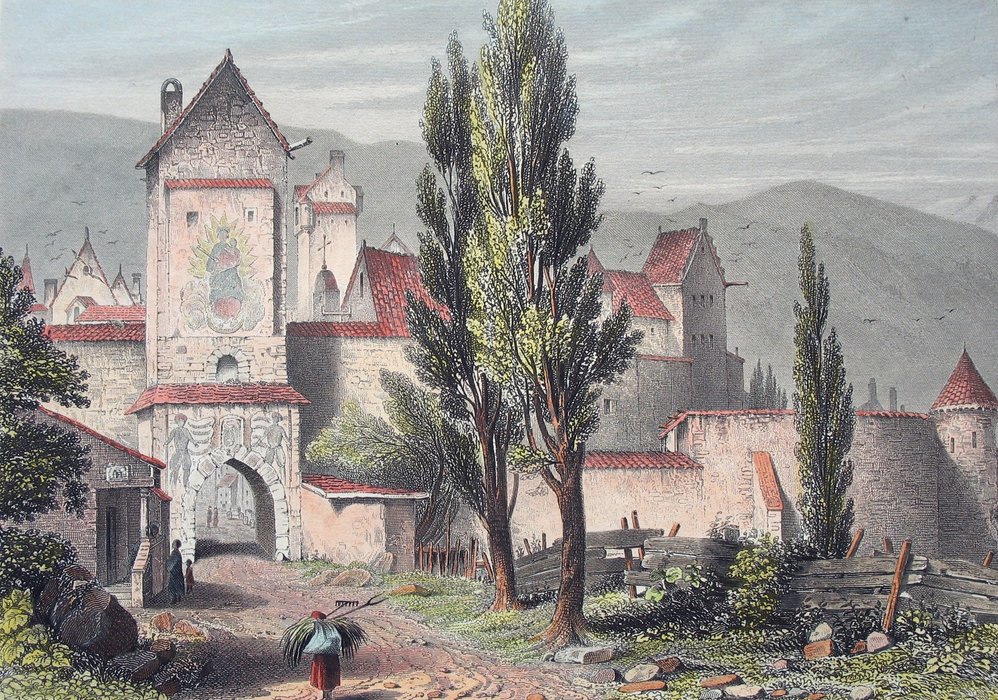
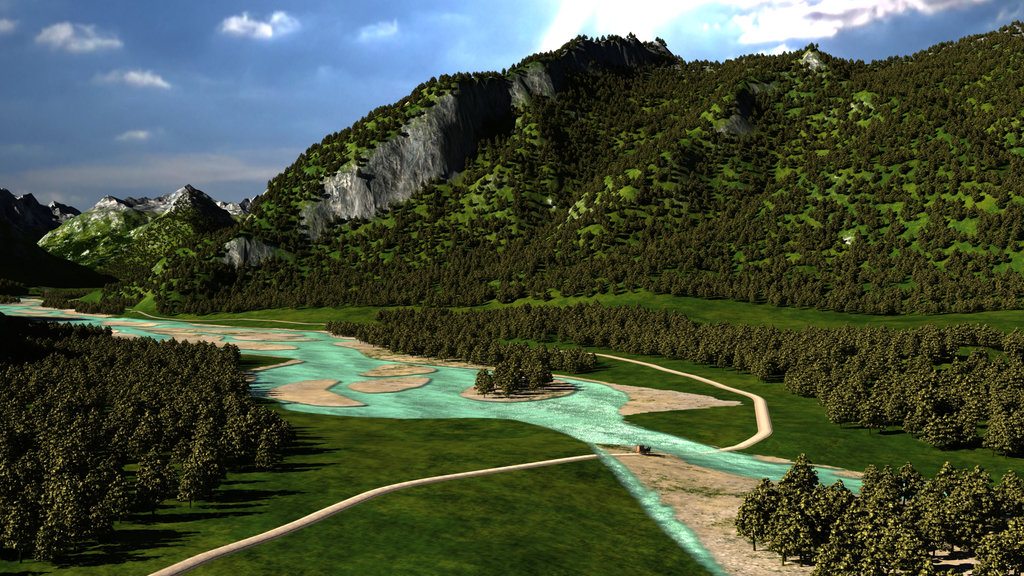
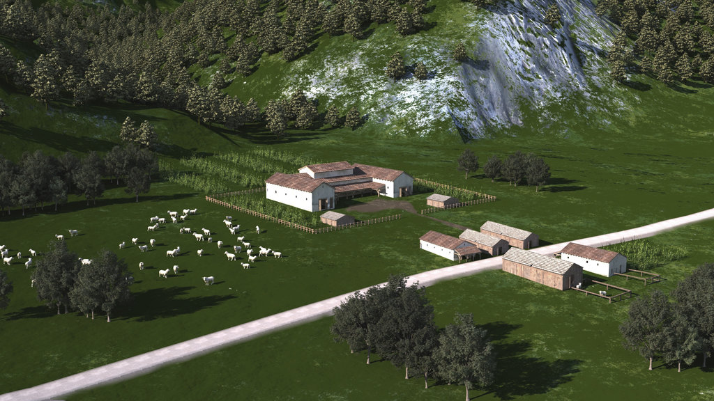
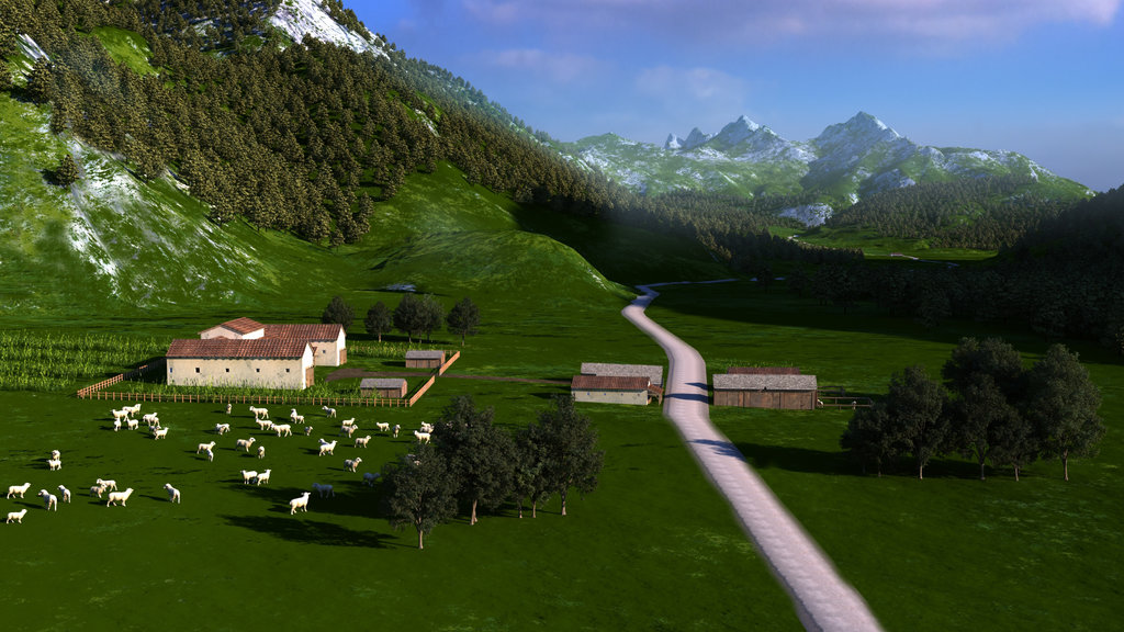
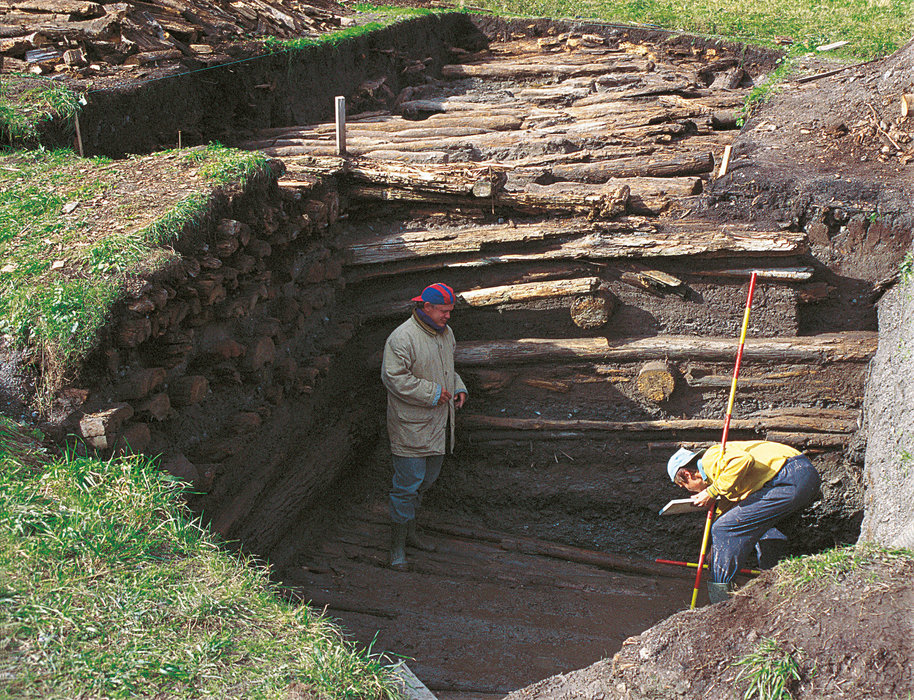
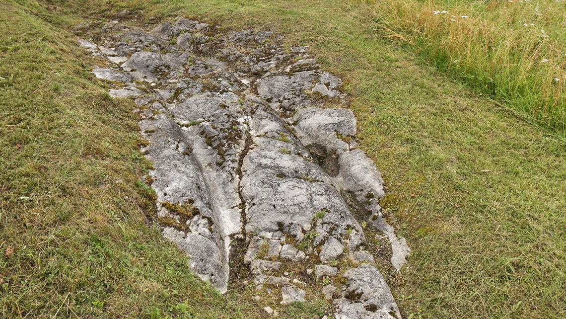
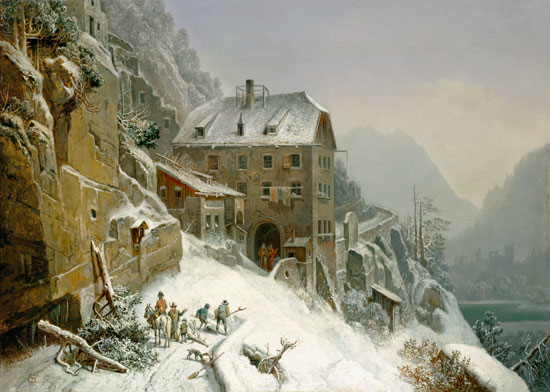
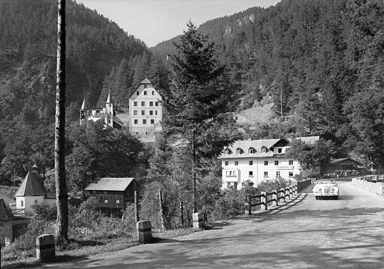
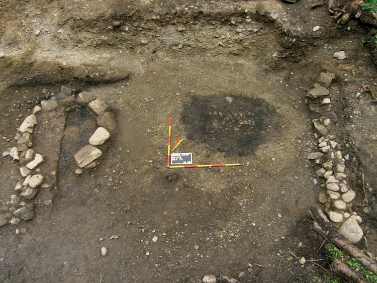
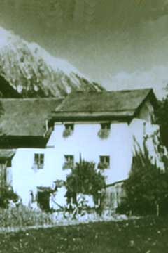
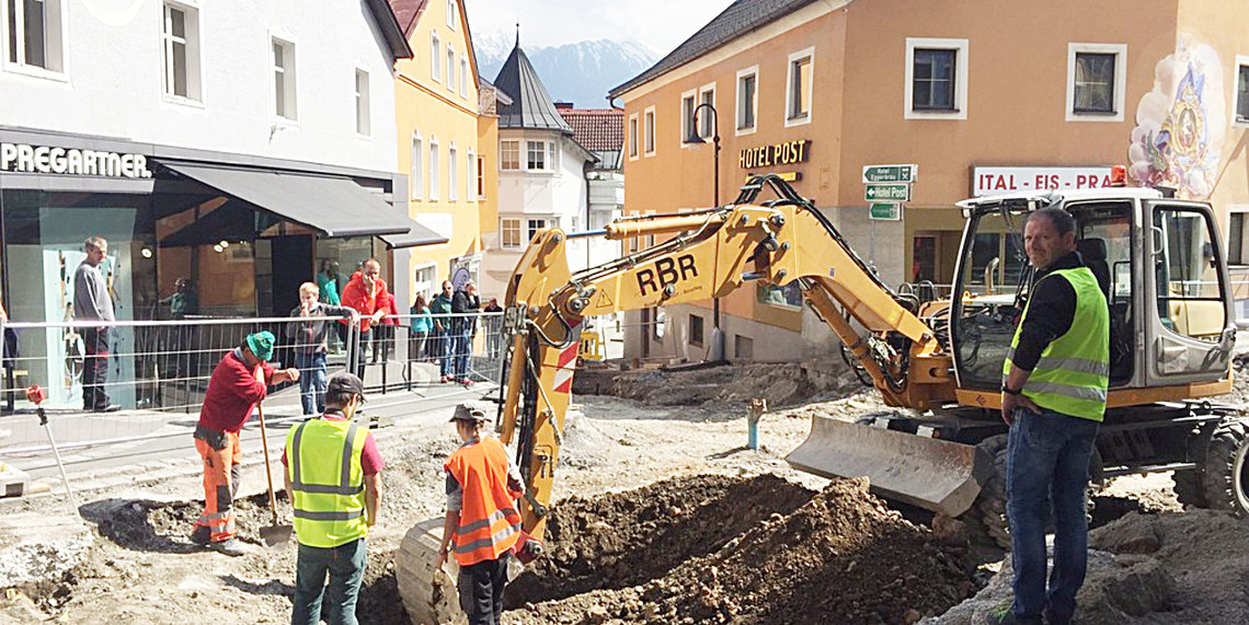
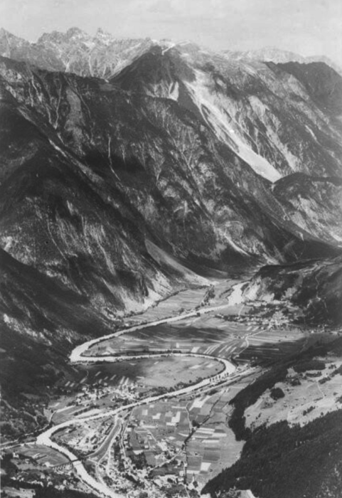
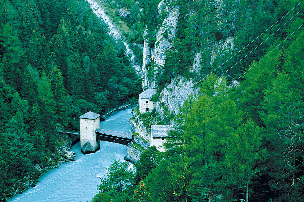
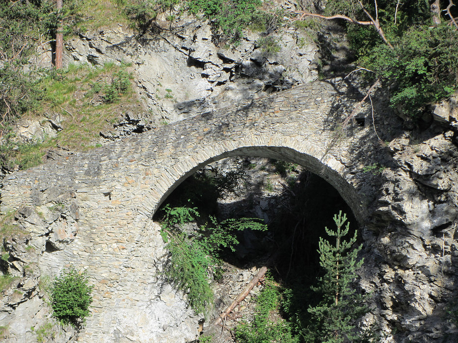
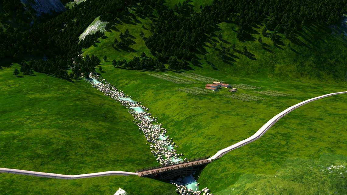
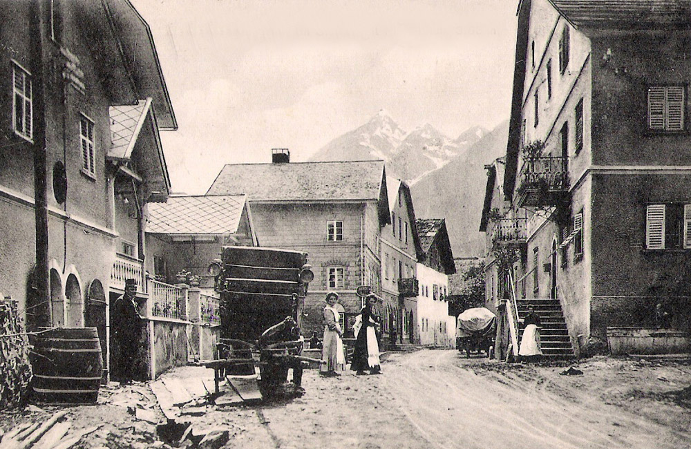
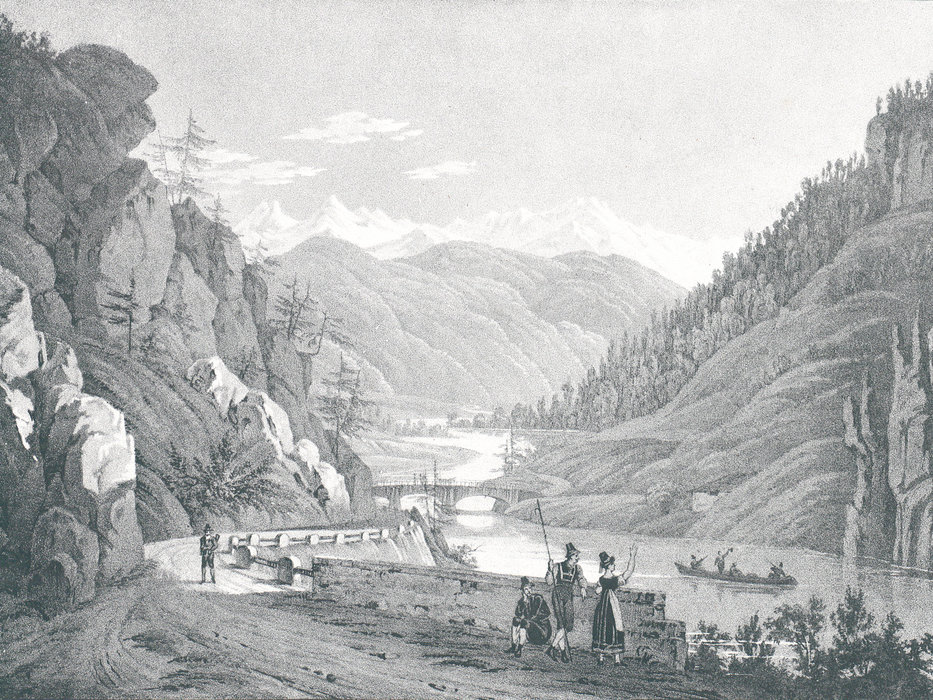
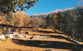
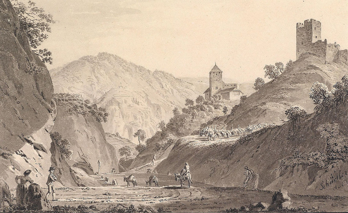
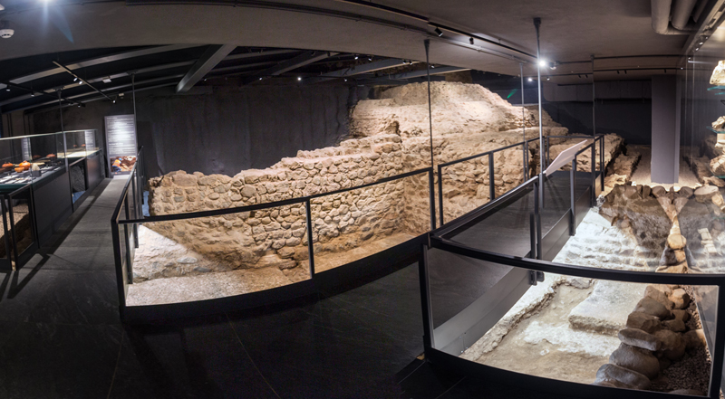
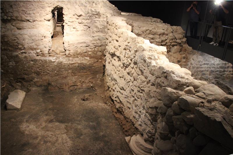
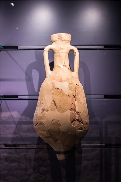
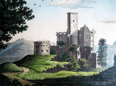
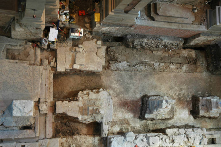
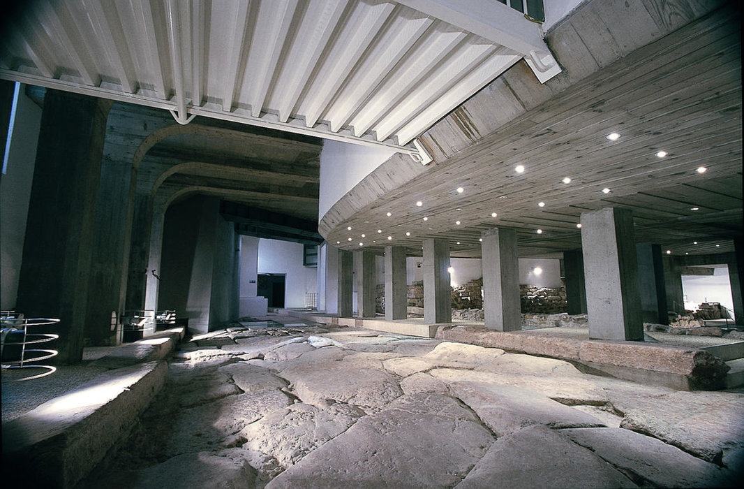
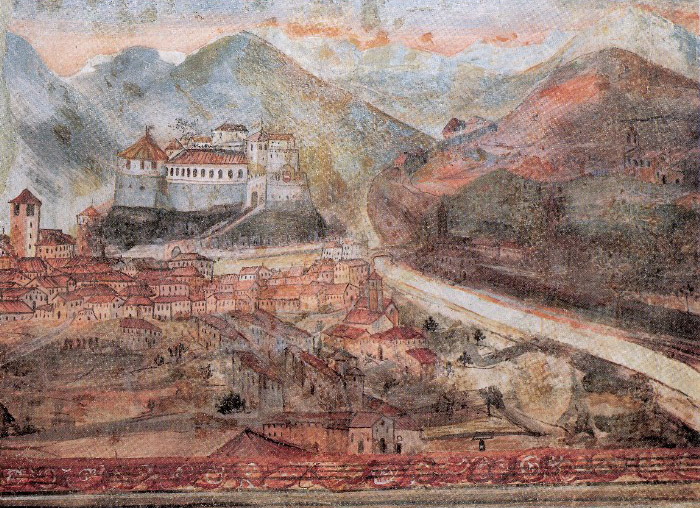
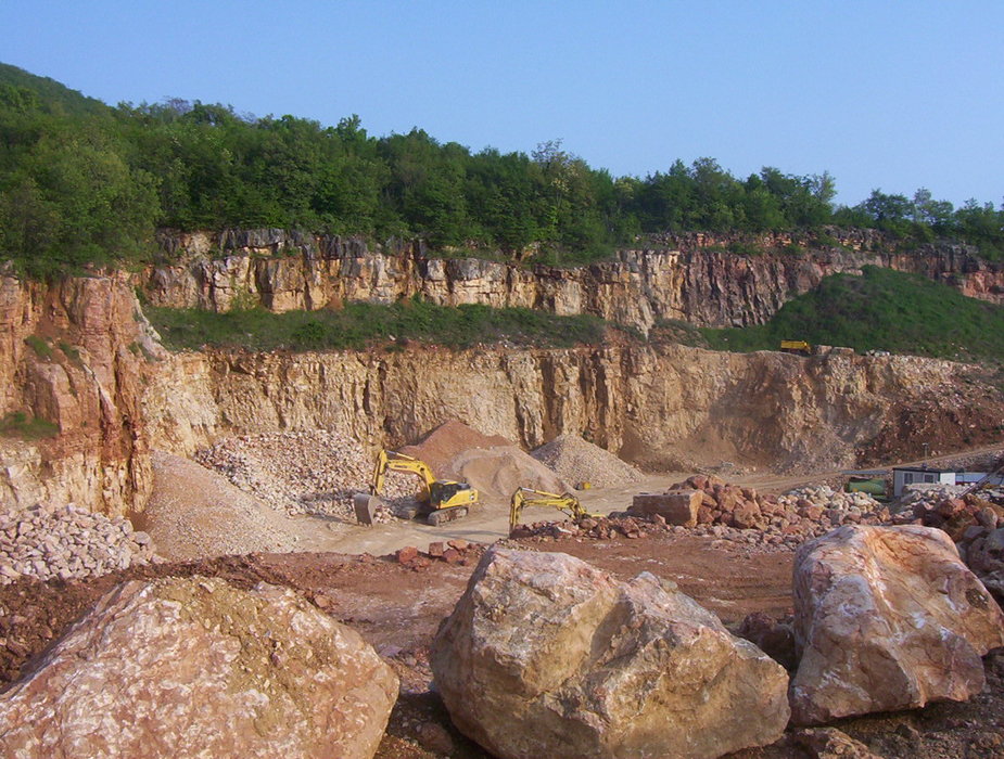
In Algund there was most probably a river crossing already in Roman and pre-Roman times. The place, where also today a bridge over the Adige is located, was the last possibility to cross the river relatively easily, before the river with its water, the carried debris, alluvial forests, swamps, ... dominated the whole valley, except for some debris cones on the right and on the left. Bridges south of Algundo were therefore much longer and more complex to build, which is why there were few of them and - where at all possible - supra-regional roads have run along the right and left of the Adige since time immemorial. Incidentally, the bridgehead of the medieval bridge can be admired in the Bridgehead Museum in Algund near the swimming pool, directly on the Adige River.

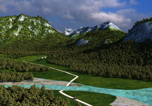
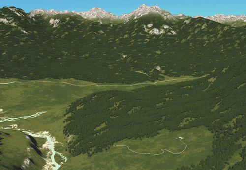
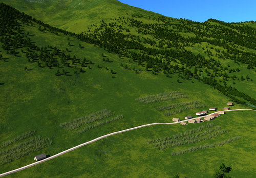
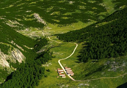
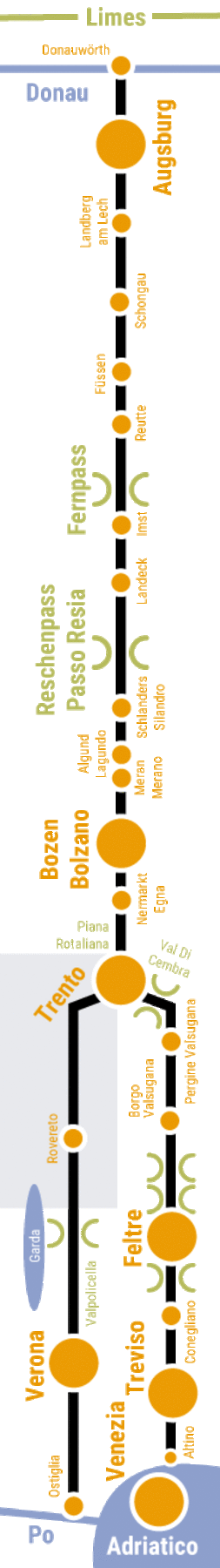
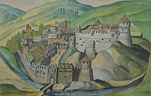
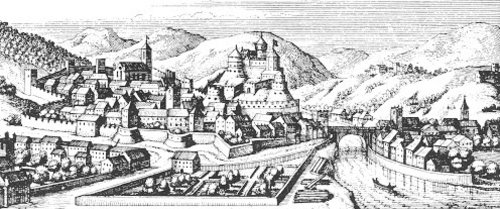
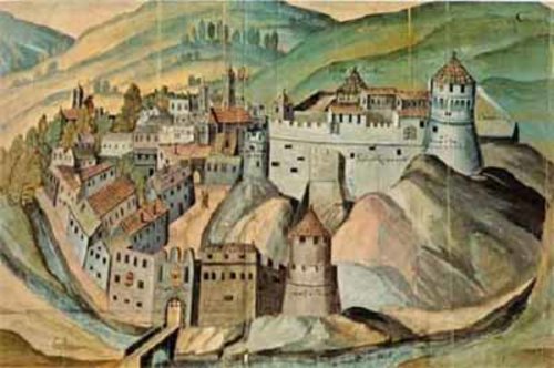
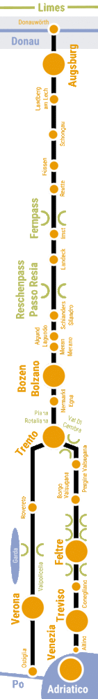
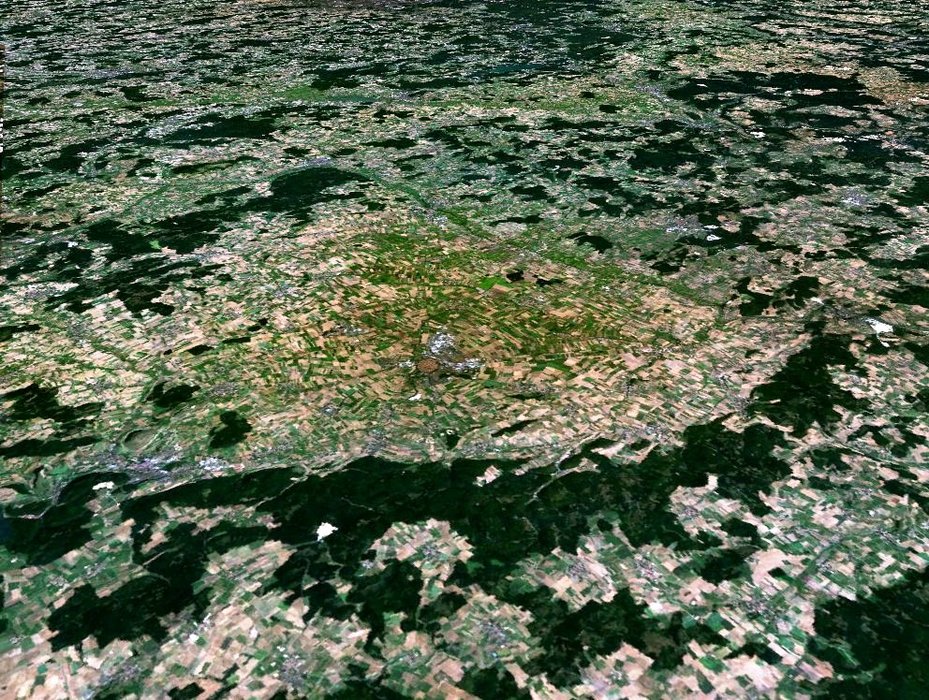
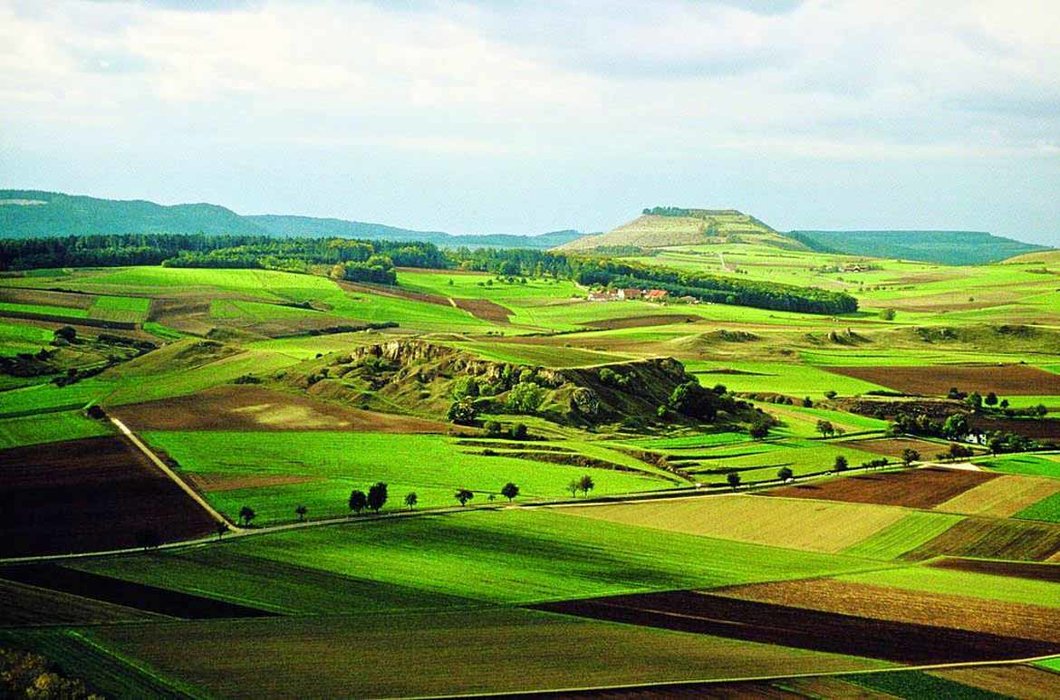
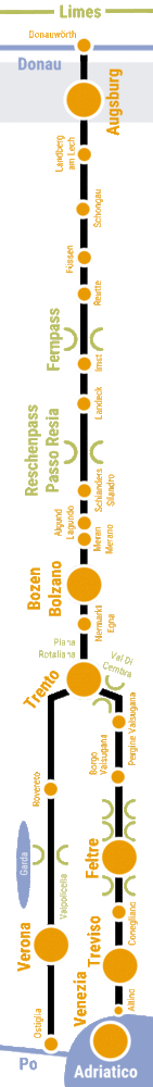
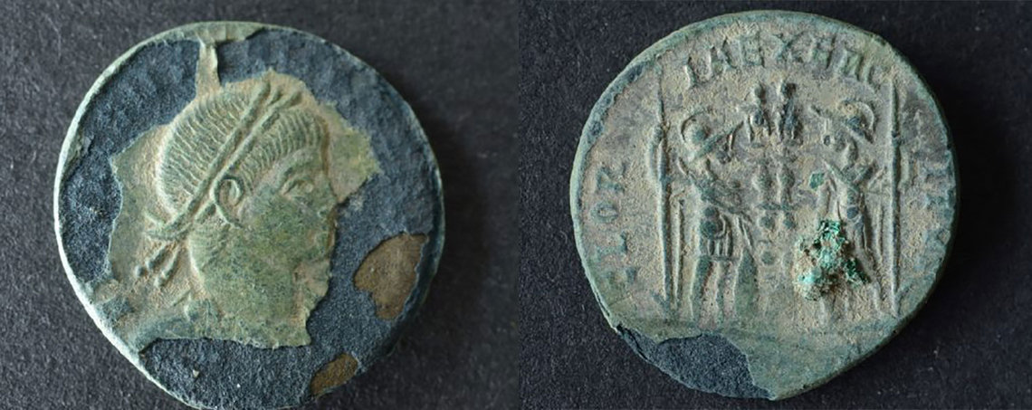
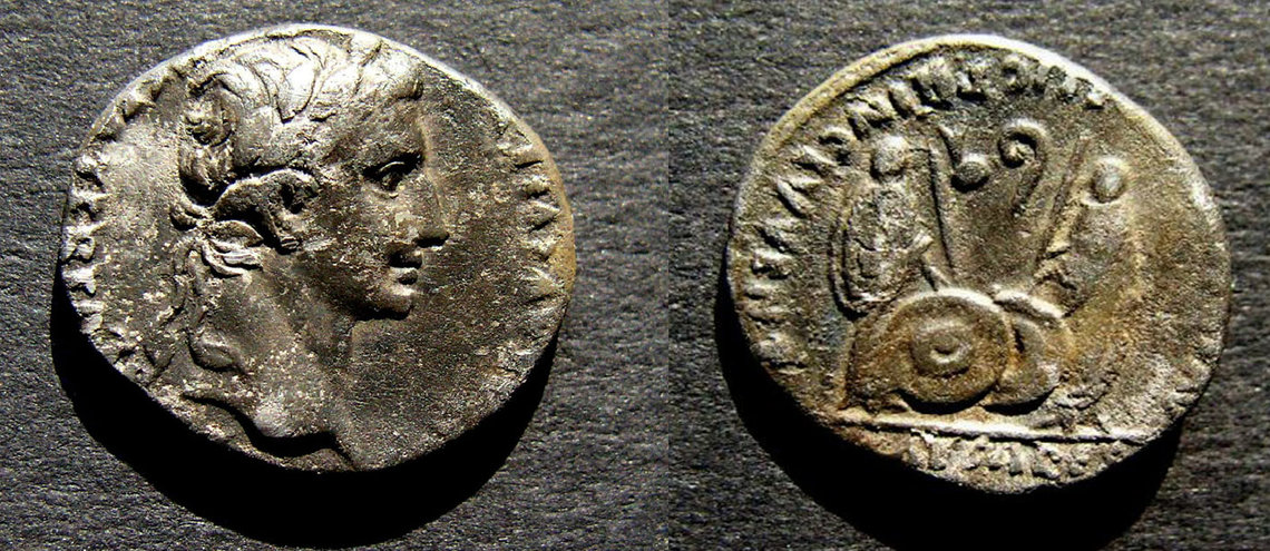
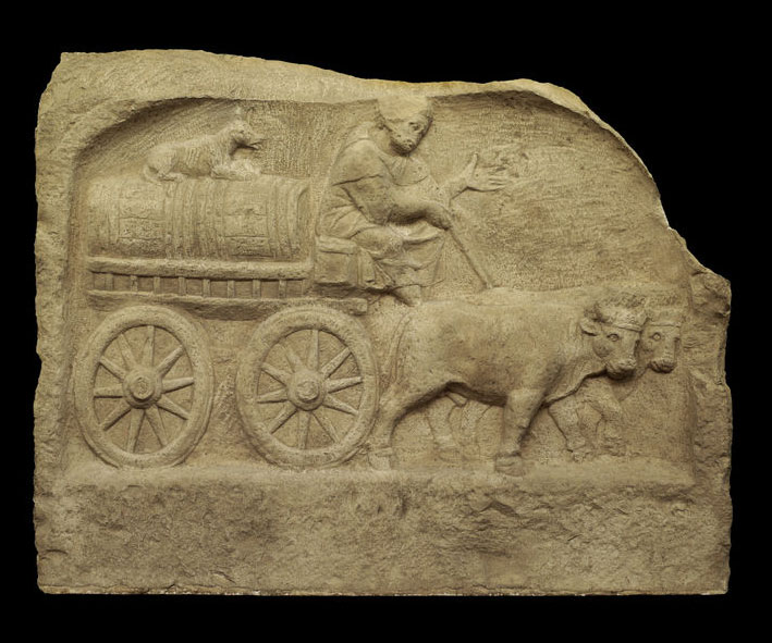
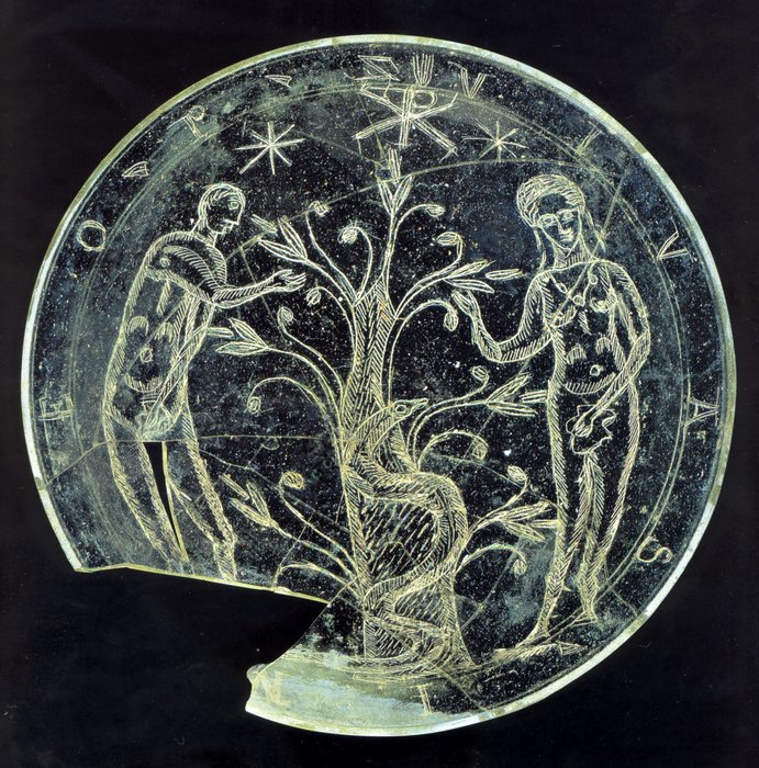
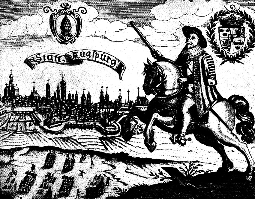
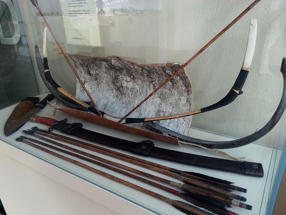
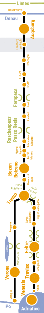
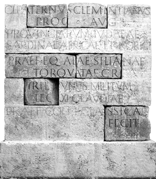
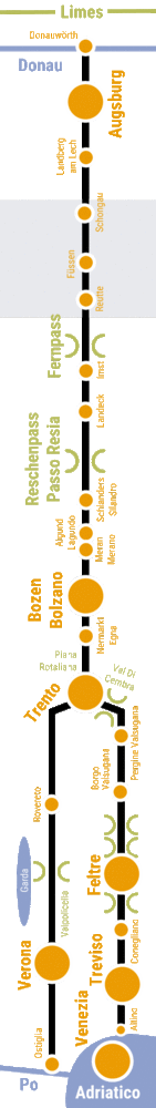
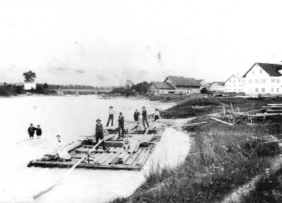
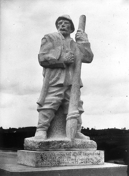
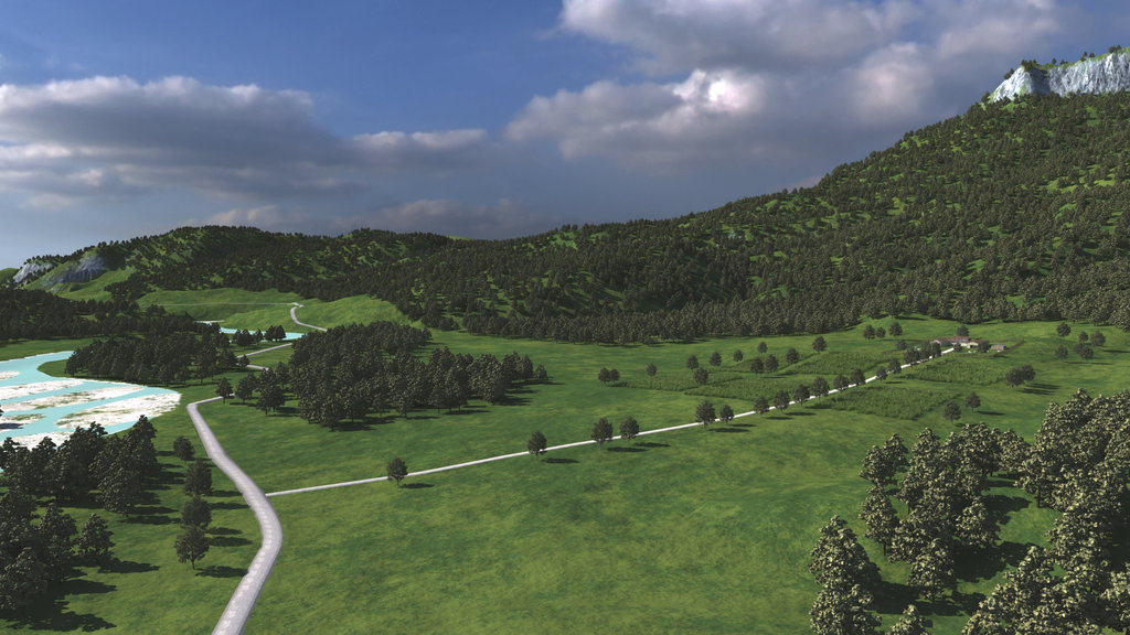
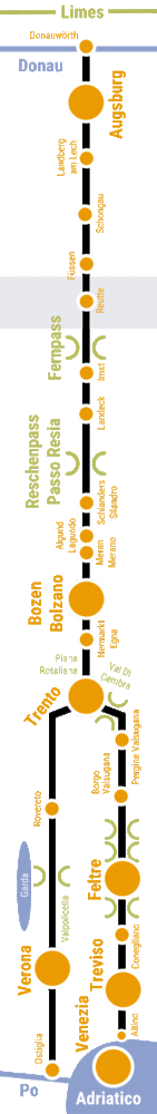
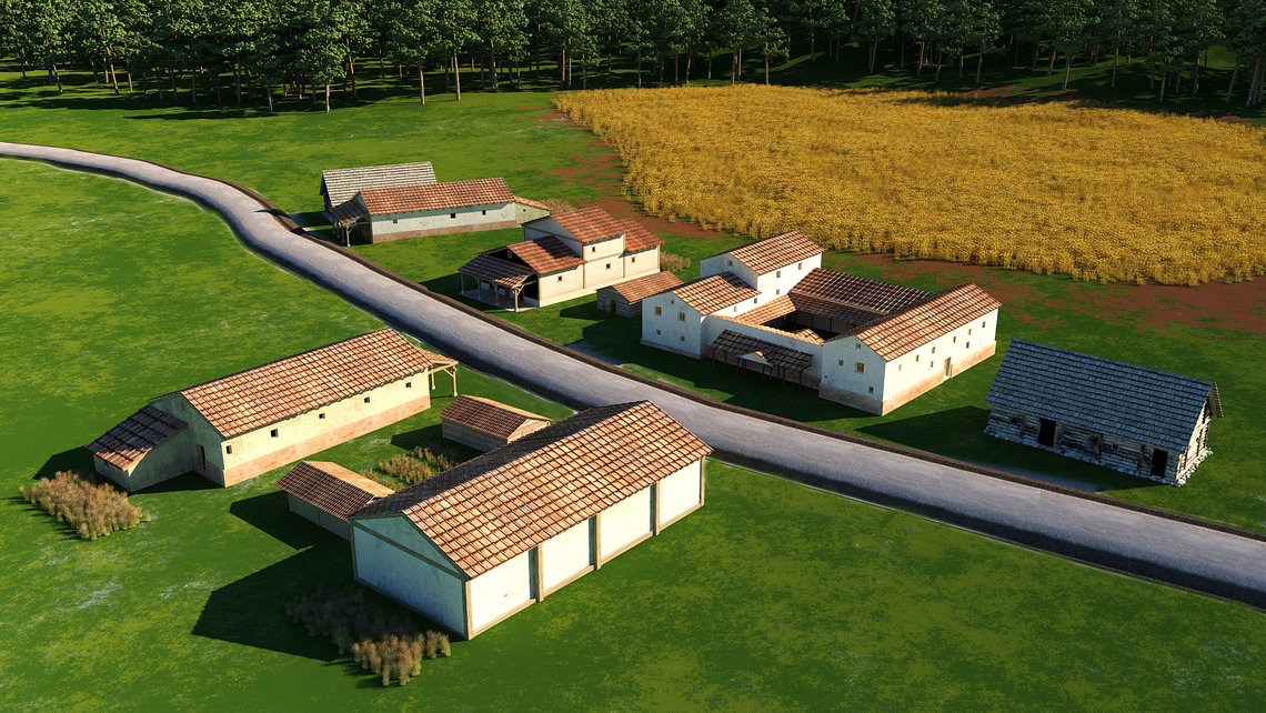
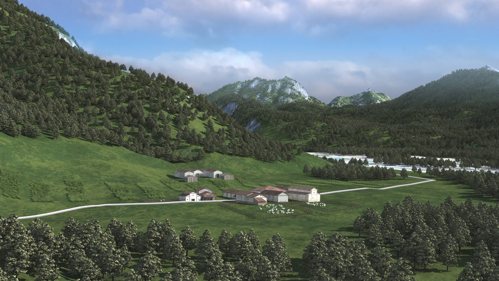
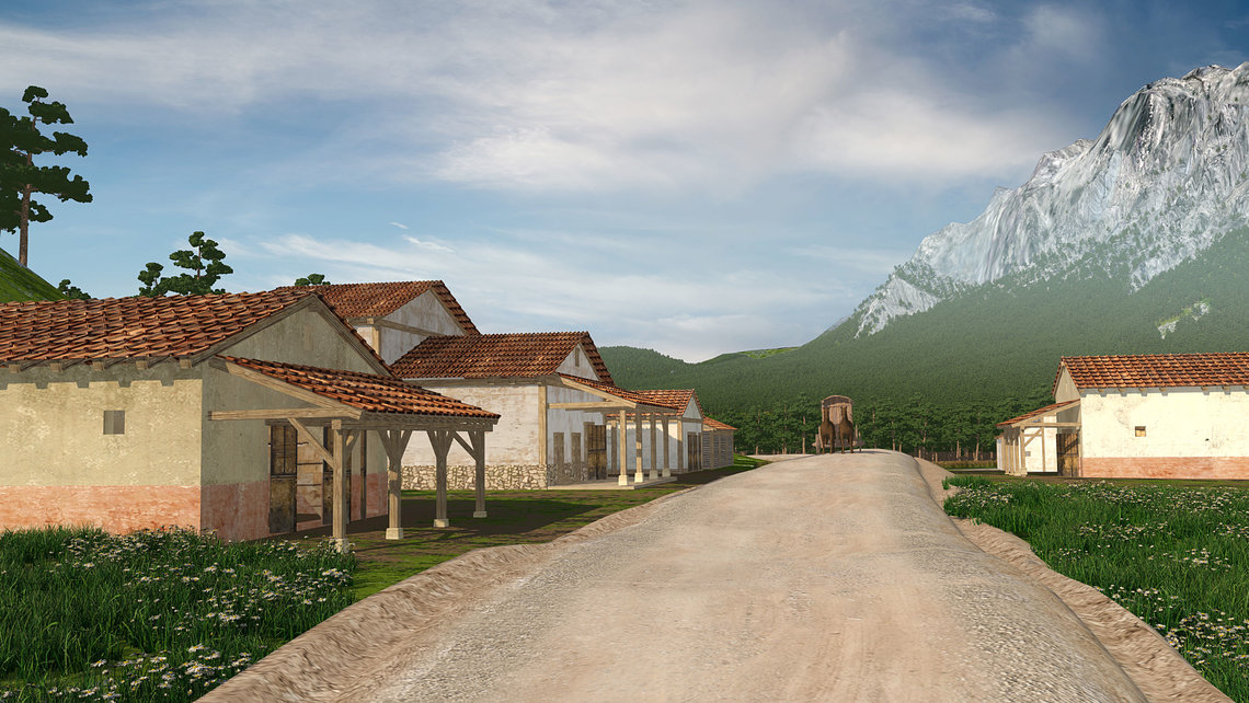
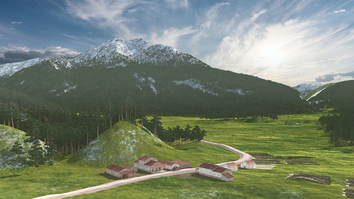
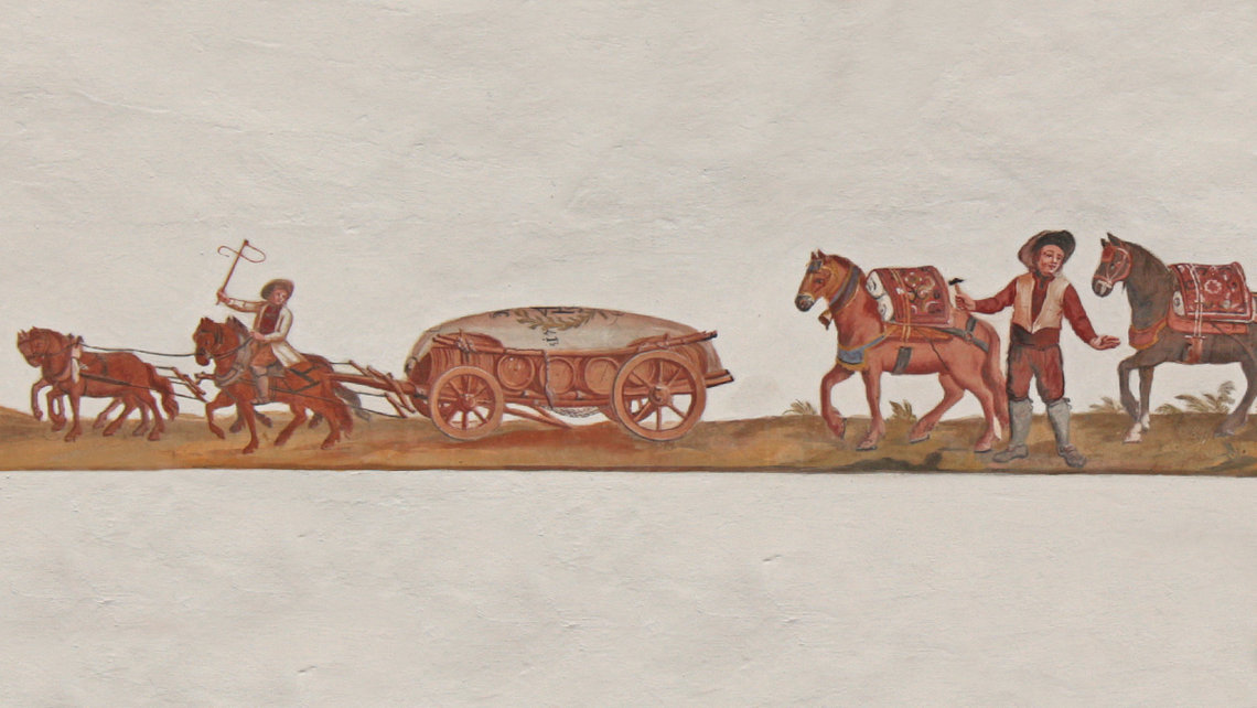
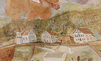
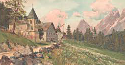
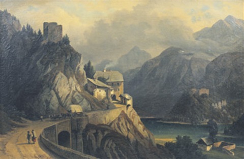
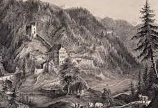
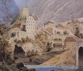
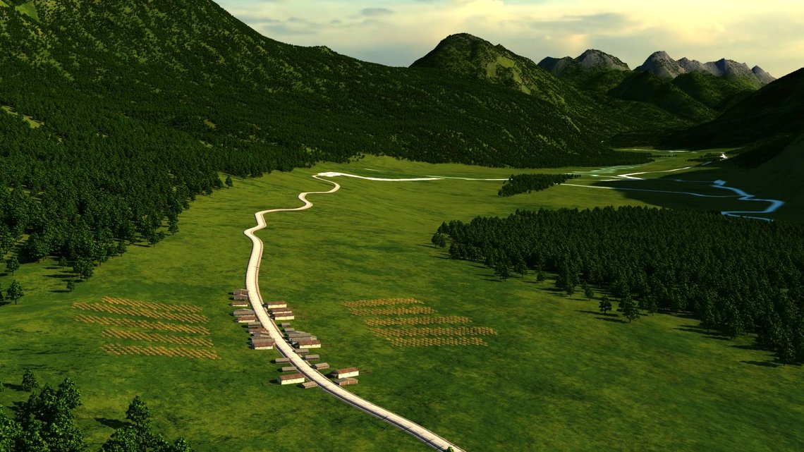
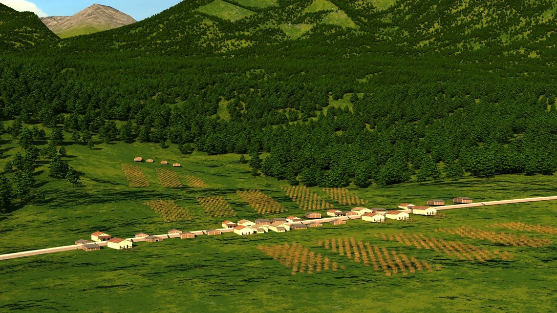
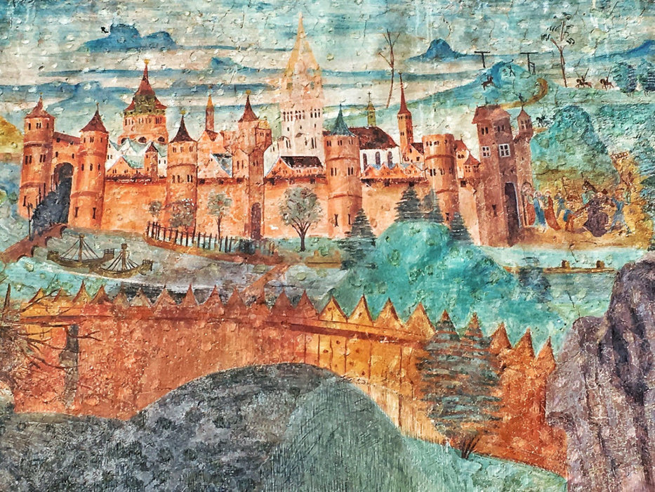
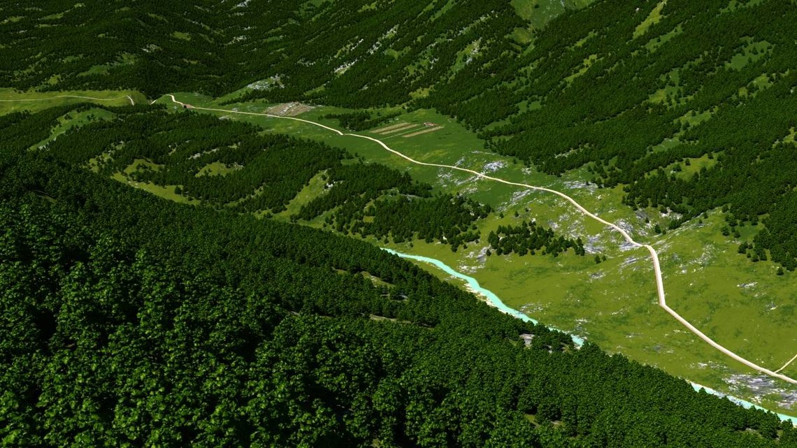
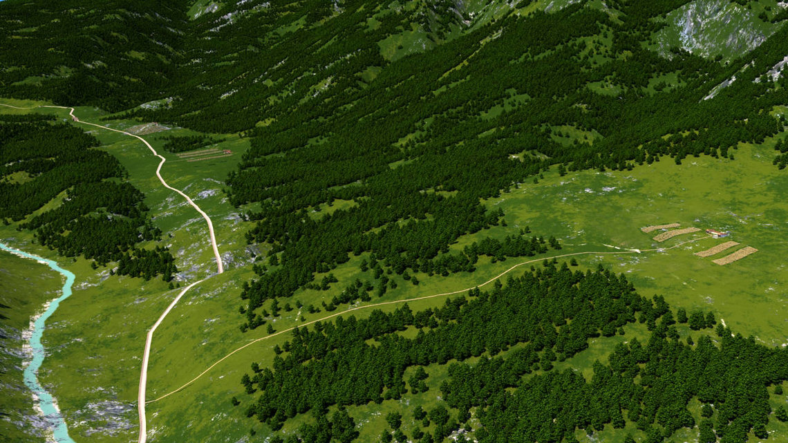
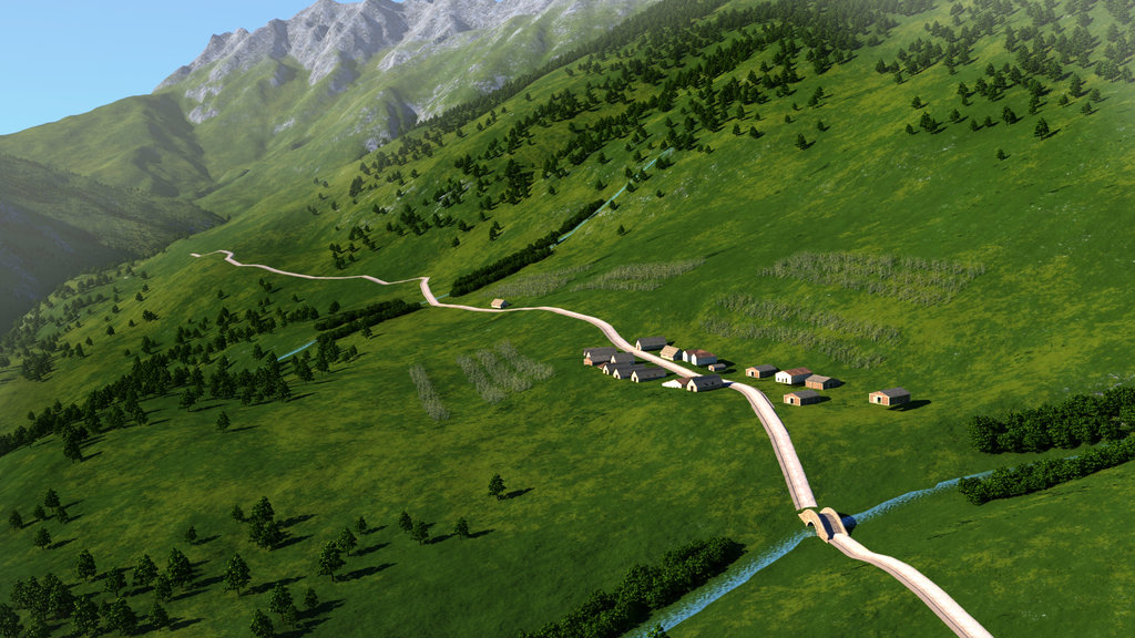
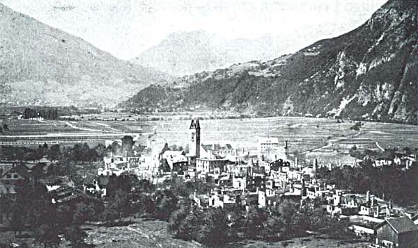
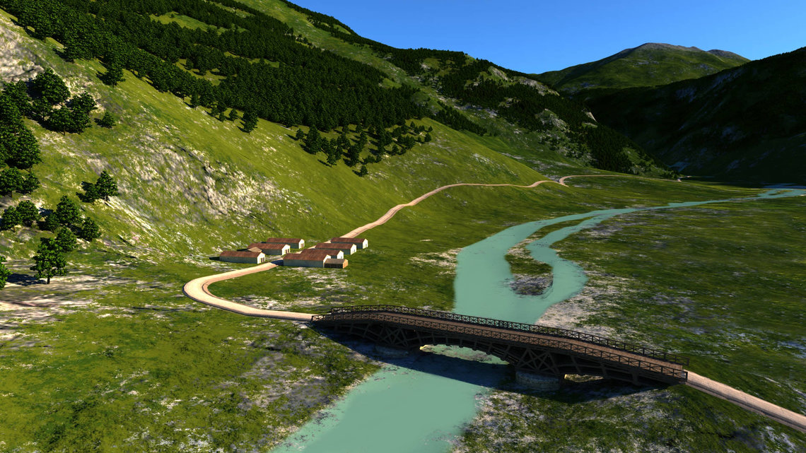
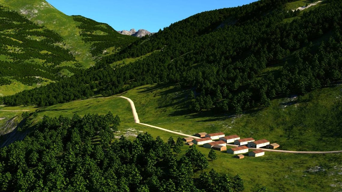
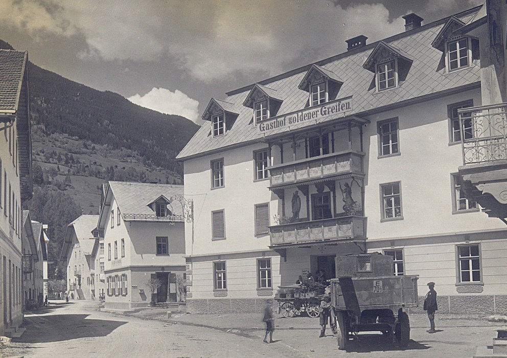
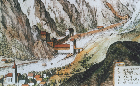
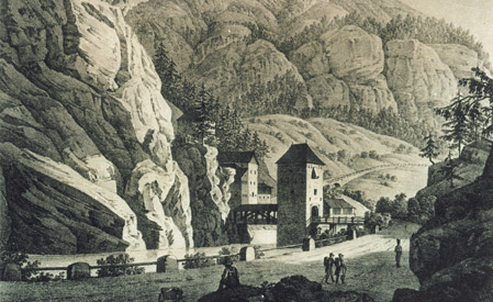
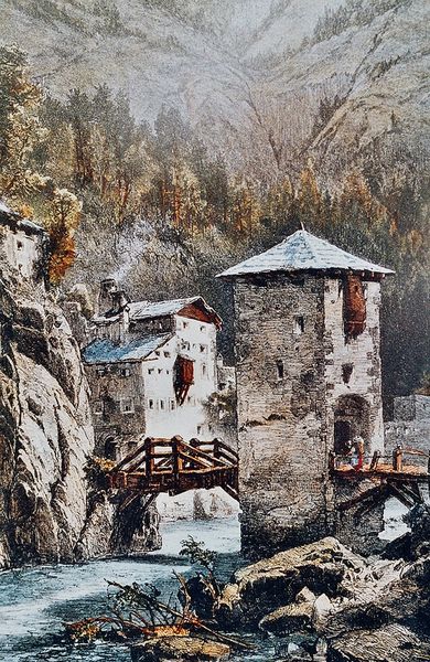
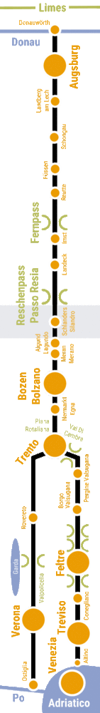
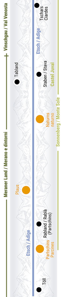
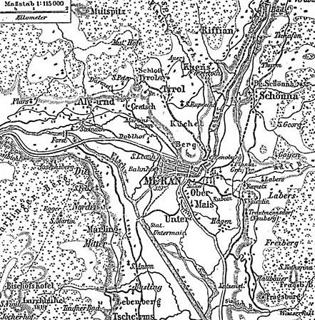
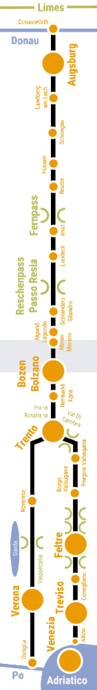
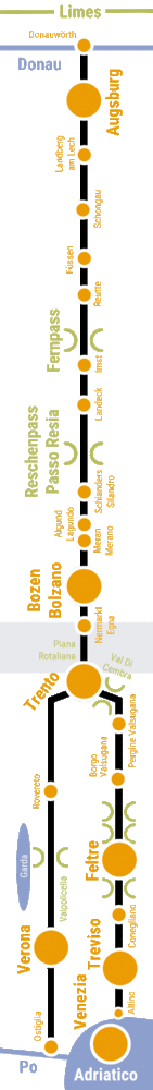
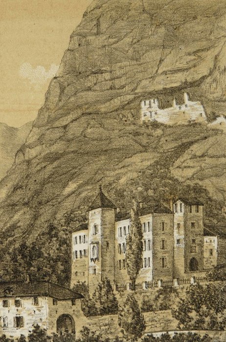
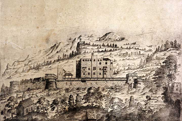
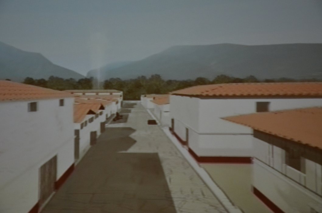
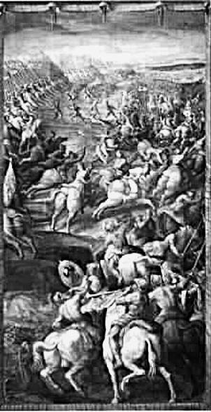
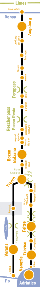
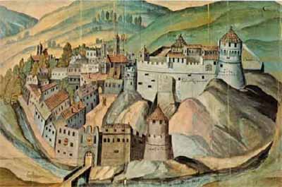
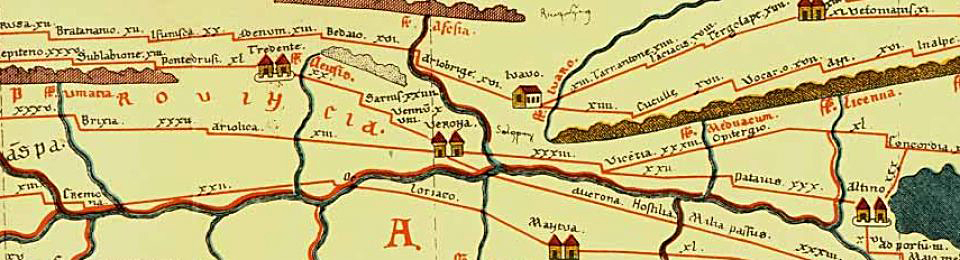
History(s): The Via Claudia Augusta makes provincial capitals

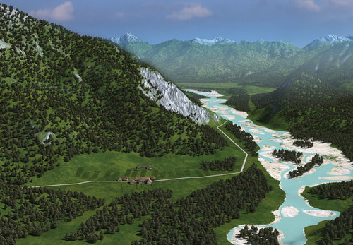
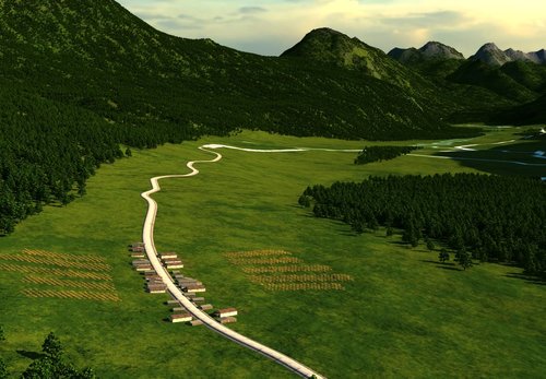
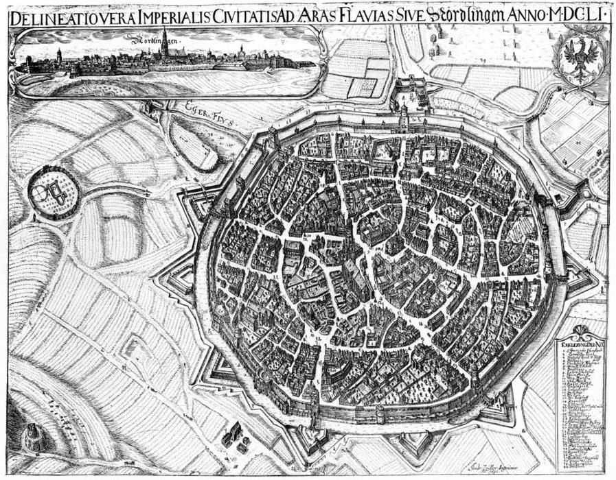
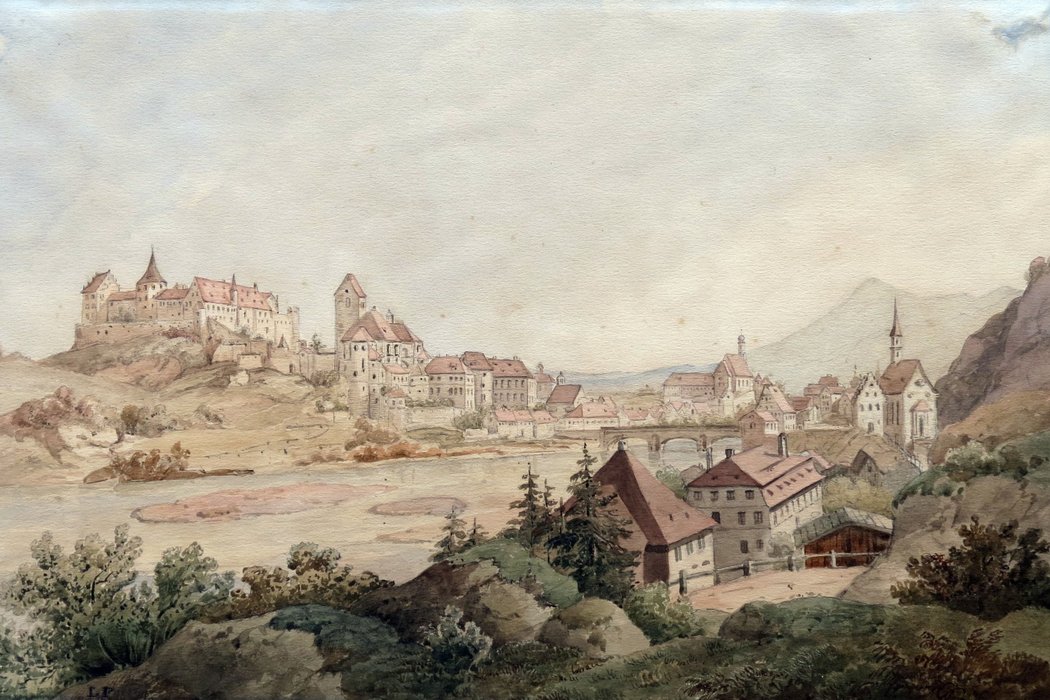
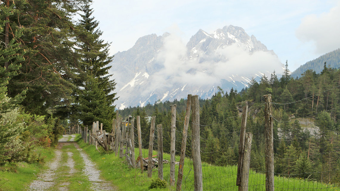
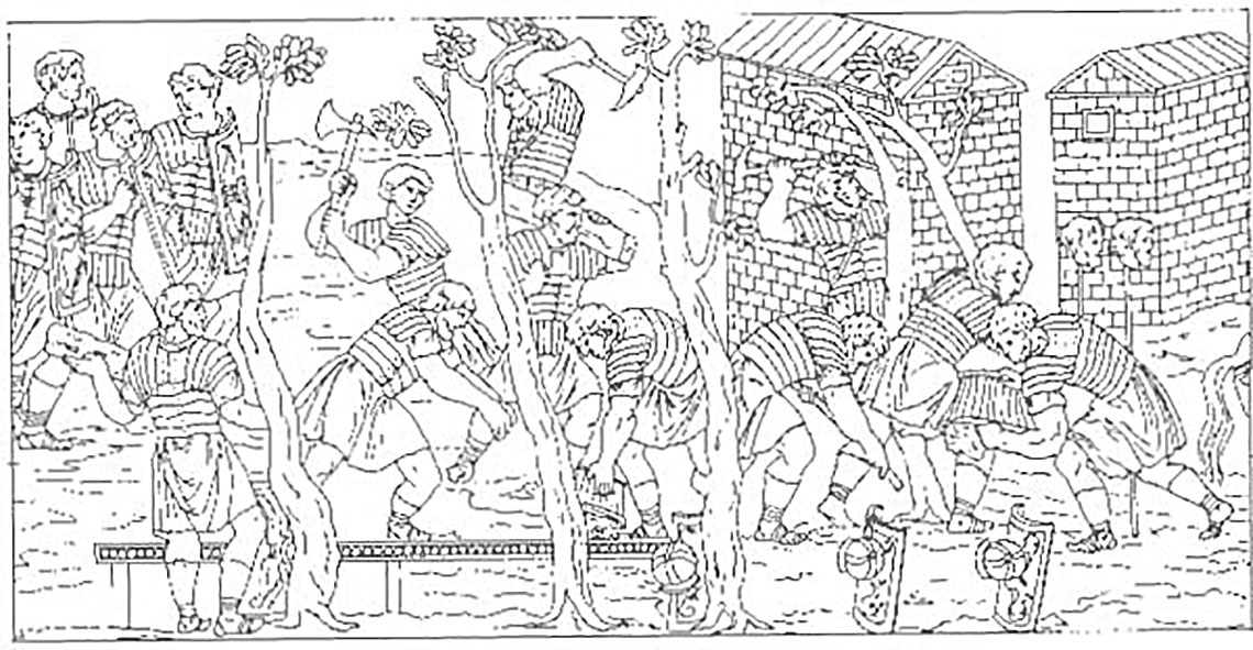
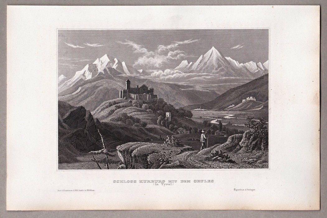
When the Romans built the first "Alpine highway", they did not choose this route for nothing. At that time it was the easiest route over the central Alps, because on the Brenner route not only 2 but 3 passes had to be overcome, including the Ritten Pass between Bolzano and Chiusa. In 200 A.D. the Romans succeeded in building a road through the valley narrows, thus for the first time in history the Brenner route took over from the Via Claudia Augusta as the most important Alpine crossing. However, the valley route fell into disrepair with the Roman Empire and the Via Claudia Augusta over the Reschen and Fernpasses again became the most important road for centuries in the Middle Ages. Incidentally, this was the longest period in which the Via Claudia Augusta was number one. Due to its location on the road, Merano was able to develop into the first capital of the county of Tyrol. When towards the end of the Middle Ages the Bolzano merchant Kunter again built a road on the traces of the Roman road through the narrow valley between Bolzano and Chiusa, the Brenner route outstripped the Reschen route as the most important crossing of the Alps, and the city of Innsbruck outstripped the city of Merano.

Interaktive Karte zu diesem Thema öffnen

Grundsätzlich suchten die Römer für die Via Claudia Augusta den kürzesten Weg. Die Römerstraße verlief also möglichst geradlinig, in der Regel an der Sonnenseite des Tales, leicht oberhalb der Talsohle, damit sie nicht bei Unwettern in Mitleidenschaft gezogen wurde sowie nach Regen und Schneefall rasch wieder trocken und schneefrei war. Zu allen Regeln gibt's natürlich auch Ausnahmen

Interaktive Karte zu diesem Thema öffnen

Entlang der gesamten Via Claudia Augusta sind zahlreiche Sehenswürdigkeiten zu entdecken, Spuren der Geschichte, Denkmäler und andere Sehenswürdigkeiten.

Fragen zum Teilabschnitt beantwortet unter anderem die

ViaClaudiaAugustaInfo
info@viaclaudia.at
0043 664 27 63 555

Interaktive Karte zu diesem Thema öffnen

Wenn Sie bei der Entdeckung der Geschichte vor Ort übernachten möchten, empfehlen wir Ihnen folgende Gastgeber:

Übersichtskarte Teilabschnitt 26
Übersichtskarte rechts Teilabschnitt 26 Meran, Bozen

Nehcsiwz Narem dnu Nezob: Sad etshciernegrub Teibeg Saporue Sad Tmanefarggru

  • 26
Ruine Altenburg, Burg Warth bei St. Pauls

The Via Claudia Augusta through the Burgraviate between Merano and Bolzano, in Roman times.

Tony Grubhofer Forst 1899

Ssolhcs Tsrof

Schloss Tyrol

Ssolhcs Loryt

Ruine Brunnenburg, Meran, Foto Wikipedia Gemeinfrei

Eniur Grubnennurb ieb Narem

Stahlstich Schloss Schenna

Ssolhcs Annehcs

Schloss Planta Meran

Ssolhcs Atnalp

Burg Katzenstein, Foto: Wikipedia Gemeinfrei

Grub Nietsneztak

Grundriss Schloss Lebenberg, Foto: Burgenwelt
Kaiserstube Schloss Lebenberg, Foto: Meraner Land

Ssolhcs Grebnebel

Mayenburg Völlan, Foto Sentres

Grubneyam

Grundriss Wehrburg
Wehrburg

Grubrhew

Schloss Castell Brandis

Ssolhcs Sidnarb

Lana Castel Leonburg Schloss

Ssolhcs Grubnoel

Burg Hocheppan 1828, Foto: Wikipedia Gemeinfrei

Grub Nappehcoh

Schloss Maretsch mit Bergmassiv im Hintergrund 1940

Ssolhcs Hcsteram

Ssolhcs Nietsleknur

Ruine Altenburg, Burg Warth bei St. Pauls

Eniur Grubnetla dnu Grub Htraw ieb Ts. Slua

Gnutsef Norksdnumgis

Interaktive Karte zu diesem Thema öffnen

Grundsätzlich suchten die Römer für die Via Claudia Augusta den kürzesten Weg. Die Römerstraße verlief also möglichst geradlinig, in der Regel an der Sonnenseite des Tales, leicht oberhalb der Talsohle, damit sie nicht bei Unwettern in Mitleidenschaft gezogen wurde sowie nach Regen und Schneefall rasch wieder trocken und schneefrei war. Zu allen Regeln gibt's natürlich auch Ausnahmen

Interaktive Karte zu diesem Thema öffnen

Entlang der gesamten Via Claudia Augusta sind zahlreiche Sehenswürdigkeiten zu entdecken, Spuren der Geschichte, Denkmäler und andere Sehenswürdigkeiten.

Fragen zum Teilabschnitt beantwortet unter anderem die

ViaClaudiaAugustaInfo
info@viaclaudia.at
0043 664 27 63 555

Interaktive Karte zu diesem Thema öffnen

Wenn Sie bei der Entdeckung der Geschichte vor Ort übernachten möchten, empfehlen wir Ihnen folgende Gastgeber:

Übersichtskarte Teilabschnitt 27
Übersichtskarte rechts Teilabschnitt 27 Bozen

Nezob: Sehcsimmr Regalrutilim Snop Isurd Ehsrf Gnuldeiskra

  • 27
Bozen Hörtmair 1541
Tabula Peutingeriana mit Sterzing Klausen

Sad Regalrutilim Snop Isurd, sad hciltsm red Reflat dnu hcildss sed Kcasie tetumrev driw, tsi neben Gnizrets, Nesualk dnu Otnert ni red nekitna Etrak Alubat Anairegnituep uz nedni

The Via Claudia Augusta through the Bolzano area, in Roman times.

Ausgrabung Pons Drusi
Amphore Pons Drusi Museum, Foto: Tobias Pircher
Denar des Julius Cesar Museum
Ausstellung, Museum, Pons Drusi, Foto: Tobias Pircher

Ieb Netiebrauab ma Murtnezneroines Fohresirg edruw enie ehcsimmr Ellahneluus tim Nekserf tkcedtne, eid Liet renie Alliv ra Eid Gnubargsua dnu enleznie Ednuf dnis mi Miehneroines uz nekcedtne

Bozen Hörtmair 1541

Nie Kcilb rebs Grub Norksdnumgis Gnuthcir Nezob mu 1541. Eid Gnudnibrevneparts thcirpstne ni awte red netetumrev Gnureuqlat, eid trod nohcs ni red Tiezremmr nednatseb ta

Bozen, Standtansicht, Ludwig Pfendter, 1607

Nezob nov Nedss sua tethcarteb, mu 1607

Bozen, Botzen Kupferstich, Matthäus Merian, 1649

Hcitsrefpuk nov Nezob (1649).

Baumwollspinnerei Hermann Kofler, Bozen

Nov Nezob gnig eid Gnureisilairtsudni Sloritdss sua Eid Sotof negiez eid Ierennipsllowmuab Relfok hcilgnsrpsu dnu hcan menie Dnarb mi Rhaj 1890, eiwos sad etnakram Krewtfark Nuadra

Stadtplan von Bozen aus Geuters Reiseführer, 1914

Renzob Nalptdats sua 1914.

Sad Lamknedsegeis tguez nov renie Tiez, eid eid Neppurgsgnureklmveb netlapseg tah

Curort Gries 1884, Foto: Wikipedia Otto An Der Lan
Kohlerer Bahn Bozen

ni Seirg nnageb red Sumsiruot.

Interaktive Karte zu diesem Thema öffnen

Grundsätzlich suchten die Römer für die Via Claudia Augusta den kürzesten Weg. Die Römerstraße verlief also möglichst geradlinig, in der Regel an der Sonnenseite des Tales, leicht oberhalb der Talsohle, damit sie nicht bei Unwettern in Mitleidenschaft gezogen wurde sowie nach Regen und Schneefall rasch wieder trocken und schneefrei war. Zu allen Regeln gibt's natürlich auch Ausnahmen

Interaktive Karte zu diesem Thema öffnen

Entlang der gesamten Via Claudia Augusta sind zahlreiche Sehenswürdigkeiten zu entdecken, Spuren der Geschichte, Denkmäler und andere Sehenswürdigkeiten.

Fragen zum Teilabschnitt beantwortet unter anderem die

ViaClaudiaAugustaInfo
info@viaclaudia.at
0043 664 27 63 555

Interaktive Karte zu diesem Thema öffnen

Wenn Sie bei der Entdeckung der Geschichte vor Ort übernachten möchten, empfehlen wir Ihnen folgende Gastgeber:

Übersichtskarte Teilabschnitt 28
Übersichtskarte rechts Teilabschnitt 28 Südtirols Süden

Ni Sloritdss Nedss: Redefletsac dnu Noitatsneparts Eadidn

  • 28
Strassenstation Endidä
Archälogische Funde, Jungsteinzeit bis Römerzeit, am Ufer des Kalterer See

Ehciltieznietsgnuj Elletsdnuf ma Reretlak Ee

Eisenzeitliches Haus, 5.-3. Jhd. v. Chr.

Sehciltieznesie Suah ni Nettafp

Eisenbeil, 1. - 5. Jhd. v. Chr.

Liebnesie sua Tkramuen (5. Hj. v. Rhc.)

The Via Claudia Augusta from Bolzano through the south of South Tyrol, in Roman times.

Strassenstation Endidä

Ehcsimmr Noitatsneparts Eadidne ni Tkramue

Grabungsdoku Bozen
Mosaik, Römerzeitliche Villa

Negnubarg ni Nappe dnu setgelegierf Kiaso

Hospiz Klösterle Laag

Sad Elretsmlk ni Gaal trennire krats na eid ehcsimmr Noitatsneparts Eadidn

Haderburg

Kcilb fua eid Eniur red Grubredah blahrebo nov Nrula

Anton Lindner Hocheppan 1837, Aquarell, Privatbesitz

Nappehcoh 1837

Laimburg Kaltern

Eniur red Grubmial ni Nretlak

Landesmuseum Volkskunde
Kaltern Karren

Nretlak

Interaktive Karte zu diesem Thema öffnen

Grundsätzlich suchten die Römer für die Via Claudia Augusta den kürzesten Weg. Die Römerstraße verlief also möglichst geradlinig, in der Regel an der Sonnenseite des Tales, leicht oberhalb der Talsohle, damit sie nicht bei Unwettern in Mitleidenschaft gezogen wurde sowie nach Regen und Schneefall rasch wieder trocken und schneefrei war. Zu allen Regeln gibt's natürlich auch Ausnahmen

Interaktive Karte zu diesem Thema öffnen

Entlang der gesamten Via Claudia Augusta sind zahlreiche Sehenswürdigkeiten zu entdecken, Spuren der Geschichte, Denkmäler und andere Sehenswürdigkeiten.

Fragen zum Teilabschnitt beantwortet unter anderem die

ViaClaudiaAugustaInfo
info@viaclaudia.at
0043 664 27 63 555

Interaktive Karte zu diesem Thema öffnen

Wenn Sie bei der Entdeckung der Geschichte vor Ort übernachten möchten, empfehlen wir Ihnen folgende Gastgeber:

Übersichtskarte Teilabschnitt 29
Übersichtskarte rechts Teilabschnitt 29 Piana Rotaliana

Hcrud eid Anaip Anailator: Ma Ssulfnemmasuz nov Hcste dnu Eco

  • 29
Castello Do Monreale, Königsberg, Johanna von Isser, Grossrubatscher 1831

The Via Claudia Augusta from the south of South Tyrol through the Piana Rotaliana to Trento, in Roman times.

Grabung Dre Cane
Grabung Dre Cane

Ehcsigolouhcra Gnubargsua "Ert Snac"

Monete Trovato A San Gottardo Mezzocorona

ehcsimmr Eznsm, eid ni Nas Odrattog nednufeg edru

Castello Mezzocorona San Gottardo

Olletsac Anorocozzem dnu eid Grubnelhmh Nas Odratto

Castello Do Monreale, Königsberg, Johanna von Isser, Grossrubatscher 1831

Olletsac Elaernom Grebsginmk

Castello Thun 1680

Olletsac Nuht, 1680

Mezzolombardo stazione tranviaria

Fohnhab nov Odrabmolozzem

Interaktive Karte zu diesem Thema öffnen

Grundsätzlich suchten die Römer für die Via Claudia Augusta den kürzesten Weg. Die Römerstraße verlief also möglichst geradlinig, in der Regel an der Sonnenseite des Tales, leicht oberhalb der Talsohle, damit sie nicht bei Unwettern in Mitleidenschaft gezogen wurde sowie nach Regen und Schneefall rasch wieder trocken und schneefrei war. Zu allen Regeln gibt's natürlich auch Ausnahmen

Interaktive Karte zu diesem Thema öffnen

Entlang der gesamten Via Claudia Augusta sind zahlreiche Sehenswürdigkeiten zu entdecken, Spuren der Geschichte, Denkmäler und andere Sehenswürdigkeiten.

Fragen zum Teilabschnitt beantwortet unter anderem die

ViaClaudiaAugustaInfo
info@viaclaudia.at
0043 664 27 63 555

Interaktive Karte zu diesem Thema öffnen

Wenn Sie bei der Entdeckung der Geschichte vor Ort übernachten möchten, empfehlen wir Ihnen folgende Gastgeber:

Übersichtskarte Teilabschnitt 30
Übersichtskarte rechts Teilabschnitt 30 Val Di Cembra

Lav id Arbmec, Snip:

  • 30
Castel Cles
Albrecht Dürer, Castello di Segonzano 1494, Berlino Kupferstichkabinett

Olletsac Id Onaznoges nov Thcerbla Rers

Castel Cles

Letsac Selc

Val Di Cembra Sover Frazione Piscine Veduta del Paese

Al enoizarf Enicsip id Revos

Interaktive Karte zu diesem Thema öffnen

Grundsätzlich suchten die Römer für die Via Claudia Augusta den kürzesten Weg. Die Römerstraße verlief also möglichst geradlinig, in der Regel an der Sonnenseite des Tales, leicht oberhalb der Talsohle, damit sie nicht bei Unwettern in Mitleidenschaft gezogen wurde sowie nach Regen und Schneefall rasch wieder trocken und schneefrei war. Zu allen Regeln gibt's natürlich auch Ausnahmen

Interaktive Karte zu diesem Thema öffnen

Entlang der gesamten Via Claudia Augusta sind zahlreiche Sehenswürdigkeiten zu entdecken, Spuren der Geschichte, Denkmäler und andere Sehenswürdigkeiten.

Fragen zum Teilabschnitt beantwortet unter anderem die

ViaClaudiaAugustaInfo
info@viaclaudia.at
0043 664 27 63 555

Interaktive Karte zu diesem Thema öffnen

Wenn Sie bei der Entdeckung der Geschichte vor Ort übernachten möchten, empfehlen wir Ihnen folgende Gastgeber:

Übersichtskarte Teilabschnitt 31p
Übersichtskarte rechts Teilabschnitt 31p Trento

Trento (Richtung Rovereto, Verona, Ostiglia, Po):

  • 31p
Concilio Trento Museo Buonconsiglio
Tabula Peutingeriana mit Sterzing Klausen

Pons Drusi (Bozen) und Trento in der römischen Straßenkarte Tabula Peutingeriana

The Via Claudia Augusta from the Piana Rotaliana to Trento (Tridentum), in Roman times.

trento veduta dall alto dello scavo archeologico in corso nella chiesa di sant

Scavo a Trento

Image full width

Mosaico

Modell der römischen Stadt Tridentum

Schaufenster in die römische Geschichte

Sarkophag in der frühchristlichen Kirche San Vigilio

la sala dei vescovi

Die Fürst-Bischöfe von Trento hatten lange Zeit geistige und weltliche Macht.

Moneta Vescovo Di Trento

Münze des Bischofs von Trento

Concilio Trento Museo Buonconsiglio

Beim Konzil von Trento wurden die Weichen für die Gegen-Reformation gestellt

Rinascimento Trento
Rinascimento Trento

so, wie sich die Altstadt von Trento heute präsentiert, wurde sie im Renaissance-Stil für das Konzil von Trento herausgeputzt

Buonconsiglio, Foto: Jakub Halun

Auch das Schloss Buonconsiglio erinnert an das Konzil

Trento 18 Jhd

Trento im 18. Jh.

Preda di guerra piazza Dante

Im 1. Weltkrieg lag auch Trento an der Front

Trento 1922-1935

Die Stadt in den 30ern

Interaktive Karte zu diesem Thema öffnen

Generally, the Romans built the Via Claudia Augusta along the shortest route between two points. The Roman road was built as straight as possible and mostly ran along the sunny side of the valley, slightly above the bottom. This prevented storm damage and ensured that the road dried quickly after rains or snowfall. But, of course, there were exceptions to every rule.

Interaktive Karte zu diesem Thema öffnen

There are plenty of interesting sights along the entire Via Claudia Augusta: historical sites, monuments, and other attractions.

If you have questions about this section, contact ...

ViaClaudiaAugustaInfo
info@viaclaudia.at
0043 664 27 63 555

Accomodation and camping

If you wish to stay a night or two while discovering the history of the area, we recommend the following accommodation providers:

"4 maps across the millenia"
(Rovereto e Vallagarina edition)

Historische Karten mit Ausgabe in ISSUU

Text of the historic maps of ...
400 A.D.

"Life on the street"

Already the Etruscans, Venetians, Rhaetians and Celts had a lively exchange about the Etsch Valley. With the development of their routes to the first trans-European road across the Alps, even more life came to Vallagarina. This important road brought new influences and opportunities to earn money. As a result, further settlements also developed between the traffic junctions of Trento and Verona, including road stations, which the Romans established at regular intervals. It is striking that the road in Vallagarina crossed the river only once. Those who did not need the road in the immediate vicinity lived at a certain distance, as the remains of the Roman country villa in Isera still bear witness to today.


1500

"Numerous castles"

Even in the Middle Ages and modern times, the inhabitants of Vallagarina lived essentially from the road, and even more important was the Adige waterway, especially for the transport of heavy goods. Ports and ferry services existed in Trento and Nomi, near Rovereto and Avio. Not a single bridge over the Adige is known in Vallagarina. Along this important transport link, numerous castles developed, from which the traffic routes can be easily surveyed. Castel Beseno is the largest of these and is today perfectly equipped for a multifaceted experience of a castle. Clearly the most important place was already then Rovereto, which Maximilian I made into a town in 1510.


1800

"The 18th century"

The Vallagarina did not experience a real industrial revolution in the 18th century. Not even the creation of the Savings Bank and the Brennero railway, which was expensive and not very efficient, could change that. The Vallagarina traditionally produced mainly silk, wood, wine, velvet and leather. In addition there was the tobacco factory in Rovereto. There was no capital for more investments. Moreover, from 1859 Trentino was on the edge of the empire, separated by a border from the important markets of Lobardia and Veneto, which levied considerable customs duties. The winegrowers fought against phylloxera. In silkworm cultivation, the peprine caused problems. Many citizens left the country as guest workers or permanently.

Übersichtskarte Teilabschnitt 32p
Übersichtskarte rechts Teilabschnitt 32p Vallagarina Nord

Die nördliche Vallagarina:

  • 32p
Battaglia di Calliano 1487

The Via Claudia Augusta from Trento through the Vallagarina, in Roman times

Die Schlacht von Calliano in der nördlichen Vallagarina 1487 war maßgebend, dass die Herrschaft der Repubblica di Venezia endete und die Vallagarina wieder unter den Einfluss der Fürst-Bischöfe von Trento kam. In Calliano wird jedes Jahr dem gemeinsamen Erfolg der Truppen des Trentino un der Grafen von Tirol gedacht.

S. Ilario

Interaktive Karte zu diesem Thema öffnen

Generally, the Romans built the Via Claudia Augusta along the shortest route between two points. The Roman road was built as straight as possible and mostly ran along the sunny side of the valley, slightly above the bottom. This prevented storm damage and ensured that the road dried quickly after rains or snowfall. But, of course, there were exceptions to every rule.

Sights

There are plenty of interesting sights along the entire Via Claudia Augusta: historical sites, monuments, and other attractions.

If you have questions about this section, contact ...

ViaClaudiaAugustaInfo
info@viaclaudia.at
0043 664 27 63 555

Accomodation and camping

If you wish to stay a night or two while discovering the history of the area, we recommend the following accommodation providers:

Übersichtskarte Teilabschnitt 33p
Übersichtskarte rechts Teilabschnitt 33p Rovereto

Rovereto:
Zentrum der Vallagarina
Stadt der Seide

  • 33p
Seiden Fabrikation Rovereto

The Via Claudia Augusta from Trento through the Vallagarina, in Roman times.

villa romana di isera

In Isera, vis-a-vis von Rovereto, wurde eine römische Villa ergraben

eine Ansicht von Rovereto um 1300 und eine Annahme, wie es ausgesehen haben könnte.

Die Porta San Marco in der Altstadt von Rovereto erinnert an die Zeit, in der die Vallagarina Teil der Repubblica Venezia war (1416 - 1509).

Rovereto um ca. 1500.

Rovereto um 1700

Seiden Fabrikation Rovereto

Seide spielte in der Wirtschaft von Rovereto eine wichtige Rolle. Fabrik der Fratelli Bettini.

Interaktive Karte zu diesem Thema öffnen

Generally, the Romans built the Via Claudia Augusta along the shortest route between two points. The Roman road was built as straight as possible and mostly ran along the sunny side of the valley, slightly above the bottom. This prevented storm damage and ensured that the road dried quickly after rains or snowfall. But, of course, there were exceptions to every rule.

Sights

There are plenty of interesting sights along the entire Via Claudia Augusta: historical sites, monuments, and other attractions.

If you have questions about this section, contact ...

ViaClaudiaAugustaInfo
info@viaclaudia.at
0043 664 27 63 555

Accomodation and camping

If you wish to stay a night or two while discovering the history of the area, we recommend the following accommodation providers:

Übersichtskarte Teilabschnitt 34p
Übersichtskarte rechts Teilabschnitt 34p Nördliche Provinz Verona Garda

Die südliche Vallagarina:
Spuren zeugen von Sauriern

  • 34p
Daspletosaurus Gruppe Der Fleischfressenden Theropoden

Südlich von Rovereto, in der Ortschaft Lavini di Marco, sind Fußabdrücke von Dinosauriern zu sehen, unter anderem von Theropoden (fleischfressende Dinosaurier, die dem Dilophosaurus ähnlich sind), auf zweibeinige Pflanzenfresser (Ornithopoden) als auch vierbeinige Pflanzenfresser (Sauropoden) zurückzuführen sind. Sie sind 190 bis 200 Millionen Jahre alt.

The Via Claudia Augusta from Trento through the Vallagarina, in Roman times.

Grotta Rio Malo Covelo Ai Piccoli Foto Alpe Cimbra

römischer Kontrollposten für Transportgüter "Covelo di Rio Malo ai Piccoli di Lavarone", grotta di 30 metri

Ein Alter Cimber

Im dreizehnten Jahrhundert wurde auf Geheiß des Trentiner Fürst-Bischofs Federico Vanga beschlossen, die aus der Provinz Vicenza kommende Cimbri-Gemeinschaft anzuerkennen. Die Cimbri sind eine bayerische Sprach-Minderheit, die heute vor allem in den Orten Folgaria, Lavarone und Luserna auf der Hochebene "Altipiani cimbri" 

Interaktive Karte zu diesem Thema öffnen

Generally, the Romans built the Via Claudia Augusta along the shortest route between two points. The Roman road was built as straight as possible and mostly ran along the sunny side of the valley, slightly above the bottom. This prevented storm damage and ensured that the road dried quickly after rains or snowfall. But, of course, there were exceptions to every rule.

Sights

There are plenty of interesting sights along the entire Via Claudia Augusta: historical sites, monuments, and other attractions.

If you have questions about this section, contact ...

ViaClaudiaAugustaInfo
info@viaclaudia.at
0043 664 27 63 555

Accomodation and camping

If you wish to stay a night or two while discovering the history of the area, we recommend the following accommodation providers:

Übersichtskarte Teilabschnitt 35p
Übersichtskarte rechts Teilabschnitt 35p Vallagarina Veronese

Veroneser Etschtal, Monte Baldo und Lago di Garda:
Felszeichnungen von Jägern und Sammlern
Stets umkämpftes Grenzgebiet

Incisioni Rupestri Di Pianaura Ad Arco

Felszeichnungen, die man am Monte Baldo fand, zeugen davon, dass sich in der Gegend schon sehr früh Menschen aufgehalten haben

The Via Claudia Augusta through the northern part of the province of Verona, in Roman times.

Arco Castello Monte Baldo Monte Maggiore

Castello Monte Baldo

Monte Altissimo Grande Guerra
Monte Baldo Grande Guerra

Auch der Monte Baldo war Teil der hart umkäpmften Front im 1. Weltkrieg

Interaktive Karte zu diesem Thema öffnen

Generally, the Romans built the Via Claudia Augusta along the shortest route between two points. The Roman road was built as straight as possible and mostly ran along the sunny side of the valley, slightly above the bottom. This prevented storm damage and ensured that the road dried quickly after rains or snowfall. But, of course, there were exceptions to every rule.

Sights

There are plenty of interesting sights along the entire Via Claudia Augusta: historical sites, monuments, and other attractions.

If you have questions about this section, contact ...

ViaClaudiaAugustaInfo
info@viaclaudia.at
0043 664 27 63 555

Accomodation and camping

If you wish to stay a night or two while discovering the history of the area, we recommend the following accommodation providers:

Übersichtskarte Teilabschnitt 36p
Übersichtskarte rechts Teilabschnitt 36p Garda Veronese

Rivoli Veronese, Bardolino, Lazise, Affi, Cavaion Veronese
Strategisch bedeutsames Tor zu Gardasee und Po-Ebene
Immer schon begehrter Siedlungsort

Napoleon in der Schlacht von Rivoli

The Via Claudia Augusta through the northern part of the province of Verona, in Roman times.

Grabungen Gaium Indagine Gaium

Grabungen in Rivoli Veronese.

Schlacht von Rivoli Napoleon
Napoleon in der Schlacht von Rivoli

Schlacht von Rivoli während der Napoleonischen Kriege.

Rivoli Verones Ceraino Wohlgemuth 1866

Forte Wohlgemuth an der Talenge Ceraino bei Rivoli Veronese 1866.

Interaktive Karte zu diesem Thema öffnen

Generally, the Romans built the Via Claudia Augusta along the shortest route between two points. The Roman road was built as straight as possible and mostly ran along the sunny side of the valley, slightly above the bottom. This prevented storm damage and ensured that the road dried quickly after rains or snowfall. But, of course, there were exceptions to every rule.

If you have questions about this section, contact ...

ViaClaudiaAugustaInfo
info@viaclaudia.at
0043 664 27 63 555

Accomodation and camping

If you wish to stay a night or two while discovering the history of the area, we recommend the following accommodation providers:

Übersichtskarte Teilabschnitt 37p
Übersichtskarte rechts Teilabschnitt 37p Valpolicella

Valpolicella:

  • 36p
Villa Monga 17 Jh
Ritrovamenti Preistorici Monte Loffa

Prähistorische Funde

The Via Claudia Augusta through the northern part of the province of Verona, in Roman times.

Mosaico Dell Epoca Romana Trovato

Diese römische Mosaik wurde in Negrar entdeckt

Mappa Valpolicella Di Giovanni Nacchio

Karte der Valpolicella um 1625

Facciata Della Pieve Di San Floriano

Zahlreiche Sakralbauten zeugen von der reichen Geschichte. Im Bild San Floriano.

Villa Monga 17 Jh


Auch in der Valpolicella findet man die für den Veneto typischen Ville.

Ferrovia Verona Caprino

Frühe Bilder Des Bahnhofes von Carino

Cave Di Prun Valpolicella
Cava Marmo Valpolicella

In der Valpolicella wurde und wird Marmor abgebaut

Interaktive Karte zu diesem Thema öffnen

Grundsätzlich suchten die Römer für die Via Claudia Augusta den kürzesten Weg. Die Römerstraße verlief also möglichst geradlinig, in der Regel an der Sonnenseite des Tales, leicht oberhalb der Talsohle, damit sie nicht bei Unwettern in Mitleidenschaft gezogen wurde sowie nach Regen und Schneefall rasch wieder trocken und schneefrei war. Zu allen Regeln gibt's natürlich auch Ausnahmen

Entlang der gesamten Via Claudia Augusta sind zahlreiche Sehenswürdigkeiten zu entdecken, Spuren der Geschichte, Denkmäler und andere Sehenswürdigkeiten.

Fragen zum Teilabschnitt beantwortet unter anderem die

ViaClaudiaAugustaInfo
info@viaclaudia.at
0043 664 27 63 555

Wenn Sie bei der Entdeckung der Geschichte vor Ort übernachten möchten, empfehlen wir Ihnen folgende Gastgeber:

Übersichtskarte Teilabschnitt 38p
Übersichtskarte rechts Teilabschnitt 38p Verona

Verona:
Gründung der Räter und Euganeer
Römerstadt am Alpen-Eingang

  • 37p
Veduta Verona
Verona In The Tabula Peutingeriana

Verona in der römischen Straßenkarte Tabula Peutingeriana

The Via Claudia Augusta through the Verona area, in Roman times.

archäologisiche Grabungen Seminario / Verona

Mosaik Verona

römisches Mosaik

Guided Tours Untergrund Verona

das römische Verona ist bei unterirdischen Führungen zu erleben

Teatro Romano

Das Teatro Romano, am Ostufer der Etsch

Sito Archeologico

Schaufenster ins römische Verona

Römische Glasschüsseln

römische Glasschuesseln im archologischen Museum

Santa Inquisizione Concilio Verona

Concilio in Verona

Veduta Verona

mittelalterliche Ansicht von Verona

Mura Scaligere

Das Verona der Scligeri

rogo di streghe

Hexenverbrennung

Verona 1647

Verona 1647

Verona 1866

1866

Via San Paolo Verona

Via San Paolo

Mulini sull'Adige.

Piazza Bra Verona Old

Piazza Bra und die Verona, noch mit Straßenverkehr

Tram Verona

Aus den Anfängen der Tram

Interaktive Karte zu diesem Thema öffnen

Generally, the Romans built the Via Claudia Augusta along the shortest route between two points. The Roman road was built as straight as possible and mostly ran along the sunny side of the valley, slightly above the bottom. This prevented storm damage and ensured that the road dried quickly after rains or snowfall. But, of course, there were exceptions to every rule.

Sights

There are plenty of interesting sights along the entire Via Claudia Augusta: historical sites, monuments, and other attractions.

If you have questions about this section, contact ...

ViaClaudiaAugustaInfo
info@viaclaudia.at
0043 664 27 63 555

Accomodation and camping

If you wish to stay a night or two while discovering the history of the area, we recommend the following accommodation providers:

Übersichtskarte Teilabschnitt 39p
Übersichtskarte rechts Teilabschnitt 39p Pianura Padana

Po-Ebene zwischen Verona und Po:

Scavi Grabungen Gazzo Veronese

The Via Claudia Augusta through the Po Valley, in Roman times.

Scavi Grabungen Gazzo Veronese

Grabungen an der Via Claudia Augusta, in Gazzo Veronese

Villafranca 1883 Stich

Castello in Villafranca

Saluti Da Vigasio

frühe Ansichtskarte von Vigasio

(Hi)story(s): Between water and land

Originally the Po Valley was sea. It is also called "Mar Padano". For a long time the Padana plain, as it is also called, was a frontline area between the sea and the mainland. In cold periods the mainland gained the upper hand, in warm periods again the sea, although after cold seasons the rivers always transported more material to the plain. Eventually, the mainland won, but it remained marshy in large parts for a long time. Before the Romans, settlements were located around the marshes. which were often pile dwellings. Presumably, the Romans were the first to systematically drain marshes on a larger scale, efforts that subsequently became literally marshy again. Systematic, larger-scale draining of the marshes began again at the end of the Middle Ages. The water was canalized, used for irrigation but also for transportation, and still today it runs through the entire plain. Many goods, for example, reached the markets in Mantova by water. Partly there are still marshes along the courses of the rivers, such as the protected wetland "Paludi di Ostiglia" (marshes of Ostiglia). With climate change, one would wish to have more water again. 

Interaktive Karte zu diesem Thema öffnen

Generally, the Romans built the Via Claudia Augusta along the shortest route between two points. The Roman road was built as straight as possible and mostly ran along the sunny side of the valley, slightly above the bottom. This prevented storm damage and ensured that the road dried quickly after rains or snowfall. But, of course, there were exceptions to every rule.

Sehenswürdigkeiten

There are plenty of interesting sights along the entire Via Claudia Augusta: historical sites, monuments, and other attractions.

If you have questions about this section, contact ...

ViaClaudiaAugustaInfo
info@viaclaudia.at
0043 664 27 63 555

Accomodation and camping

If you wish to stay a night or two while discovering the history of the area, we recommend the following accommodation providers:

Übersichtskarte Teilabschnitt 40p
Übersichtskarte rechts Teilabschnitt 40p Po

Ostiglia and the river Po:
Ancient settlement site
River port of the Romans

  • 39p
Ostiglia Romana Po
Riperto Neolitico Ostiglia

Find from the Neoliticum.

The Via Claudia Augusta through the Po Valley, in Roman times.

Ostiglia Romana Po

How to imagine the roman river port in Ostiglia.

Castello Ostiglia

The fortified Ostiglia.

Mantova 1599 and 1660.

Bahnstrecke Ostiglia

Ostiglia has been a traffic junction for thousands of years. Railroad lines also crossed there. Today the railroad line between Verona, Bologno, Florence and Rome runs through the town on the Po. The railroad line between Verona and Ostiglia should correspond to the Roman route of the Via Claudia Augusta.

Alte Ansicht von Ostiglia

Old view of Ostiglia.

Po bei Ostiglia alte Ansicht

In Ostiglia there was always a crossing over the river Po.

Ostiglia alte Ansicht Rathausplatz

Historical photo of the town hall square of Ostiglia.

Interaktive Karte zu diesem Thema öffnen

Generally, the Romans built the Via Claudia Augusta along the shortest route between two points. The Roman road was built as straight as possible and mostly ran along the sunny side of the valley, slightly above the bottom. This prevented storm damage and ensured that the road dried quickly after rains or snowfall. But, of course, there were exceptions to every rule.

Sights

There are plenty of interesting sights along the entire Via Claudia Augusta: historical sites, monuments, and other attractions.

If you have questions about this section, contact ...

ViaClaudiaAugustaInfo
info@viaclaudia.at
0043 664 27 63 555

Accomodation and camping

If you wish to stay a night or two while discovering the history of the area, we recommend the following accommodation providers:

News Via Claudia Augusta

Sponsors & partners

  • Interreg Italia-Österreich - European Union
  • Gal Prealpi e Dolomiti
  • ???
  • VIA Claudia Augusta
  • Tirol - Unser Land